Tuesday, July 27, 2010

Palawan ‘UNESCO Man and Biosphere Reserve’ in the grip of Mining Companies?

Puerto Princesa - ALDAW. On the 7th of June (see IC release) 600 protesters from farmers and indigenous communities reached the capital city of Puerto Princesa on Palawan Island requesting the Provincial Government not to endorse the proposed mining plans of MacroAsia and Ipilan Nickel Corporation (INC). As a result of the negotiations taking place between the protesters’ delegation and policy makers in Puerto Princesa, the Provincial Government agreed that endorsement of both MacroAsia and INC should have required further investigation. However, that promise was not honoured and, after a few days, the Provincial Government gave his endorsement to MAC and INC to operate in one of the best conserved biocultural paradises found in the Philippines, and in South-East Asia as a whole.

The area given out to mining concession is also inhabited by traditional indigenous Palawan having limited contacts with the outside world. Moreover, the Gantong range and neighboring areas where MAC and INC intend to operate are within the area recently declared as Mount Mantalingahan Protected Landscape, pursuant to Presidential Proclamation no. 1815.
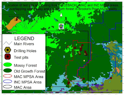
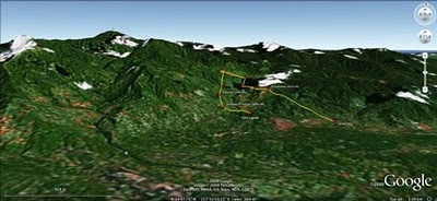
Location of test pits and drilling holes within the mining concessions and
their overlap with mossy and old growth forest in Brook's Point Municipality
Both the MPSA areas of MacroAsia and INC are located in ecologically valuable areas which include watersheds, hunting/ agricultural grounds, extractive reserves of Non-Timber Forest Products (NTFPs) such as Almaciga (Agathis philippinensis) resin, on which upland indigenous communities depend for their daily subsistence. Also indigenous peoples’ sacred and worship sites are found within the mining tenements of these companies.

Representatives of ELAC (Environmental Legal Assistance Center) are now filing cases against government officials and their respective agencies for having endorsed MAC and INC without securing first the needed social acceptability requirements and in disregard of the Strategic Environmental Plan (Republic Act 7611).

Say ELAC Atty. Edward G. Lorenzo: “the sustainable management of the entire Province is, in fact, governed by the SEP law which prohibits any human activity in those areas that are classified as ‘core zones’ and that – very unfortunately - are now part of MAC and INC mining tenements”. A indigenous member of the indigenous community of Gieb (Barangay Maasin, Brooke’s Point Municipality) also claims: “they (mining personnel of MAC) just entered our land without asking permission, and they removed our rice plants to excavate big ditches in our agricultural fields and also up into the mountains, only few meters away from the Balgtik (Agathis Philippinensis) trees that we sell and from which we depend for our survival”. According to another member of the same community: “MacroAsia peoples have removed soil and trees also in those sacred forest that we call lylien and that are inhabited by powerful super-human beings (Taw Kawasa)”.

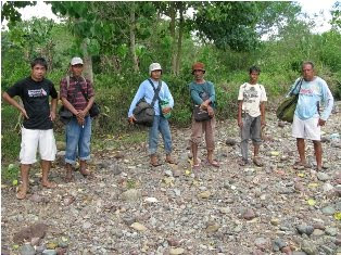
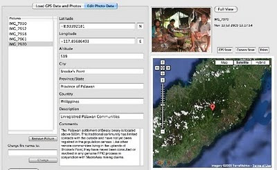
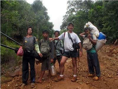
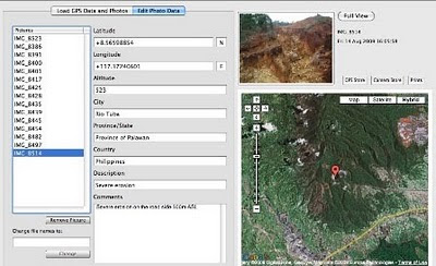
Between 12-16 July a geotagging field reconnaissance carried out by the ALDAW (Ancestral/Land Domain Watch) in collaboration with the Centre for Biocultural Diversity (CBCD) of the University of Kent has confirmed that MacroAsia test pits and drilling holes are found in ‘core zones’ (areas of maximum protection) around and even above 1,000 m ASL. Indigenous peoples trained on basic GPS and Geotagging technologies, with their own set of equipment divided into two groups to cover a large portion of the MAC and INC mining tenement area.

It appears that both MAC and INC have violated the basic tenets of the Strategic Environmental Plan (SEC) and also of the Indigenous Peoples Rights Act (IPRA Law), a national law protecting the interests of Indigenous Cultural Communities (ICC). Faced by this and similar accusations, the Provincial Government recently made a statement according to which MacroAsia and INC may not be allowed to operate in core zones, but their activities might be limited only to multiple/manipulative use areas. Again, ocular inspection and GPS data obtained by ALDAW and CBCD indicate the those portions of MacroAsia and INC mining concessions, which are outside the core zones, still include forested buffer zones which, obviously, do not fit by any means into the standard definition of ‘multiple/manipulative use zones’, where – according to the law – mining might be allowed. In fact, the mining claims of both MAC and INC are entirely located in ‘core zones’, ‘restricted zones’, agricultural and agroforestry areas that are subject to various cropping regimes. All these categories, according to the SEP law, should not be subject to any other form of large-scale extractive activity.

Also, lowland farmers are extremely concerned about the siltation of their wet-rice cultivation, as all irrigation water coming into their fields originates from the mountains where mining is supposed to take place. Members of academic institutions have suggested that: unless these precious water catchments are protected from mining operations, at least 50% of Brooke’s point sustainable agriculture, which requires irrigation, might be lost.

Says a spokesman of Alyansa Tigil Mina (the largest anti-mining advocacy group in the country) “Ironically enough the mining companies and the politicians who are endorsing them have also infringed the Philippine Mining Act which prohibits mining in old growth or virgin forest, proclaimed watershed forest reserves, wilderness area, and other areas of outstanding environmental value”. According to Atty. Mary Jean Feliciano of the ALDAW Network “in endorsing the mining exploration of both MAC and INC, the Sangguniang Bayan (Local Government of Brooke’s Point) has acted in contradiction with its own Municipal Comprehensive Land Use Plan (CLUP) for 2000-2010, in which mining was never considered as a development strategy and, in doing so, it has also bypassed the interests of local communities, as well as all forms of public consultations”.
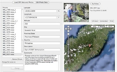
Cornerstone of a CADT (Certificate of Ancestral Domain Title)

Undoubtedly, the endorsement by both Local and Provincial governments of the proposed operations of MAC and INC contravenes also those provisions contained in well know conventions [e.g. The Convention on Biological Diversity (CBD) and the UN Declaration on the Rights of Indigenous Peoples that the Philippine Government has already signed. Says a member of the Palawan advocacy community: “When the Government itself infringes its own laws so bluntly, it means that the fundamentals of democracy are breaking apart and a new form of state-led terrorism is coming into being to deprive hundreds of farmers and indigenous peoples of their traditional, and thus legitimate sources of life, just to benefit a handful of greedy and irresponsible businessmen and their cronies”.

On July 30, 2010 the members of the Palawan Council for Sustainable Development (PCSD) - a local government body in charge of the protection and sustainable management of the province - will meet to decide whether to issue a SEP clearance to the operations of MacroAsia and Ipilan Nickel Corporations. The future of one of the most pristine forests in the Philippines and the life of thousands of peoples who depend from it, is now in the hands of the Council.

Indigenous peoples and their networks, farmers, fisher folks, the Palawan NGO Network Inc (PNNI) and its associates, are uniting their effort to convince the PCSD to take a responsible decision which will ensure the sustainable future of Brook’s Point Municipality and of its biocultural diversity.


What you can do ...

Sign a Petition to Stop Mining in Palawan!


And address your concerns to:

Palawan Council for Sustainable Development
oed@pcsd.ph . and c/o Mearl Hilario mearlhilario@yahoo.com
FAX: 0063 (048) 434-4234

Honorable Governor of Palawan
Baham Mitra
abmitra2001@yahoo.com
FAX: 0063 (048) 433-2948

For more information watch ALDAW videos
http://www.vimeo.com/aldawnetwork
http://www.youtube.com/user/ALDAWpalawan
http://hub.witness.org/en/users/aldaw-network
or contact the ALDAW Network (Ancestral Land/Domain Watch) aldawnetwork@gmail.com  and Alyansa Tigil Mina (nc@alyansatigilmina.net / alyansatigilmina@gmail.com )

Friday, July 23, 2010

Le projet de cartographie participative dans le Bassin du Congo

Freddy Nguema Allogo est responsable technique du projet cartographie participative dans le Bassin du Congo par compte de Brainforest Gabon. Freddy décrives le projet et son état d’avancement.


Le projet régional de cartographie participative dans le Bassin du Congo pour la République du Congo a été lancé le 18 juin à Brazzaville. Initié par la Rainforest Foundation du Royaume Uni, ce projet qui s’étalera sur deux ans, sera mis en œuvre par l’Observatoire congolais des droits de l’homme (OCDH).

L’objectif global de la cartographie participative dans le Bassin du Congo est de promouvoir l’inclusion des droits des communautés forestières pour un contrôle et une utilisation rationnelle des forêts.

Le projet vise à renforcer les capacités des communautés forestières, de l’administration et des organisations de la société civile à mieux connaître les ressources forestières ; à soutenir les communautés forestières dans leur dialogue avec les autorités compétentes.

L’initiative de Rainforest Foundation traduit la volonté du Gouvernement anglais de ralentir le processus de déforestation par le développement des capacités des populations et des institutions des pays du Bassin du Congo dans la gestion durable des forêts, tout en assurant les meilleures conditions de vie aux communautés locales.

Ainsi, ces cartes géo référencées, une fois produites, devront mettre en valeur la richesse des écosystèmes forestiers du Congo et souligner les dimensions économiques, sociales et culturelles qu’ils représentent pour les populations qui y vivent

Tuesday, July 06, 2010

High resolution participatory satellite imagery interpretation in Southern Etiopia


A SPOT 5 scene was used to explore indigenous land use patterns, pastoral rangeland management and infrastructures with Borana pastoralist, a customary institution in Oromia region, Southern Ethiopia. Video material produced in August 2009. Contribution: Massimiliano Rossi

Sunday, June 13, 2010

RROMUEPATSRO: Mapping the Historical-Cultural Space of the Yanesha, Perú


This video is the first in a series titled “Where Our Ancestors Walked: Mapping the Historical-Cultural Space of the Yanesha People,” which was made in collaboration with the Yanesha people in order to preserve their history and its relation with their territory as sacred landscape. Rromuepatsro presents the Yanesha people, located in the eastern slope of the Peruvian central Andes, and explores their vital relationship with their ancestors and the natural landscape. It shows how they have used PGIS, anthropological research and Yanesha oral history to map their historical cultural space and thus reaffirm their millennial link to the ancient world and the civilization of the central Andes.

This video has been produced in Spanish and English by the Instituto del Bien Común (IBC), Lima, Perú.

Wednesday, June 09, 2010

Reviving our culture, Mapping our future


The story of a special gathering in Venda, South Africa, and a community process in eco-cultural mapping. Indigenous leaders from Altai (Russia) and the Colombian Amazon, and NGO representatives from South Africa, Kenya and Ethiopia, accompany Tshidvizhe community as they explore a simple yet powerful way to express the past and present of their territory and livelihoods onto hand-drawn maps. The maps highlight the importance of their culture, sacred sites and territory, and empower them to map the future they need to strive for.

Production: The Gaia Foundation, African Biodiversity Network (ABN), Mupo Foundation and the Technical Centre for Agricultural and Rural Co-operation ACP-EU (CTA).

Friday, June 04, 2010

Participatory mapping at IFAD

The International Fund for Agricultural Development (IFAD) is implementing the project “Piloting IFAD’s Participatory Mapping Approach for Specific Livelihoods” through innovative twinning arrangements.

The second phase of the project has focused on participatory mapping. As a result IFAD published “Good Practices in Participatory Mapping” and the “IFAD Adaptive Approach to Participatory Mapping”.

The next phase is focusing is participatory monitoring and evaluation of participatory mapping processes.

Below are the main outcomes of the second phase:
  • The International Fund for Agricultural Development (Corbett J. M.) (2009) “ Good practices in participatory mapping.” The International Fund for Agricultural Development, Rome, Italy. 55 pages.

Tuesday, June 01, 2010

Whose Map? | ¿De Quién Son Los Mapas? | à qui appartiennent les cartes ? English / français/ español

In recent years, changes in participatory methodologies (PMs) may have been even more rapid than those in spatial technologies. Local people's abilities to make maps only became widely known and facilitated in the early 1990s. In this article Dr. Robert Chambers argues that participatory mapping has spread like a pandemic with many variants and applications not only in natural resource management but also in many other domains. With mapping as one element, there are now signs of a new pluralist eclecticism and creativity in PMs. The medium and means of mapping, whether ground, paper or GIS and the style and mode of facilitation, influence who takes part, the nature of outcomes and power relationships. Much depends on the behaviour and attitudes of facilitators and who controls the process. Many ethical issues present troubling dilemmas, and lead to overarching questions about empowerment and ownership. Questions to be asked, again and again, are: Who is empowered and who disempowered? And, who gains and who loses?

Below is the original article published on  EJISDC, an open access journal, and translations in French and Spanish done in the context of the development of the "Training Kit on Participatory Spatial Information Managamant and Communication" soon to be published by CTA and IFAD.
Here is a related interview with Robert Chambers subtitled in 10 languages (you can embed this video on your blog or web site!)

Sunday, May 30, 2010

Participatory Spatial Information Management and Communication in Developing Countries / English / Français / Español

The merging of participatory development methods with geo-spatial technologies has come to be known as Participatory GIS and is now an emergent development practice in its own right. PGIS combines a range of geo-spatial information  management  tools and methods such as sketch maps, participatory 3D models, community-based air photo and satellite imagery interpretation, GPS transect walks and GIS-based cognitive mapping. Participatory GIS implies making GIT&S available to disadvantaged groups in society in order to enhance their capacity in generating, managing, analysing and communicating spatial information.

PGIS practice is geared towards community empowerment through measured, demand-driven, user-friendly and integrated applications of geo-spatial technologies. GIS-based maps and spatial analysis thus become major conduits in the process. A good PGIS practice is embedded into long-lasting and locally driven spatial decision-making processes, is flexible, adapts to different socio-cultural and bio-physical environments, depends on multidisciplinary facilitation and skills and builds essentially on visual language. If appropriately utilized, the practice should exert profound impacts on community empowerment, innovation and social change. More importantly, by placing control of access and use of culturally sensitive spatial information in the hands of those who generated them, PGIS practice can protect traditional knowledge and wisdom from external exploitation.

Effective participation is the key to good PGIS practice. Whilst the focus of traditional GIS applications is often on the outcome, PGIS initiatives tend to emphasize the processes by which outcomes are attained. At times the participatory process can obfuscate systematic inequalities through unequal and superficial participation. For example, PGIS applications may be used to legitimise decisions which in fact were taken by outsiders. The process can also easily be hijacked by community elites. For PGIS practices to be successful, they must be placed in a well thought out and demand-driven process based on the proactive collaboration of the custodians of local and traditional knowledge and of facilitators skilled in applying PGIS and transferring technical know-how to local actors. Participation thus cuts across the process from gaining a clear understanding of the existing legal and regulatory frameworks, to jointly setting project objectives, defining strategies and choosing appropriate geo-spatial information management tools. The integrated and multifaceted nature of PGIS provides legitimacy for local knowledge and generates a great sense of confidence and pride which prepares participant communities in dealing with outsiders. The process is intended to build self-esteem, raise awareness about pressing issues in the community and produce concrete and sustainable spatial solutions.

Below is the original article published on  EJISDC, an open access journal, and translations in French and Spanish done in the context of the development of the "Training Kit on Participatory Spatial Information Managamant and Communication" soon to be published by CTA and IFAD.
A vast freely accessible digital library is available at http://www.iapad.org/bibliography.htm
Selected publications on the subject are available at www.gis4d.com

Thursday, May 27, 2010

PPgis.net Open Forum on Participatory Geographic Information Systems and Technologies


PPgis.net serves as a global avenue for discussing issues, sharing experiences and good practices related to community mapping, public participation GIS (PPGIS), participatory GIS (PGIS) and other geographic information technologies used to support integrated conservation and development, sustainable natural resource management and customary property rights in developing countries and among indigenous people worldwide. 
Members of the network are able to share information and lessons learned, post questions and announcements and upload and download resource documents which are relevant to the practice. 
 
The site is an online gateway for accessing discussion lists in English, French, Spanish and Portuguese, all dealing with participatory mapping.

Monday, May 24, 2010

Mapping Indigenous Lands / Mapeo de tierras indígenas / Cartographier les territoires autochtones

We have just completed the translation of this important publication by Mac Chapin & colleagues.
Here are the links to the documents.
  • Mac Chapin, Zachary Lamb, and Bill Threlkeld. Mapping Indigenous Lands. Annual Review of Anthropology 34 (2005) : 619-639
  • Mac Chapin, Zachary Lamb, and Bill Threlkeld. Mapeo de tierras indígenas. Annual Review of Anthropology 34 (2005) : 619-639 - Traducido y publicado por el Centro Técnico de Cooperación Agrícola y Rural (CTA), con autorización de ―Annual Review of Anthropology‖
  • Mac Chapin, Zachary Lamb, and Bill Threlkeld. Cartographier les territoires autochtones. Annual Review of Anthropology 34 (2005) : 619-639 - Traduit et publié par le Centre Technique de Coopération Agricole et Rurale (CTA) avec la permission de « Annual Review of Anthropology »

Monday, May 17, 2010

Participatory Action Research Approaches and Methods: Connecting People, Participation and Place

Participatory Action Research (PAR) approaches and methods have seen an explosion of recent interest in the social and environmental sciences. PAR involves collaborative research, education and action which is oriented towards social change, representing a major epistemological challenge to mainstream research traditions. It has recently been the subject of heated critique and debate and rapid theoretical and methodological development.

This book captures these developments, exploring the justification, theorisation, practice and implications of PAR. It offers a critical introduction to understanding and working with PAR in different social, spatial and institutional contexts. The authors engage with PAR’s radical potential, while maintaining a critical awareness of its challenges and dangers. The book is divided into three parts. The first part explores the intellectual, ethical and pragmatic contexts of PAR; the development and diversity of approaches to PAR; recent poststructuralist perspectives on PAR as a form of power; the ethic of participation; and issues of safety and well-being. Part two is a critical exploration of the politics, places and practices of PAR. Contributors draw on diverse research experiences with differently situated groups and issues including environmentally sustainable practices, family livelihoods, sexual health, gendered experiences of employment, and specific communities such as people with disabilities, migrant groups, and young people. The principles, dilemmas and strategies associated with participatory approaches and methods including diagramming, cartographies, art, theatre, photovoice, video and geographical information systems are also discussed. Part three reflects on how effective PAR is, including the analysis of its products and processes, participatory learning, representation and dissemination, institutional benefits and challenges, and working between research, action, activism and change.

The authors find that a spatial perspective and an attention to scale offer helpful means of negotiating the potentials and paradoxes of PAR. This approach responds to critiques of PAR by highlighting how the spatial politics of practising participation can be mobilised to create more effective and just research processes and outcomes. The book adds significant weight to the recent critical reappraisal of PAR, suggesting why, when, where and how we might take forward PAR’s commitment to enabling collaborative social transformation. It will be particularly useful to researchers and students of Human Geography, Development Studies and Sociology.

Sunday, May 16, 2010

Choosing a participatory mapping method versus another

PGIS practitioners make use of a range of low and high tech geographic information technologies for acquisition, validation, analysis, representation and sharing of geo-spatial information. There are a number of factors that influence the choice of one method over another or the combination of more than one method. Factors include the ‘purpose behind the initiative’, the ‘resources available’ and the ‘institutional setting or environment’.
The choice of method should emanate predominantly from within the community . Participatory maps often represent a socially or culturally distinct understanding of land and seascapes and include information that is excluded from mainstream maps. These usually represent the views of the dominant sectors of society. Participatory maps can pose alternatives to the languages and images of the existing power structures and become a medium of empowerment by allowing local communities to represent themselves spatially.

For this reason, participatory maps should be made through an inclusive process at community level. The higher the level of participation by all members of the community, the more beneficial the outcome because the final maps, and related outputs like multimedia, will reflect the collective knowledge, concerns and aspirations.

In September 2010, CTA and IFAD will launch a Training Kit dedicated to “Participatory Spatial Information Management and Communication” and having the specific objective of supporting the spread of good practice in generating, managing, analysing and communicating spatial information. More information on the training kit will be made available on the Internet and on this blog.

Wednesday, May 12, 2010

Participatory Video Validates Geo-Tagging Evidences on Mining Threats to Palawan Ecology and Indigenous Livelihoods

A field update from the ALDAW Network (Ancestral Land/Domain Watch)
May 2010

Between July and September 2009, a mission organized by the Philippines-based Ancestral Land/Domain Watch (ALDAW) and the Centre for Biocultural Diversity (CBCD) at the University of Kent demonstrated how the ecological balance and the survival of vulnerable indigenous communities on Palawan Island (a “Man and Biosphere Reserve” program of UNESCO) is being threatened by the ongoing mining rush. The mission’s actual ‘matching’ of collected GPS data to photographs shows that the Mineral Production Sharing Agreements (MPSA) of mining firms, such as MacroAsia and Rio Tuba Nickel Mining Corporations, overlap with precious watersheds and the so called “core zones” of maximum protection. During the mission indigenous communities were engaged in the making and editing of participatory videos.


Today the voices of these isolated Palawan communities are available through the following links:

http://www.youtube.com/user/ALDAWpalawan
http://vimeo.com/aldawnetwork

Wednesday, April 28, 2010

ILO Convention on indigenous and tribal peoples: a manual

This is an easy-to-use manual to ILO Convention No. 169. It helps to understand the Convention, and how it can be used to gain recognition, promotion and protection of indigenous and tribal peoples' rights.
The manual - dated 2003 - does not explain each article of the Convention. It focuses on key concepts such as, for example, human rights, culture,land, development, education and health.
Nor does it strictly follow the structure of the Convention. It is divided into different sections. Each section deals with a key concept.
For easy reference, the manual has included the article or articles of the Convention which are being discussed. There is a descriptive explanation of each article. Concepts are introduced by using examples and experiences from indigenous and tribal peoples. This is to demonstrate the articles of the Convention in a practical way. ILO also included diagrams and photographs which highlight and explain some important elements of the articles.

Wednesday, April 21, 2010

Rethinking the Power of Maps

A contemporary follow-up to the bestselling Power of Maps, this book takes a fresh look at what maps do, whose interests they serve, and how they can be used in surprising, creative, and radical ways.

In Rethinking the Power of Maps, Denis Wood describes how cartography facilitated the rise of the modern state and how maps continue to embody and project the interests of their creators. He demystifies the hidden assumptions of map making and explores the promises and limitations of diverse counter-mapping practices today.

Thought-provoking illustrations include U.S. Geological Survey maps; electoral and transportation maps; and numerous examples of critical cartography, participatory GIS, and map art.

Wednesday, March 24, 2010

Power of Maps: (Counter) Mapping for Conservation

This paper considers what is at stake in defining and mapping protected areas for conservation. The authors link issues of power in cartography to themes from political ecology, social natures, and conservation biology literatures to extend our understanding of maps as reflective of, and productive of, power. Reviewing insights from these literatures to consider power asymmetries common to conservation practice, they highlight ways that mapping practices and products reinforce and contribute to such dynamics.

The authors argue that in doing so enriches consideration of the power geometries of conservation cartographies by inviting fuller consideration of diverse species and landscapes, as well as enabling discussion of other representational and productive effects of conservation mappings. Once determined, how might conservation maps serve to naturalize certain spaces or boundaries as fixed, or contribute to certain socio-psychological understandings of conservation possibilities or outcomes?

In the closing sections, the authors invoke the idea of ‘counter-mapping’ to explore strategies that might redress these concerns. Possibilities range from efforts to adapt the form of protected areas to more critical approaches that question the appropriateness of territorial focus and mapping practices for conservation goals.

In conclusion, Harris and Hazen argue that theorizing power in human, other-than-human, and inter-species contexts is essential to understanding the power geometries of conservation mapping.

Citation: Leila M. Harris and Helen D. Hazen, 2006. Power of Maps: (Counter) Mapping for Conservation. ACME: An International E-Journal for Critical Geographies, 4 (1), 99-130

Thursday, March 04, 2010

Geographic Information Technology and local spatial knowledge


Louis Liebenberg, founder and developer of CyberTracker technology shares his views on the importance of maintaining local knowledge at the forefront and to beware of the fact that technology may seduce users at the cost of dis-empowering local knowledge holders. Louis further highlights the role of the "Training Kit on Participatory Spatial Information Management and Communication" in empowering the grassroots.

Thursday, February 25, 2010

Palawan, Voices from the lost frontier

In March 2006, the Philippines’ President Gloria Macapagal-Arroyo has called for a revitalization of mining nation-wide. The future of Palawan, known as the Philippines’ “Last Frontier” is now under serious threat. The island was declared a “Man and Biosphere Reserve” by the UNESCO and it is also the home of vanishing and isolated indigenous communities. Despite the numerous policies and laws establishing the entire province as a protected area, Palawan is becoming one of the most attractive mining investments destinations. This documentary is the outcome of a joint effort of indigenous communities, farmers, local NGOs and international institutions.

Wednesday, February 24, 2010

Biocultural Diversity Conservation: A Global Sourcebook

Biocultural Diversity Conservation:
A Global Sourcebook

By Luisa Maffi and Ellen Woodley

Publication date: 19th February 2010

'All of the world's cultures are utterly dependent upon the biodiversity among which they live. Each culture has developed ways of adapting to their biodiversity, drawing on nature for goods, services, inspiration, mythology, and much else besides. Biocultural Diversity Conservation is a treasure trove of the many approaches that have been taken by the world's diverse cultures to maintain the biological systems upon which they depend. This invaluable resource will certainly find great utility in all parts of the world and among many disciplines. '
Jeffrey A. McNeely, Senior Science Advisor, IUCN

'Here is a treasure trove of a book, one that will truly make a difference in the world. It represents a key milestone in our global understanding of the profound and inextricable links between cultural and biological diversity. Written by two of the leading lights in this new and growing field, it is filled with important information, case studies and analyses on a global scale.'
Nancy J. Turner, University of Victoria, Canada

'At long last: an authoritative guide to biocultural conservation. This is a splendid illumination of the intermingled diversity of culture and nature ... revealing and revolutionary.'
Thomas E. Lovejoy, Biodiversity Chair, The Heinz Center for Science, Economics and the Environment, USA

The field of biocultural diversity is emerging as a dynamic, integrative approach to understanding the links between nature and culture and the interrelationships between humans and the environment at scales from the global to the local. Its multifaceted contributions have ranged from theoretical elaborations, to mappings of the overlapping distributions of biological and cultural diversity, to the development of indicators as tools to measure, assess, and monitor the state and trends of biocultural diversity, to on-the-ground implementation in field projects.

This book is a unique compendium and analysis of projects from all around the world that take an integrated biocultural approach to sustaining cultures and biodiversity. The 45 projects reviewed exemplify a new focus in conservation: this is based on the emerging realization that protecting and restoring biodiversity and maintaining and revitalizing cultural diversity and cultural vitality are intimately, indeed inextricably, interrelated.

Tuesday, February 23, 2010

Ethics are central to community-based mapping processes


Dr. Nigel Crawhall, Director of Secretariat at the Indigenous Peoples of Africa Coordinating Committee (IPACC), a pan-African network, elaborates on the value of ethics in the context of participatory mapping processes.

More on practical ethics in PPGIS/PGIS practice is found here.

Sunday, February 21, 2010

Mapping the Sea - Improving Livelihoods


In 2005, when the Tsunami hit Banda Aceh in Indonesia, it killed many of the elderly fishermen. Much of the traditional knowledge about the waters surrounding Banda Aceh was lost with them. Traditionally this precious knowledge was transferred from generation to generation. In the post-Tsunami vacuum, this community-led initiative was able to retrieve and document some of that endangered knowledge.

This video documents the efforts done in one community, where traditional authorities coordinated the mapping of the coastal waters including the sea floor. So far 460 km of coastline have been mapped including previously unmapped features like four seamounts, four geologic faults and eighteen coral areas. In addition to the physical data, the community documented key biodiversity areas including shark nurseries, nesting beaches, spawning grounds. Data will be used to support the development of coastal resources and fisheries management plans.

According to Sumatra Konservasi Alam this project was completed at minimal cost (less than 10% of the cost of a conventional survey) and in less than one year. More information on the initiative is found at http://www.konservasi.org

Tuesday, February 16, 2010

Ogiek Indigenous Peoples Mapping their Lands


Julius Muchemi, Executive Director of ERMIS Africa, an NGO based in Kenya, reports on a Participatory 3D Modelling exercise which occurred in Nessuit, Kenya in August 2006. In the course of the exercise - attended by representatives from 21 Ogiek clans - an area of 52,800 ha was mapped at a scale 1:10,000. participants included close to 120 representatives from the different clans, men and women. Elders populated the model with their memories dating back to 1925 and reconstructed the landscape as it was at that time. The model displays 64 data layers including different types of areas, points and lines. In 2008 the Ogiek people expanded the coverage of the model to include further 40,000 ha.

Read more ...

Sunday, February 14, 2010

GIS for Emergency Preparedness and Health Risk Reduction

Geographical Information Systems (GIS) have developed rapidly in recent years and now provide powerful tools for the capture, manipulation, integration, interrogation, modelling, analysis and visualisation of data -- tools that are already used for policy support in a wide range of areas at almost all geographic and administrative levels. This holds especially for emergency preparedness and health risk reduction, which are all essentially spatial problems. To date, however, many initiatives have remained disconnected and uncoordinated, leading to less powerful, less compatible and less widely implemented systems than might otherwise have been the case. The important matters discussed here include the probabilistic nature of most environmental hazards and the semi-random factors that influence interactions between these and human exposures; the effects of temporal and spatial scales on hazard assessment and imputed risk; the effects of measurement error in risk estimation and the stratification of risks and their impacts according to socioeconomic characteristics; and the quantification of socioeconomic differences in vulnerability and susceptibility to environmental hazards. GIS are powerful analytical tools in their own right, but what is needed is much more effective communication between the many disciplines, professions and stakeholders concerned -- something which this book helps to achieve.

Wednesday, February 10, 2010

Report on the situation of human rights and fundamental freedoms of indigenous peoples in Kenya

I have just come across the report prepared in December 2006 by the special rapporteur on the situation of human rights and fundamental freedoms of indigenous people in Kenya. Considering the current situation in Mau, I thought that it would be worth adding visibility to this public document.

I am quoting part of the text and offer a link to the full document at the bottom of this post.

...

C. Hunter-gatherers and forest peoples

36. Settlement schemes, logging and charcoal production have put a severe strain on Kenya’s rich and varied forests, and have resulted in the loss of the traditional habitat of Kenya’s forest peoples, the indigenous hunter-gatherers such as the Awer (Boni), Ogiek, Sengwer, Watta, and Yaaku. While existing laws are oriented to the protection of wildlife and forest resources, many of these communities can no longer live by their traditional livelihoods, and their cultures and language are rapidly vanishing as a result; illegal logging has played a major role in this as well.

37. The way of life of the Ogiek is well adapted to the Mau Forest environment where they have lived for centuries. Numbering about 20,000 countrywide, they have been dispersed and assimilated in recent decades, and dispossessed of their traditional source of livelihood. When the Mau Forest was gazetted as a National Forest in 1974, the Ogiek were evicted from their traditional habitat without prior consultation or compensation, in violation of their basic human rights. They were henceforth prevented from hunting or collecting bee honey for survival in the forest, and were reduced to a miserable subsistence on the margins of this area rich in plants and wildlife. On the other hand, illegal logging, the introduction of exotic plantations and the excision of parts of the forest for private development by outside settlers have endangered the Mau Forest as a water catchment area, as well as the country’s environmental security. The Special Rapporteur on adequate housing, Miloon Kothari, signalled in his report on his mission to Kenya that the destruction of the forest has affected the rights of the Ogiek to housing, health, food and a safe environment, threatening to further destroy their cultural identity and the community as a whole (see E/CN.4/2005/48/Add.2, para. 61).

38. Despite a court injunction in their favour in 1997, the Government has proceeded to alienate Ogiek forest land, and a recent court decision does not recognize the Ogiek’s ancestral title to the forest. Still, the Government has distributed title deeds to land to several thousand Ogiek, and some non-Ogiek outsiders have tried to enrol as Ogieks in the hope that they may eventually also be given title deeds. The unresolved conflict between the Ogiek and their neighbours continues to this day. Being considered as squatters on their own land and legally banned from using the forest resources for their livelihood, their attempt to survive according to their traditional lifestyle and culture has often been criminalized and their repeated recourse to the courts has not been successful. Ogiek attribute this vulnerability to the fact that they are not recognized as a distinct tribe and therefore lack political representation. The Special Rapporteur met with members of several Ogiek villages, listened to their grievances and heard their demands for the recognition of their right to land and to maintain their traditional lifestyle in the forest.

...

90. In view of the above, the Special Rapporteur makes the following recommendations:

A. Recommendations to the Government

...

Forest areas

102. The rights of indigenous hunter-gatherer communities (particularly the Ogiek in Mau Forest) to occupy and use the resources in gazetted forest areas should be legally recognized and respected. Further excisions of gazetted forest areas and evictions of hunter-gatherers should be stopped. Titles derived from illegal excision or allocation of forest lands should be revoked, and new titles should only be granted to original inhabitants. Illegal commercial logging should be stopped.

C. Recommendations to indigenous communities and organizations
...
124. Indigenous peoples’ organizations are encouraged to develop concrete strategies for data collection, research and documentation to support their advocacy work both at the national and international levels.


D. Recommendations to civil society and political parties
...
127. NGOs and donors should strengthen their relations with indigenous communities, support their development initiatives and promote a better understanding of their demands and aspirations within Kenyan society.

...

Read / download the full document.

Monday, February 08, 2010

Knowledge and cultural transmission in Kenyan participatory mapping


In this 5 minute interview Dr. Nigel Crawhall, Director of Secretariat at IPACC, elaborates on intergenerational ecological knowledge transmission in Participatory 3-dimensional modelling (P3DM). Crawhall discusses his observations on intergenerational interaction when the Ogiek community of Nessuit, Kenya built a geo-referenced model of their mountain forest landscape in 2006.

Sunday, February 07, 2010

Geographic Information Science and Public Participation

Computer-mediated participation is at the crossroads. In the early heady days of the digital revolution, access to "high" technologies such as GIS promised the empowerment of marginalized communities by providing data and information that was previously hidden away from public view. To a great extent, this goal has been achieved at least in the U.S. and Western Europe – data about a range of government initiatives and raw data about different aspects of spatial planning such as land use, community facilities, property ownership are available a mouse-click away. Now, that the public, have access to information, are we able to make better plans for the future of our cities and regions? Are we more inclusive in our planning efforts? Are we able to foster collaborative governance structures mediated by digital technologies?

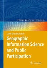
In Geographic Information Science and Public Participation (Advances in Geographic Information Science), Dr. Laxmi Ramasubramanian discusses these issues, using a three-part structure. The first part of the book is theoretical – it reviews the literature in the field, establishes a framework to organize the literature and to link three different subject areas (participation and community development, GIS and other related technologies, and planning processes). The second part of the book discusses a series of success stories, case studies that review actual situations where participatory planning using GIS has enabled community wellbeing and empowerment. These case studies vary in scale and focus on different planning issues (planning broadly defined). The final part of the book steps back to review alternative scenarios for the future, exploring where we are headed, as the technologies we are using to plan rapidly change.

The foreword for the book is written by Prof. Bill Huxhold.

Tuesday, February 02, 2010

Digital Cartography

Digital Cartography from dynamicmediainstitute.org on Vimeo.

By Andrew Ellis, Alexander Wang, Students at the Dynamic Media Institute, Massachusetts College of Art and Design

Digital Cartography is a short documentary film on the transition of maps into their digital form. In this film we speak with programmer and mapmaker Jeffrey Warren from the MIT Media Lab and Dietmar Offenhuber from SENSEable City Lab at MIT. We explore the cultural, economic and technical aspects of mapmaking and how they affect the way we communicate with one another.

In our interviews with Jeffrey and Dietmar we learn about the social and geographical ramifications of building maps and how designers can implement their literacy in communication design to explore different avenues for mapping. Participatory mapping such as Open Street Maps and psychogeography and the virtual dérive are some of the themes discussed around the history and future of mapping in the digital age. Jeffrey gives us a demonstration on low cost arial photography using a helium balloon and a consumer digital camera to stitch photos onto google maps.

Metodología participativa para construir una maqueta 3D en Telpaneca, Nicaragua

Este video trata sobre la construcción de una maqueta (un mapa en 3 dimensiones) de un territorio rural. Se basa en una experiencia que se dió con pueblos indígenas en los territorios de Telpaneca, en Nicaragua.


El video es una producción de la Unión Nacional de Agricultores y Ganaderos (UNAG) de Nueva Segovia, y la ONG francesa Agrónomos y Veterinarios Sin Fronteras (AVSF).

Monday, February 01, 2010

Community Mapping in Tsunami Affected Areas in Aceh, Indonesia

A touching 10-minute video production on how community mapping has been used in post-Tsunami Aceh, Indonesia.


The documentary has been jointly produced by the Indonesia Community Mapping Network or Jaringan Kerja Pemetaan Partisipatif (JKPP), and the Center for people Economic Development or Yayasan Rumpun Bambu Indonesia (YRBI).

More videos on participatory mapping are found here.

Sunday, January 31, 2010

CyberTracker releases a sample database for Disaster Relief Rapid Surveying

Cape Town, South Africa. A sample database for Disaster Relief can be downloaded and modified for specific relief efforts from the CyberTracker Conservation website
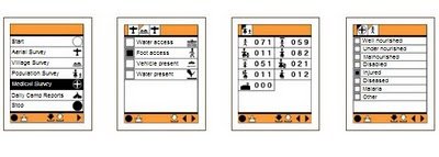
The CyberTracker software can be installed on GPS-enabled Windows Mobile smartphones.

This may help to gather crucial data required to co-ordinate disaster relief logistics.
One of the critical problems in disaster relief management is the lack of reliable data on basic needs on the ground after a major natural disaster. Disaster relief efforts must overcome serious logistical problems due to poor communication and unreliable information. Gathering good quality data on the ground will make it possible to make informed decisions on where the highest priorities are.

Better information on quantities of relief supplies needed, such as medicines, food, blankets, shelter and clothing will ensure that resources are used more efficiently where they are needed most.

Source: Louis Liebenberg, CyberTracker Conservation

Saturday, January 30, 2010

Indigenous People’s Exchanges Amongst Philippines and Peru Promoted by CBCD and ALDAW

Through A Christensen Fund grant “Linking Networks on Pastoralism and Mobile production systems”, Dario Novellino (research at the Centre for Biocultural Diversity (CBCD) of the University of Kent and CEESP member) has facilitated the establishment of solidarity links between the indigenous communities of Palawan and those of Madre de Dios (Peru) who have resisted and are resisting mining for more than two decades.

The establishment of this linkage took place right at the time when indigenous peoples of the Amazonian Peru had began various forms of open resistance against hydrocarbon extraction in their traditional territories. The solidarity link between the IPs of Peru and Palawan is being consolidated through the collaboration of the Ancestral Land/Domain Watch (ALDAW), the Peoples and Plants International (PPI) and, specifically, through the personal efforts of Dr. Miguel Alexiades (CBCD staff and PPI co-director). Such exchange promotes the sharing of experiences as a way of 1) fostering reflection and joint actions through the establishment of strategic alliances; and 2) addressing common problems regarding indigenous links, rights and claims over ancestral homelands and cultural landscapes.

The envisaged goal is to enable the production of jointly produced video materials that could be used to exert pressure at a national and international policy level.

Julio Cusurichi, representing the indigenous organization COINBAMAD (Consejo Indigena de la Cuenca Baja de Madre De Dios) and winner of the well-known award, the Goldman Prize - arrived in the Philippines on July 2009, leaving the country after 21 days. He traveled to Palawan (Philippines) accompanied by Dr. Novellino and the ALDAW (Ancestral Domain/Land Watch) staff. In Palawan, local indigenous organizations (Bangsa Palawan Philippines and NATRIPAL) facilitated the dialogue between Julio and different Palawan communities, while Dr. Novellino helped in the simultaneous translation from Spanish to Palawan language. During his stay, Julio met many indigenous leaders and communities’ members (including women and children) and shared his experience and lessons regarding the impacts of mining and other forms of commercial extractivism upon cultural landscapes and ancestral homelands. Participatory videos showing the impact of mining and oil extraction in Madre de Dios (Peru) have been shown also to the most isolated Palawan communities.

Through Julio’s visit, a process of direct exchange between grassroots indigenous mobilization in Madre de Dios, Peru and local indigenous anti-mining movements in Palawan has been initiated. Before Julio’s departure, this collaboration has been formalized in a Memorandum of Understanding. Video shootings made by Julio Cusurichi in Palawan have been taken back to Peru and will be shown to the Amazonian indigenous communities. A cross-visit of Palawan representatives to the Peruvian Amazon has been planned for the year 2010.

Saturday, January 23, 2010

Counter-mapping in the Philippines: The Gantong Geo-Tagged Report

On July 2009, a mission led by the Philippine-based Ancestral Land/Domain Watch (ALDAW) and the Centre for Biocultural Diversity (CBCD) at the University of Kent traveled to the eastern side of the Gantong range, in Brooke’s Point Municipality, Province of Palawan. Palawan is part of the “Man and Biosphere Reserve” program of UNESCO and hosts 49 animals and 56 botanical species found in the IUCN Red List of Threatened Species.

The mission’s actual ‘matching’ of collected GPS data to photographs shows that the Mineral Production Sharing Agreements (MPSA) of two mining firms [MacroAsia and Celestial Nickel Mining and Exploration Corporation (CNMEC) now operated by Ipilan Nickel Corporation (INC)] overlap with precious watersheds endowed with numerous creeks, springs and waterfalls providing potable water to the local indigenous communities and lowland farmers. More importantly, under the ECAN Guidelines of the Strategic Environmental Plan for Palawan (Republic Act 7611), such areas constitute the so called “core zones” of maximum protection where industrial extractive activities are not allowed.

At an altitude of about 500m ASL the mission reached indigenous settlements inhabited by very traditional Palawan having limited contacts with the outside. Their sustenance totally depends on the available forest resources, and it consists of a heterogeneous economy where sustainable swidden cultivation is integrated with foraging and the collection of non-timber forest products (NTFPs).


Overall, the mission moved from an elevation of a few meters ASL to an altitude of about 670m ASL, where one of the furthermost Palawan settlements is located. The mission’s GPS coordinates were obtained through the use of the JOBO GPS device being connected to the camera’s hot shoe. Positions were taken at intervals of several meters in order to reconstruct the mission’s full itinerary. The geo-tagged images were then loaded into ‘Photo GPS Editor’ and displayed on satellite Google map. All upland Palawan interviewed during the ALDAW/CBCD mission have declared that they have never been consulted about the entrance of mining companies in their traditional territories.


According to indigenous representatives, the Palawan branch of the National Commission on Indigenous Peoples (NCIP) – the government body mandated to ‘protect and promote the interest and well-being of cultural communities’ – is now siding with the mining companies. It is hoped that the ALDAW/CBCD Gantong geo-tagged report will facilitate the circulation of information, at both the national and international levels, on the threats faced by ‘irresponsible mining’ in the Philippines’ “last frontier”. An international campaign to support indigenous Palawan claims to their ancestral land has also been initiated by Survival International.

Source: The ALDAW NETWORK

The ALDAW NETWORK (Ancestral Land/Domain Watch) is an advocacy-campaign network of Indigenous Peoples jointly constituted by NATRIPAL (United Tribes of Palawan) and BANGSA PALAWAN PHILIPPINES (Indigenous Alliance for Equity and Wellbeing) on August 2009.

Friday, January 22, 2010

Peter Poole traces the evolution of participatory map-making


In this interview, Dr. Peter Poole traces the evolution of a participatory map-making which commenced with the introduction of GPS to the Inuits in 1989 and evolved throughout the 1990s via a series of projects in the Amazon, the Arctic and Asia.

Tenure maps depict indigenous names, resources and special places on scaled maps, intended as evidence in negotiating processes. Peter describes the search for cheap, simple, appropriate geomatic technology. Community-based teams would gather raw field data and indigenous associations or support NGOs, set up mapping units to serve the field teams.

Three lessons are described: (i) communities can make their own scaled maps, (ii) emerging mapping centres should make their services accessible to all communities, (iii) this methodology not only produces a tenure map, but also equips and inspires community mappers to diversify their skills in environmental information management.

Thursday, January 21, 2010

The Bulanjao Geotagged Report

On August 2009, a mission led by the Philippines-based Ancestral Land/Domain Watch (ALDAW) and the Centre for Biocultural Diversity (CBCD) at the University of Kent traveled to Barangay Sumbiling, Municipality of Bataraza, Province of Palawan (Philippines).

Geo-referenced audio-visual and photographic documentation was carried out in the Bulanjao range whose vegetation consists of a very unique type of forest growing on ultramafic /heavy-metal rich soils. The area is home to at least four plant species that are classified as vulnerable and two of them have already been included in the IUCN Red List.

In spite of its unique ecological features, the Bulanjao range has been subjected to mineral exploration and development by the Rio Tuba Nickel Mining Corporation (RTNMC). RTNMC is a Filipino-Japanese partnership holding a mining concession area of about 5,265 hectares.

RTNMC and its partner, Coral Bay Nickel Corporation (CBNC), need to mine nickel ores as part of the expansion of their new Hydrometallurgical Processing Plant (HPP) project. However, one the conditions specified in the Environmental Compliance Certificate (ECC) issued to them in 2002, is that “core zones” - as identified by the Strategic Environmental Plan for Palawan (Republic Act Republic Act 7611) should not be included in the areas of mining operations and, this, of course includes the Bulanjao range.

Starting at an elevation of about 40m ASL, the ALDAW/CBCD mission followed the mining road to reach the highest portions of the Bulanjao range. Geo-tagging evidence indicates that erosion on the Bulanjao mining road is occurring also at low elevations. During the rainy season the water creates deep clefts on the roadsides, hence penetrating the soil and fostering road collapse. No mitigating measures have been put into place to reduce erosion. A huge crater-like excavation has been found at 566m ASL. and land slides, induced by road construction, have been documented around the sources of the Sumbiling river, at almost 900m ASL. The latter is the most important water source for both lowland farmers and indigenous communities.

Marylin Samparan, a local IP living in the area told the mission: “time will come when our children will no longer recognize the names of trees, the footprints of animals, the birds’ songs. This will be the time when the forest will be gone, the mining companies will be gone, the rivers will no longer flow…and us? We will still be here”.

On 15 August 2009, the mission established that mining road had already reached an altitude of 859m ASL – and its exact location was defined through the following GPS coordinates (+ 8.59322548 N Latitude and + 117.36516571 E Longitude).

Mission’s findings have now been compiled into a geo-tagged report, which is being used by local indigenous communities to support their legal struggle against mining in Bulanjao.

Source: The ALDAW NETWORK

The ALDAW NETWORK (Ancestral Land/Domain Watch) is an advocacy-campaign network of Indigenous Peoples jointly constituted by NATRIPAL (United Tribes of Palawan) and BANGSA PALAWAN PHILIPPINES (Indigenous Alliance for Equity and Wellbeing) on August 2009.

Tuesday, January 19, 2010

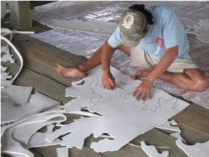
What 3-D mapmakers should know about expanded EVA / PE closed-cell foam or sponge

Expanded EVA / PE closed-cell foam or sponge is usually made out of a blend of Ethylene Vinyl Acetate copolymer (also known as EVA) and polyethylene. The product is a lightweight foam material which has a smooth surface and does not absorb water. Generally EVA sheeting is priced competitively, compared with other blown materials and is available in different densities, thicknesses and colours.
It is one of the materials most popularly known as expanded rubber or foam rubber sheeting.
EVA foam is used to produce - among others - mouse pads, flip flops and sports mats. Sheets of the material can be used for manufacturing Participatory 3D Models.
Models made out of this material are well suited for humid tropical environments where carton board may deteriorate rapidly.
Manufacturing a 3D model using 'expanded EVA / PE closed-cell foam' compared to carton board implies a slightly higher cost and non biodegradable debris, but ensures a more durable output and a consistent vertical scale/exaggeration of the 3D model. Insertion of map and push pins is easy.

More information on the topic is found here.

Friday, January 08, 2010

Interview with Steve deRoy about the role of networking and communication in PGIS practice


In this interview, Mr. Steven DeRoy illustrates the power of networking and the importance of integrating this practice into the daily realm of PGIS. These professional exchanges create an opportunity to dialogue with likeminding professionals, allowing practitioners to share ideas and approaches to solve common challenges. Maps also play a vital role in communicating ideas amongst different parties and for advocating change in current affairs

Google Earth Outreach initiative in Africa

Google Earth Outreach in Africa was recently launched with the objective of enabling non-profit and public benefit organizations in the continent to access the knowledge and resources they need to organize their data, build their maps, tell their stories through geographic visualization.

Google Earth and the various Google Geo Tools are increasingly used for communication and advocacy because of their unique ability to visually connect people to places.

By annotating Google Earth and Maps with pictures and information, organizations can tell visual and compelling stories of the work they do to the over 500 million Google Earth users.

Monday, December 14, 2009

Community mapping in Borneo

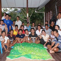
Community members and park naturalists have completed a participatory 3-dimensional scaled model of the Buayan-Kionop area showing areas important for community livelihoods. The pproject, funded by the Darwin Initiative, is designed to contribute to the nomination of the Crocker Range Biosphere Reserve. Work began in August 2009 with local partners and 10 indigenous communities. Local researchers from Buayan-Kionop are sharing their skills with neighbouring communities to document and map community livelihood patterns for the entire Ulu Papar area. They have been using a range of techniques, including participatory GIS and participatory 3-dimensional modelling (P3DM) to show areas important for cultivation, hunting, fishing and gathering of forest products. Over the next 3 years, we will build on the participatory research results in Buayan-Kionop and create spaces for community dialogue on balancing conservation and sustainable resource use in the Crocker Range.

More information on the programme is found here.

Source: Agnes Lee Agama, Southeast Asia coordinator, Global Diversity Foundation update December 2009

Friday, November 27, 2009

Eco-cultural mapping to protect natural resources and sacred sites, South Africa

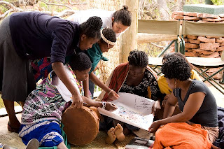
The case of the vhaVenda people echoes throughout many other rural areas in Africa and amongst other groups of traditional and indigenous peoples – the loss of communally owned territories, the expansion of industrial plantations and non-sustainable forms of land and resource use including tourism, the erosion of cultural values and sacred sites. With support from CTA, women, men and youth from Tshidzivhe community, in Limpopo province, northern South Africa, spent six days exploring ways to ‘map’ their traditional knowledge and practices for managing their natural resources. As the different maps were finished, the local people celebrated their new capacity to express traditional environmental knowledge in an appropriate way for gaining recognition, reviving traditional practices and securing their rights.

This was a unique mapping experience that involved local people as well as indigenous from other parts of the world. More than 70 vhaVenda people took part, guided by trainers in eco-cultural mapping from Colombia and accompanied by indigenous leaders from the Colombian Amazon and the Russian Republic of Altai. The process required the full participation of community members, especially the elders and the makhadzis, women custodians of sacred sites, but with minimal materials or technology.

Four maps and two ecological calendars were produced, covering what the local population refers to as “Venda territory” and with special attention to the main sacred sites. The maps show the changes and alterations to the land - the past, present and future visions - and the importance of recovering traditional practices and rituals.

Trainees from Kenya and Ethiopia, members of the African Biodiversity Network, took part and hope to carry out similar workshops in their respective countries in 2010.

Photos by Will Baxter, text by Fiona Wilton / The Gaia Foundation

Friday, November 13, 2009

Peter Poole reports on his experience with community mapping


In this interview, Peter Poole traces the evolution of a map-making methodology which commenced with his introduction of GPS to the Inuit community of Pangnirtung in 1989 and was incubated throughout the 1990’s by a series of ‘tenure mapping’ projects in the Amazon the Arctic and Asia. Tenure maps depict indigenous names, resources and special places on scaled maps, intended as evidence in negotiating land settlements.

Most tenure mapping methods rely upon external cartographic expertise. The “no-name” method enables communities to control the complete information cycle: gathering raw data, their conversion to information, its application.

The interview describes the search for cheap, simple, appropriate geomatic technology.

During several tenure mapping projects in the Amazon, a two-tier arrangement evolved whereby community-based teams would gather raw field data, the most critical task, and indigenous associations or support NGO’s, set up mapping units to serve the field teams.

The interview shifts focus to an overview of global community mapping completed by Peter Poole. In this, he concluded that, in terms of expertise, accessibility and accomplishment, the Philippines. He also drew a broad distinction to tenure mapping in America, a continent whose indigenous peoples sharing a in common ‘500 years since Columbus’ experience, and Africa, where this model does not work and where community mapping is taking off in a refreshing variety of directions.

The interview concludes with three lessons learned:
  • Yes, communities can make their own scaled maps.
  • The most successful of emerging mapping centres are those whose services are accessible to all communities.
  • This capacity-building approach to map making equips and inspires people to diversify their skills in environmental information management. These skills will be wasted unless provisions are made to follow up tenure mapping projects with either further training or employment.

Friday, November 06, 2009

Dave De Vera elaborates on Participatory GIS practice in the Philippines


Dave De Vera is the Executive Director of the Philippine Association For Intercultural Development (PAFID). In his interview Dave elaborates on the use of Participatory GIS practice in the Philippines to support indigenous communities in filing ancestral land claims. He elaborates on the mapping methods used, explains why P3DM is the most effective, and arguments on the need for local ownership of the process, competency of the technology intermediary, quality work, and constructive relationships with Government. Dave further lists cases of PAFID / Government partnerships and analyses the pillars of process legitimization.

Indigenous Peoples in Africa prepare for Copenhagen - REDD and human rights

With funding support from CTA, fifteen indigenous African leaders from East and Central Africa met in Bujumbura, Burundi to finalise a joint strategy and statement on climate change. Leaders from forest based communities in Gabon, Cameroon, DR Congo, Rwanda, Burundi, Uganda and Kenya participated in a joint UNIPROBA-IPACC policy meeting from 26-27 October 2009 to set out their concerns, priorities, action plan and statement ahead of the 15th Conference of Parties of the UN Framework Convention on Climate Change, due to take place in Copenhagen Denmark.

Delegates emphasised that indigenous peoples are important stakeholders in climate stabilisation in Africa. Indigenous leaders must educate their communities as to the causes and engage with national governments about equitable and sustainable responses. Delegates reported back on mitigation / REDD (Reducing Emissions from Deforestation and Forest Degradation) workshops that were held this year in Cape Town, Kampala, Nanyuki (Kenya) and Libreville, Gabon. The primary issues were to promote a fair and community-focused approach to REDD plus financing for forest conservation in Africa.

Government forestry officials from Uganda and Kenya gave presentations on how their governments are contracting with local communities to conserve tropical forests, and introduce new forms of carbon financing.

Jeniffer Koinante, Deputy Chairperson of IPACC gave a presentation on how the forest-based indigenous peoples of Kenya are using Participatory 3-Dimensional Models (P3DM) to help them review traditional adaptation customs, knowledge and practices, which could be harnessed to strengthen resilience of ecosystems and communities in the face of climate change.