Pages

Wednesday, September 30, 2009

The Touch Table for participatory land use planning

This video shows how the Touch Table can be used to support land use planning with multiple stakeholders with multiple interests

Friday, September 18, 2009

Web-Based GIS and the Future of Participatory GIS Applications within Local and Indigenous Communities

As resource managers search for strategies to meet the challenges posed by intense competition for scarce local resources, the implementation of Community-based GIS applications have become widespread. Besides mapping, the Participatory GIS (PGIS) projects create a peaceful medium for community groups and public officials to meet, exchange views and also learn to develop trust for each other. However, PGIS projects face many problems including the lack of basic supporting infrastructure and services. The adoption of the Internet as a platform for PGIS applications therefore raises concerns about the future of PGIS projects. While the Internet may open the participatory process, it can also hinder participation among local groups. In an era when PGIS applications have become important in the management of local resources, there is an urgent need to examine implications of the On-line PGIS project. Accordingly, in their paper, by the title Web-Based GIS and the Future of Participatory GIS Applications within Local and Indigenous Communities, Peter Kyem and James Saku assess the potential benefits and drawbacks of on-line PGIS applications within local communities.

Applications of GIS in Community Forestry: Linking Geographic Information Technology to Community Participation
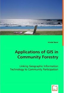
Planning and managing forest resources in todays ever-changing world is becoming very complex and demanding challenges to forest resource managers. Because of the multiple interests of forest users and other community interest groups, a wider range of up-to-date information is being requested in community forestry, than has been used in conventional government-based forest management in the past. Geographic Information Systems (GIS) and related technologies provide foresters and resource planners with powerful tools for planning, management and decision making. Recent trend towards community based forest management has added new dimensions and potential to use of GIS in community forestry. This book explores the potential and constraints for the application of GIS technology in community based forestry. This book will be of interest to forest managers, community development practitioners, researchers and students interested in using GIS technology in forestry and participatory GIS.

Wednesday, September 16, 2009

How to create a "My Map" in Google Maps


How to create personalized, annotated, customized maps using Google Maps.

Here is an example: P3DM Where?

Head teacher Julius Sangogo reports on the usefullness of a Participatory 3D Model (P3DM) in Nessuit, Kenya

Head teacher Julius Sangogo reports on the usefullness of a Participatory 3D Model in Nessuit, Kenya from CTA on Vimeo.

Three years after the completion of a Participatory 3D model in Nessuit Kenya, head teacher Julius Sangogo recalls the uses of the model by local, national and international agencies and more importantly by the pupils of the local primary school.

The Mystery of Capital among the Indigenous Peoples of the Amazon

Part 1 The Mystery of Capital among the Indigenous Peoples of the Amazon from ILD on Vimeo.

A film directed by James Becket
Conceived of and written by Hernando de Soto
Produced by Bernardo Roca Rey and Hernando de Soto
Research Director Ana Lucía Camaiora
A Becket Films LLC and Institute for Liberty and Democracy Production


Part 2 The Mystery of Capital among the Indigenous Peoples of the Amazon from ILD on Vimeo.

A film directed by James Becket Conceived of and written by Hernando de Soto Produced by Bernardo Roca Rey and Hernando de Soto Research Director Ana Lucía Camaiora A Becket Films LLC and Institute for Liberty and Democracy Production


Part 3 The Mystery of Capital among the Indigenous Peoples of the Amazon from ILD on Vimeo.

A film directed by James Becket Conceived of and written by Hernando de Soto Produced by Bernardo Roca Rey and Hernando de Soto Research Director Ana Lucía Camaiora A Becket Films LLC and Institute for Liberty and Democracy Production

Wednesday, September 09, 2009

Participatory 3D Model (P3DM) of Chivoko village, Solomon Islands

A total of 60 representatives from the Chivoko community including youth, elders, women and men, students and chiefs; representatives from "Sasamunga Live and Learn", The Nature Conservancy (TNC), the "Lauru Land Conference of Tribal Communities" (LLCTC), and the Choiseul Provincial Fisheries constructed a 1:20,000 scale Participatory 3D Model (P3DM) of Chivoko village in the Tavula ward, Choiseul Province, Solomon Islands. The model covering a total area of 192 sq km is the 1st if its kind in Solomon Islands.

The model has been done to serve a key negotiation tool for the Chivoko community to map out the watershed and coastal areas it depends on to address the challenges facing sustainable resource management and conservation. The initiative aims at securing the conservation of the Chivoko Watershed forests (approx 8000 ha) and place them legally beyond the reach of industrial logging ventures. The project will draw on national expertise to produce a collaborative watershed management plan which will provide guidance for sustainable forest development practices by a community cooperative.

More information is found here.

Tuesday, September 01, 2009

Qualitative GIS: A Mixed Methods Approach

'Qualitative GIS is coming of age, and this definitive collection explains why it deserves broad attention. These carefully selected essays by leading researchers, organized around a broad conception of qualitative GIS that extends beyond multi-media data integration to embrace new software tools and interpretive, situated epistemologies, will push readers to rethink not only their preconceptions about qualitative GIS, but also about GI science and critical GIS. GIS researchers, practitioners, observers and users will find much to chew on here' - Professor Eric Sheppard, University of Minnesota, USA

Geographic Information Systems are an essential tool for analyzing and representing quantitative spatial data. Qualitative GIS explains the recent integration of qualitative research with Geographical Information Systems

With a detailed contextualising introduction, the text is organised in three sections:

Representation: examines how researchers are using GIS to create new types of representations; working with spatial data, maps, and othervisualizations to incorporate multiple meanings and to provide texture and context. This section includes a chapter by Jon Corbett and Giacomo Rambaldi dealing with participatory mapping by the title: "Geographic information technologies, local knowledge, and change (pages 75-91).

Analysis: discusses the new techniques of analysis that are emerging at the margins between qualitative research and GIS, this in the wider context of a critical review of mixed-methods in geographical research

Theory: questions how knowledge is produced, showing how ideas of 'science' and 'truth' inform research, and demonstrates how qualitative GIS can be used to interrogate discussions of power, community, and social action

Making reference to representation, analysis, and theory throughout, the text shows how to frame questions, collect data, analyze results, and represent findings in a truly integrated way. An important addition to the mixed methods literature, Qualitative GIS will be the standard reference for upper-level students and researchers using qualitative methods and Geographic Information Systems.

Available from Amazon.com (US) and Amazon.co.uk (Europe)