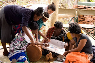
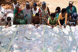
 With support from CTA, women, men and youth from Tshidzivhe community, in Limpopo province, northern South Africa, spent six days exploring ways to ‘map’ their traditional knowledge and practices for managing their natural resources. As the different maps were finished, the local people celebrated their new capacity to express traditional environmental knowledge in an appropriate way for gaining recognition, reviving traditional practices and securing their rights.
This was a unique mapping experience that involved local people as well as indigenous from other parts of the world. More than 70 vhaVenda people took part, guided by trainers in eco-cultural mapping from Colombia and accompanied by indigenous leaders from the Colombian Amazon and the Russian Republic of Altai. The process required the full participation of community members, especially the elders and the makhadzis, women custodians of sacred sites, but with minimal materials or technology.
 Four maps and two ecological calendars were produced, covering what the local population refers to as “Venda territory” and with special attention to the main sacred sites. The maps show the changes and alterations to the land - the past, present and future visions - and the importance of recovering traditional practices and rituals.
Trainees from Kenya and Ethiopia, members of the African Biodiversity Network, took part and hope to carry out similar workshops in their respective countries in 2010.
Photos by Will Baxter, text by Fiona Wilton / The Gaia Foundation
