Tuesday, April 22, 2008
Small Grants Program - Anthropology & Environment
For more information have a look at Funding opportunities for NGOs and researchers
Friday, April 18, 2008
2008 Call for grant applications from indigenous peoples’ organizations and their communities
Grants range from US$10,000 to US$30,000. Applicants must meet specific requirements and their proposals should respond to the needs of indigenous peoples in any of IFAD’s Member States.
E-mail and mail your applications to IFAD. The closing date for applications is 30 June 2008. IFAD will not accept applications after that date.
A panel made up primarily of indigenous members will work closely with IFAD staff to review proposals and make final recommendations on grant awards. The panel will review grant proposals on the basis of project relevance, feasibility and institutional capacity and make final recommendations on awards.
Activities likely to be considered for funding will build on indigenous culture, identity, knowledge, natural resources, intellectual property and human rights. Projects should improve indigenous peoples’ access to decision-making processes, empower indigenous peoples to find solutions to the challenges they face and promote collaboration in the public and private sectors.
Over the years IFAD has learned that entrusting direct management of resources and funds to indigenous communities and their institutions is an effective way to build capacity, self-determined development and ownership of programmes and projects.
To apply for a grant, read the call for proposal, the guideline for completing the application form and complete the application form.
Tuesday, April 15, 2008
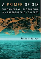
A Primer of GIS: Fundamental Geographic and Cartographic Concepts By Francis Harvey

Aboriginal Communities in Google Earth
Monday, April 14, 2008
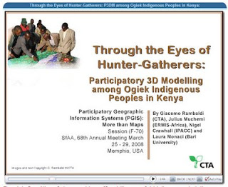
Through the Eyes of Hunter-Gatherers: Participatory 3D Modelling among Ogiek Indigenous Peoples in Kenya

Sunday, April 13, 2008
Mapping is Power
Earth Island Institute’s Sacred Land Film Project
Monday, April 07, 2008
Journey of our Life
A 14-minute participatory video production by PAFID - Mindanao documenting a journey to the land of the ancestors of Higaonon Indigenous Peoples living in Portulin, Bukidnon, Philippines. The virtual journey recreates experiences lived up by the members of the community in using a physical participatory 3D model (P3DM) to document, share across generations and safeguard their intangible cultural heritage.
Geo-visualisation for participatory spatial planning in Europe
 The principle of public participation in policy-making and policy implementation features in many European Union directives and policy documents. It is also undeniably connected to the rise of what can be called the European e-society, in which digital technologies are expected to strengthen public involvement in democratic processes. One broad group of such technologies are commonly referred to as geo-visualisations.This book contains the results of a European project that explored the potential for using innovative geo-visualisation techniques in public participation processes for spatial planning. The approach taken in the project involved continual interaction between concept development, the technological possibilities, and their practical application in case studies conducted in Belgium, Poland, Portugal, Spain and the Netherlands. The structure of the book mirrors this procedure. Three chapters discuss the general concepts of spatial planning and participation, e-interaction, and innovation in organisations. Two chapters present the results of research into the communicative potential and the usability of 3-dimensional geo-visualisations. The translation of these concepts and findings into practice is reported in five chapters devoted to the case studies.The project generated greater understanding of the ways in which geo-visualisation can help to improve public participation in the process of finding solutions to spatial planning issues. This book and accompanying DVD with extra information, is therefore a valuable resource for professionals and practitioners already working with geo-visualisations in participatory spatial planning as well as those looking to do so. They can turn to this book for insights and inspiration.
Friday, April 04, 2008
2008 Indigenous Planning Conference "Leading Change: Blending Indigenous and Western Planning Tools" (1-3 October 2008, Anchorage, Alaska, USA)
The Leading Change conference (1-3 October 2008, Anchorage, Alaska, USA) is sponsored by the American Planning Association’s (APA) Alaska and Hawaii Chapters and the Indigenous Planning Division. The three-day conference will bring together planners, tribal leaders, and community members to share local experiences, planning tools and practices that reflect a commitment to honoring history, cultural identity, tradition, and land tenure. Conference participants will share stories from their own communities organized around general topic areas including land use and natural environment; governance, nation building and leadership; local control, community sustainability, and resilience; culture, education, and community services; economy; and infrastructure, public services, and facilities.
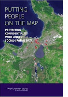
Putting People on the Map: Protecting Confidentiality with Linked Social-Spatial Data

At the same time, precise spatial data make it more likely that individuals can be identified, breaching the promise of confidentiality made when the data were collected.
Because norms of science and government agencies favor open access to all scientific data, the tension between the benefits of open access and the risks associated with potential breach of confidentiality pose significant challenges to researchers, research sponsors, scientific institutions, and data archivists. Putting People on the Map finds that several technical approaches for making data available while limiting risk have potential, but none is adequate on its own or in combination. This book offers recommendations for education, training, research, and practice to researchers, professional societies, federal agencies, institutional review boards, and data stewards.
Intangible Cultural Heritage in Fiji - video clip featured at the WSA 2007 award winners ceremony
The World Summit Award (WSA) Awarding Ceremony has been the highlight of the entire WSA process 2005-2007 and a unique ceremony to honour excellence in multimedia and e-Content creation. Up to 40 winning Teams from all over the world were present at the event and were handed out the awards by highest level international dignities.
