Sunday, August 30, 2015

The power of media: Did the documentary film "Virunga" trigger a plunge in the share price of the oil exploration firm SOCO International?

Virunga is a extraordinary documentary film which focuses on the conservation work of rangers within the Virunga National Park in the  Democratic Republic of the Congo, and the activity of a British company, Soco International, which began exploring for oil within the UNESCO World Heritage site in April 2014. SOCO is an international oil and gas exploration and production company, headquartered in London. It is listed on the London Stock Exchange.

The film premiered at the Tribeca Film Festival on April 17, 2014. Since airing on Netflix it was nominated for an Academy Award for Best Documentary Feature.

The allegations brought against Soco International by the documentary, and supported by local NGOs and civil society organizations working in and around Virunga National park, put increased pressure on the company to put an end to its exploration for oil within the protected World Heritage Site.

On June 11, 2014, Soco International and the WWF announced a joint statement in which the oil company committed "not to undertake or commission any exploratory or other drilling within Virunga National Park unless UNESCO and the DRC government agree that such activities are not incompatible with its World Heritage status". This was widely cited as a victory for WWF, which had long been campaigning for Soco to leave the region, and credit was also given to the filmmakers. However, strong concerns about the credibility of this agreement were raised by the filmmakers, alongside other NGOs such as Global Witness and Human Rights Watch, and local civil society organisations.

World Wildlife Fund executives now acknowledge that the battle over Virunga is hardly over. SOCO has yet to relinquish its operating permits or commit to an unconditional withdrawal…”They’re leaving the door open,” said Zach Abraham, director of the World Wildlife Fund’s global campaigns. (Source: adapted from Wikipedia)

On March 13, 2015, BBC reported that the Democratic Republic of Congo says it wants to redraw the boundaries of Virunga National Park, to allow for oil exploration.

On June 10, 2015 BBC reported that 'Soco paid Congo major' accused of Virunga oil intimidation.

Since the launch of the film on April 17, 2014, SOCO's share price has plunged by 63.33%. This slump can be attributed only partially to the drop in oil prices as shares from BP and Shell dropped by 14.3% and 25.9% respectively over the same period.


Call for action:
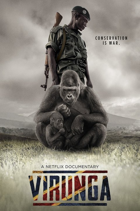
You can view the documentary film on Netflix.
You can interact with the producers via http://virungamovie.com/ and take action.
Save Virunga: http://savevirunga.com/
Watch trailer:


Heads up to Orlando von Einsiede, the film director, the French investigative journalist, Mélanie Gouby and to the team behind this great production!

Sunday, August 23, 2015

Mapping Our Land: A Guide to Making Your Own Maps of Communities and Traditional Lands


Communities all over the world are discovering that maps provide a valuable tool for recording local knowledge and discussing land-use issues. In a participatory approach to mapping, community members design the mapping project and make maps according to their own needs.

Mapping Our Land describes all stages of the community mapping process from setting the goals of the project to completion of the maps.

Alix Flavelle has taught mapping to aboriginal peoples around the world. She outlines the range of themes that communities choose to address and offers examples of how they have presented their local knowledge on maps. A variety of map-making techniques are explored, as well as guidelines for choosing which techniques best suit the purpose of the mapping project.

Clear step-by-step instructions are provided for:

  • Basic principles of map-making
  • Exploring cultural elements of maps
  • How to organize the community
  • Making sketch maps on paper or mylar
  • Using topographic maps
  • Making three-dimensional models
  • How to do a compass survey
  • Using a Global Positioning System (GPS)
  • Interpreting aerial, radar and satellite images
  • Drawing the final map
  • Land rights, resource management and protecting local knowledge.

Accessible and full of practical information and ideas, this book is a toolbox intended to help communities design and complete a mapping project that fits their unique culture, landscape and situation, and their purpose for making maps.

Available from Amazon: Mapping Our Land

Handbook on Participatory Land Use Planning: Methods and tools developed and tested in Viengkham District, Luang Prabang Province, Lao PDR

“This approach puts the keys of development in the hands of local communities and avoids engaging them into endless assistance programs” District Governor Viengkham - 2011

Securing land tenure rights for village communities through participatory land use planning is a hot topic for policy makers, researchers and development practitioners. In Lao PDR, the government policy aimed at turning land into capital may well turn to land grabbing wherever local communities are not informed about their rights and are not involved in land use planning.

Participatory Land Use Planning  (PLUP) is an empowerment process for villagers who get trained as land use negotiators. They learn the real value of their land and labour.

The proposed PLUP method helps them to visualize land related issues, to assess the potential impact of alternative scenarios before they make decision. While local people know well their own situation they often do not know how to collectively design a better future for the whole village through land use planning. ‘PLUP fiction’ is a learning device for land zoning and local development planning. Based on a virtual village territory visualized on a board, members of the village land management committee learn how to make informed decisions about land zoning according to the needs of different stakeholders.

Using the method learned during the landscape simulation game, they negotiate their own land use zoning on the 3D model representing their village landscape. They first design their current land use by using coloured pins and string on the 3D model. Then, land zones are digitized, analyzed and compared to the needs expressed by the villagers in their village action plan, i.e. village economic development, labour force availability, rice sufficiency, livestock carrying capacity, preservation of ecosystems services.

New land use plans are designed successively until all the committee members are satisfied. The iterative zoning process is facilitated by the use of a GIS software (QGIS) and an Excel based tool. On completion of the PLUP exercise, the 3D model painted with the new land use plan remains with the community.

The purpose of this PLUP Handbook is to provide practical tools and methods for PLUP implementation based on experiments conducted in Viengkham District, Luang Prabang Province. Lessons drawn from this experience have been gradually incorporated into the tools and procedures described in this Handbook and Toolbox as a reference guide for PLUP practitioners.

Download: Handbook on Participatory Land Use Planning: Methods and tools developed and tested in Viengkham District, Luang Prabang Province, Lao PDR

Authors: Jean-Christophe Castella, Jeremy Bourgoin, Lionel Cottet, Maëlle Drouillat, Khamla Nanthavong, Sangthong Phatsalin, Guillaume Lestrelin, Bounthanom Bouahom and Manithaithip Thepphavanh

Publisher: National Agriculture and Forestry Research Institute (NAFRI), Institute of Research for Development (IRD) and Centre for International Forestry Research (CIFOR), May 2012

Saturday, August 22, 2015

Participatory Methods in Community-based Coastal Resource Management

This 3 volumes sourcebook is a documentation of various tools and methods developed in the course of doing Community-based Coastal Resource Management (CBCRM) as effectively and efficiently employed by field practitioners in the Philippines, Indonesia, India and other Asian countries. The main section of the sourcebook is the step by step description of various participatory methods field tested by the authors and their organizations. A simple outline was devised for most of the topics to include the definition, purpose, materials, suggested approach, outputs, strengths, weaknesses and variations. The sourcebook is designed for use by people working directly with coastal communities to help strengthen their capability to manage, protect and develop their local resources.

Download the chapter on Resource Mapping
ISBN: 0-942717-90-2
Publisher: International Institute for Rural reconstruction (IIRR), 1998

The Canadian International Development Agency (CIDA), International Development Research Centre (IDRC), Royal Netherlands Embassy, Small Islands Agricultural Support Services Programme (SMISLE) and the Western Samar Agricultural Resources Development Programme were the funding partners for this publication. Collaborating organizations were IDRC, International Center for Living Aquatic Resources and Management (ICLARM), Voluntary Service Overseas (VSO), SEAMEO Regional Center for Graduate Study and Research in Agriculture (SEARCA), SMISLE and Coastal Resource Management Project (CRMP).

Wednesday, August 19, 2015

Mapping for Change: Practice, technologies and communication - 10 years have passed - publication still valid and available

This CD “Mapping for Change: Practice, technologies and communication” includes a selection of papers presented at the “Mapping for Change: International Conference of Spatial Information Management and Communication” held in Nairobi, Kenya, on 7th-10th September, 2005 and published in Participatory Learning and Action (PLA) 54 in April 2006. Guest editors of PLA 54 are Giacomo Rambaldi; Jon Corbett; Mike McCall; Rachel Olson; Julius Muchemi; Peter Kwaku Kyem; Daniel Wiener and Robert Chambers.

The CD contains PDF versions of the articles published in PLA 54 translated in the following languages: Arabic, Bangla, Chinese (traditional and simplified), French, Hindi, Persian-Dari, Portuguese, Spanish, Swahili and Tamil as well as the English versions. The CD includes additional resources (mainly in English), including a video of the Conference and key literature on the practice, including UNESCO Conventions on Cultural Mapping.

Available (for free) to residents in Africa, Caribbean and Pacific (ACP) countries via CTA Publishing.

Credits for Translations, layout and typesetting 
  • Arabic: Translation by Dr. El-Hussaini Yehia, Center for Development Services, Cairo, with thanks to Ali Mokhtar
  • Bangla: Translation by Enamul Huda and Taifur Rahman, PRA Promoters’ Society, Bangladesh
  • Chinese (Simplified): Translation by Liu Xiaoqian, Yang Fang , Li Fang, Li Xiaoyun, China Agricultural University, Beijing
  • Chinese (Traditional): Translation by Wang Yaohui, National Linkou Senior High School, Linkou Township, Taiwan with special thanks to Hsiao Ya Wen, National Changhua University of Education, Changhua City, Taiwan (Chapters 1 and 2); Lin Mei Jhih, Shengang Junior High School, Shengang Township, Taichung County, Taiwan (Chapter 4); Chuang Yu Chun, National Yangmei Senior High School, Yangmei Township, Taoyuan County, Taiwan (Chapter 7); Shen Tsui Mei, National Linkou Senior High School, Linkou Township, Taipei County, Taiwan (Chapter 9); Jhang Yu Jing, National Sihu Senior High School, Sihu Township, Changhua County, Taiwan (Chapter 12); Lin Wen-Xin, Kaohsiung Municipal Chung-Cheng Industrial Vocational High School, Cianjhen District, Kaohsiung City, Taiwan (Chapter 15)
  • French: Translation by Maryck Nicolas, with thanks to Marie Jaecky of IIED for proofreading
  • Hindi: Translation by Meera Jayaswal, with thanks to Dr. Neela Mukherjee, Director, Development Tracks, Delhi, India, and to Mr.K.K.Singh, Ujjawal Kumar and Sanjay Das for page layout and typesetting
  • Persian-Dari: Translation by Reza Nobacht, with thanks to CENESTA, Tehran for technical support, to Esmaeel Hamidi and Jeyran Farvar for copy editing and proof reading, to Pooya Ghoddousi for coordination and Jeyran Farvar for page layout and typesetting
  • Portuguese: Translation by Francis Sahadeo, with thanks to Ines Fortes for copyediting
  • Spanish: Translation by María Isabel Sanz Bonino, with thanks to Alejandra Larrazábal and Mike McCall for copyediting and Tanya Pascual for proofreading
  • Swahili: Translation by Catherine Wanjiku Gichingi and Margaret Njeri Gichingiri (ERMIS Africa) with thanks to Julius Muchemi, Executive Director and Bancy Wanjiru, Programme Administrator
  • Tamil: Translation by John Devavaram and his team at SPEECH, Madurai, India, including Arunodayam

Saturday, August 08, 2015

Saamaka peoples upscale the use Participatory 3 Dimensional Modelling along the Upper Suriname River


In partnership with Tropenbos International Suriname (TBI), WWF, and the Association of Saamaka Authorities (VSG), CTA introduced the Participatory 3D Modelling (P3DM) process in Suriname in 2014. Due to the successful outcome of the 1st exercise, VSG – supported by TBI – applied for support from UNDP GEF Small Grants Programme (GEF-SGP) for extending the mapped area and upscale the community based planning exercise along the Upper Suriname River, towards the interior of the country.

Once GEF-SGP released the funds, a second P3DM exercise took place in June and July 2015. Areas that are important for the community’s way of life, particularly areas with high cultural and historical value were at the core of the process. Over an 11-day period, a total of ~65 representatives from 10 villages traveled to the village of Pikin Slee, to collectively determine a representative portion of Saamaka traditional land as a 3D physical map (built at a 1:15,000 scale).

The map was conceived with the specific objective of empowering local communities to play an active role in sound land-use and sustainable development. Saamaka participants populated the 3D model with locations of ecosystem services and cultural and historical landscape of value. With this, P3DM is demonstrating its utility in both socio-ecological production landscape based research, as well as in collaborative historical, cultural and ethno-archaeology studies in Suriname.

In this context, Tropenbos International Suriname is collaborating with the History Department of the Anton de Kom University of Suriname, Faculty of Humanity so that historical and contemporary cultural landscape use and services are better portrayed.

Notes: The project is granted to the Association of Saamaka Authorities (VSG), executed by Tropenbos International Suriname and financially supported by the UNDP GEF Small Grants Programme. CTA supported the participation of 2 delegates from CARIBSAVE in the exercise to ensure wider replication of the process in the Caribbean region.

More on 2014 P3DM activities in Suriname: