The Leading Change conference (1-3 October 2008, Anchorage, Alaska, USA) is sponsored by the American Planning Association’s (APA) Alaska and Hawaii Chapters and the Indigenous Planning Division. The three-day conference will bring together planners, tribal leaders, and community members to share local experiences, planning tools and practices that reflect a commitment to honoring history, cultural identity, tradition, and land tenure. Conference participants will share stories from their own communities organized around general topic areas including land use and natural environment; governance, nation building and leadership; local control, community sustainability, and resilience; culture, education, and community services; economy; and infrastructure, public services, and facilities.

Friday, April 04, 2008
2008 Indigenous Planning Conference "Leading Change: Blending Indigenous and Western Planning Tools" (1-3 October 2008, Anchorage, Alaska, USA)
Putting People on the Map: Protecting Confidentiality with Linked Social-Spatial Data
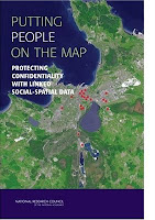
At the same time, precise spatial data make it more likely that individuals can be identified, breaching the promise of confidentiality made when the data were collected.
Because norms of science and government agencies favor open access to all scientific data, the tension between the benefits of open access and the risks associated with potential breach of confidentiality pose significant challenges to researchers, research sponsors, scientific institutions, and data archivists. Putting People on the Map finds that several technical approaches for making data available while limiting risk have potential, but none is adequate on its own or in combination. This book offers recommendations for education, training, research, and practice to researchers, professional societies, federal agencies, institutional review boards, and data stewards.
Intangible Cultural Heritage in Fiji - video clip featured at the WSA 2007 award winners ceremony
The World Summit Award (WSA) Awarding Ceremony has been the highlight of the entire WSA process 2005-2007 and a unique ceremony to honour excellence in multimedia and e-Content creation. Up to 40 winning Teams from all over the world were present at the event and were handed out the awards by highest level international dignities.
Sunday, March 16, 2008
Difference between Google Maps and Google Earth
Google Earth Outreach
Sunday, February 24, 2008
An Atlas of Radical Cartography
 An Atlas of Radical Cartography published by The Journal of Aesthetics and Protest, makes an important contribution to a growing cultural movement that traverses the boundaries between art, cartography, geography and activism. It pairs writers with artists, architects, designers and collectives to address the role of the map as political agent (rather than neutral document). Ten mapping projects dealing with social and political issues such as migration, incarceration, globalization, housing rights, garbage and energy issues, are complemented by 10 critical essays and dialogues responding to each map. The maps themselves are printed as posters, unbound for leisurely perusal. Among the contributors are artists Trevor Paglen, John Emerson, Ashley Hunt and Pedro Lasch, and essayists Avery Gordon, Heather Rogers, Alejandro De Acosta and Jenny Price.
Tuesday, February 12, 2008
Panel on Mapping Cultural and Biological Diversity; April 5-7, New York, USA
Remote Sensing and GIS Conference, May 5 - 6, 2008, Kupang, Indonesia
As part of Charles Darwin Universities AUSAID funded Public Service Linkages Program a GIS and Remote sensing Conference will be held at Nusa Cendana University in Kupang 5-6 May.
The conference will act as a forum to discuss the following: (i) current applications, projects and research in NTT using remote sensing and GIS technology; (ii) the development of formal and informal data and skill sharing networks; (iii) protocols for collecting and archiving data. A provincial wide conference is very important at this time when a range of regional initiatives are being developed to support good governance through data collection, archiving and analysis. The effecting sharing of capacity and aspirations within NTT will assist in the development of a coordinated approach in the development of spatial planning.
This is an advanced notice and call for presentations. It is proposed that presentations from the conference be published as proceedings. The organisers have currently identified the following broad topics:
- Critical land assessment in the Assesa catchment in Ngada
- Fire mapping and monitoring in Sumba
- Deforestation monitoring in Timor
- GIS for land capability assessment – development planning
- GIS for analysis of health and education data
- Community GIS and Participatory 3D Modeling (P3DM).
- Standards for data collection and storage
- Arrangements for data sharing
- Accuracy assessment
For further information you may contact: Dr. Marthen R. Pellokila (UNDANA) Email: rpellokila[at]yahoo.com and Rohan Fisher (CDU) Email: cycadmedia[at]bigpond.com
Saturday, January 12, 2008
Participatory 3D modelling applied also in the Sagarmatha National Park and World Heritage Site, Nepal.
 A Participatory 3D Modelling (P3DM) exercise was carried last December 2007 in the Sagarmatha National Park (SNP) and World Heritage Site, Nepal in the framework of the Hindu Kush-Karakoram-Himalaya (HKKH) Partnership Project. The 3D model, now located at the park entrance gate in Monjo has been constructed by 21 representatives from a wide cross section of the communities in the park (source: Menris ICIMOD)
Friday, January 11, 2008
New Social Cartography Project of the Amazon - Self-cartographing of people and tradicional communities
Cartographing research practices and self-cartographing help the affected social agents (marrons, indians, small farmers, settlers, fishermen, artisans, coal miners) to appropriate the results of these techniques and to guide their action of social and environmental changing. The meaning of affronting economical, environmental and political interventions that may interfere harmly on the life conditions, social and physical reproduction shows up the content of many actions.
The elaboration of the fascicles, the discussions and correlated activities (researching, identifying, codifying, mapping, cartographing) correspond to the positions and interests of the agents who formulate these activities and all this results in an appropriation of knowledge by those who produced it.
Project coordinators: Alfredo Wagner Berno de Almeida (Universidade Federal do Amazonas, Manaus, Brazil) and Rosa E. Acevedo Marin (Universidade Federal do Pará, Núcleo de Altos Estudos Amazônicos, Belém, Brazil)
Wednesday, January 02, 2008
Volunteered geographic information
Reference: Goodchild MF (2007). Citizens as sensors: the world of volunteered geography. GeoJournal (DOI 10.1007/s10708-007-9111-y)
Position paper presented by Dr. Goodchild at the Workshop on Volunteered Geographic Information, December 13-14, 2007, Santa Barbara, California, USA
All papers presented at the workshop are available via this link
Saturday, December 08, 2007
Dr. Nigel Crawhall, director of the Indigenous Peoples of Africa Coordinating Committee (IPACC) thoughts about P3DM
Saturday, December 01, 2007
Locating Participatory 3D Models on Earth
View Larger Map
Thursday, November 22, 2007
Participatory Geographic Information Systems: More than maps
In their Call for Papers the session organisers wrote: "Most activities that we undertake, either as academics or practitioners, require producing tangible outputs as part of the work process. Outputs serve as metrics to evaluate progress and determine future direction. Mention of a Participatory Geographic Information System (PGIS) invariably elicits numerous requests to see the maps, and fewer questions regarding the process that went into their development. The "P" in PGIS has its roots in the development literature and in Participatory Rural Appraisal and Participatory Learning and Action in particular, which stress the importance of process. The relationship is not one way however, and in this session we would like to draw attention to the contributions that PGIS experiences offer to the larger development community. Our objective is to reflect on a variety of experiences with PGIS and focus the discussion on positive externalities and the intangible benefits that arise through process."
The theme for the Annual Meeri is The Public Sphere and Engaged Scholarship: Opportunities and Challenges for Applied Anthropology. The full description can be found at http://www.sfaa.net/sfaa2008.html .
Friday, November 16, 2007
Conflict and Natural Resources Book Recommendations

Thursday, November 15, 2007
Participatory GIS — a people's GIS?
Sunday, November 11, 2007
World Summit Award 2007 - Report Back on the session on e-Culture
This short video documents the feedback on the session provided by the rapporteur, Dr. Paul Hoffert, Chairperson of Bell Cabada Fund, Canada and Fellow at the Berkman Centre for Internet and Society, Harvard University, USA.
Other sessions of the WSA 2007 Winners' Conference covered the following categories: e-Entertainment, e-Inclusiveness, e-Governance, e-Science, e-Business, e-Health and e-Learning.
Friday, November 09, 2007
Participatory 3D Modelling (P3DM) receiving the 2007 World Summit Award in the category e-culture
 On November 5, 2007 at a ceremony which took place during the Global Forum 2007 at the Fondazione Giorgio Cini in Venice, Italy, the CTA-supported project Participatory 3D Modelling (P3DM) for Resource Use, Development Planning and Safeguarding Intangible Cultural Heritage in Fiji was given the World Summit Award 2007 in the category e-culture. The product has been considered as one of the 40 best practice examples of quality e-Content in the world. The project has been jointly implemented by the following organisation: Fiji Locally-Managed Marine Area (FLMMA) Network, WWF South Pacific Programme, Native Lands Trust Board, Secretariat of the Pacific Community, National Trust of Fiji, Lomaiviti Provincial Council and the Technical Centre for Agricultural and Rural Co-operation (CTA).
Friday, October 26, 2007
Participatory 3D Modelling in Fiji for Safeguarding Cultural Heritage and Natural Resources
In 2005 a Participatory 3D Modelling (P3DM) exercise took place in Levuka, Ovalau Island. The exercise has been made possible by the coordinated effort of the Fiji Locally-Managed Marine Area (FLMMA) Network, the WWF South Pacific Programme (WWF-SPP), the Technical Centre for Agricultural & Rural Cooperation (CTA), the Native Lands Trust Board (NLTB), the National Trust of Fiji, the Development of Sustainable Agriculture in the Pacific (SPC-DSAP) Project and the Lomaiviti Provincial Council of the Ministry of Fijian Affairs and Provincial Development.
The PGIS exercise resulted in the production of an island wide management plan addressing both cultural heritage and natural resources management issues. Based on the analysis done using the 3D model as reference, Tikinas (districts) have now produced and implemented their district-wide management plans.
The 2 min video illustrates the process and is nurtured by the fantastic voices of the inhabitants of Ovalau Island.
Sunday, September 30, 2007
The World Summit Award has announced the Winners of 2007
Participatory 3D Modelling (P3DM) for Resource Use, Development Planning and Safeguarding Intangible Cultural Heritage in Fiji has been proclaimed as one of the five the winner for the e-culture category.
Preserving and presenting tangible and intangible cultural heritage in line with the challenges of the future; demonstrating valuable cultural assets clearly and informatively using state-of-the-art technology.
Participatory 3D Modelling (P3DM) integrates people’s knowledge and spatial information (contour lines) to produce stand-alone scale relief models that have proved to be user-friendly and relatively accurate data storage and analysis devices and at the same time excellent communication media.
P3DM works best when used jointly with Global Positioning Systems (GPS) and Geographic Information Systems (GIS) in a Participatory GIS (PGIS) context.
PGIS is the result of a spontaneous merger of Participatory Learning and Action (PLA) methods with Geographic Information Technologies and Systems (GIT&S) to compose peoples’ spatial knowledge in the forms of virtual or physical, 2 or 3 dimensional maps used as interactive vehicles for discussion, information exchange, analysis and as support in advocacy, decision making and action taking. PGIS practice is usually geared towards community empowerment through measured, demand-driven, user-friendly and integrated applications of GIT&S, where maps become a major conduit in the process.
The project objective was to support community based biodiversity conservation for ensuring food security and sustainable livelihoods.
 Whilst PGIS started in the late 1980s it has become much refined and more accessible due to the decrease in cost of soft and hardware. The deployment of this product and its adaptation to the Fijian context has been strongly appreciated by the local communities and other stakeholders involved in the process, which resulted in the development and adoption of community-based natural and cultural resources management plans.
The exercise has been made possible by the coordinated effort of the following organisations: WWF South Pacific Programme (WWF-SPP), Technical Centre for Agricultural and Rural Cooperation (CTA), Native Lands Trust Board (NLTB), Secretariat of the Pacific Community (SPC), National Trust of Fiji, and the Lomaiviti Provincial Council of the Ministry of Fijian Affairs and Provincial Development.
Recommended readings: