Showing posts with label Africa. Show all posts

Sunday, October 04, 2009

Participatory 3D Model of the historical Wechecha mountain complex, Ethiopia

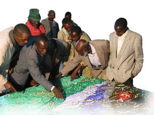
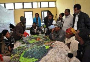
MELCA Mahiber, an Ethiopian NGO which is part of the African Biodiversity Network (ABN) facilitated the construction of a Participatory 3 Dimensional Model (P3DM) of the historical Wechecha mountain complex, which is found in Oromiya Regional State, adjacent to Wolmera and Sebeta Awas Woreda in Ethiopia.

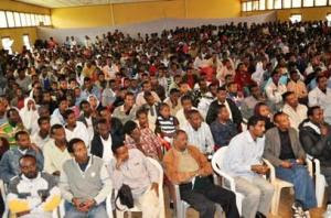
Once completed the model has been inaugurated by a Representative of the President of Federal Democratic Republic of Ethiopia. Over 500 people participated in the ceremony including members of the House of People Representative Councils, governmental officials and representatives from international organizations, CSO and local communities.
The 1:10.000 scale model covers an area of 24 km by 28 km. Over 40 students and representatives from youth groups constructed the blank model. Residents of the area, especially elders, were invited to populate the map with their spatial knowledge. In the process information about the mountain area has been shared across generations and between local communities and other stakeholders, opening the door for deeper discussions on the sustainable management and safeguarding of both local culture and environment. The local Governors were very supportive. They played an active role in the process together with the organisers.

The objective of the exercise was to document the Traditional Ecological Knowledge (TEK) of resident communities, and add value and authority to it in order to increase the value external authorities would attach to it when it comes to collaborative natural resource management. A second objective of the exercise was to enhance the transfer of TEK the younger generations.

Now thet the model is completed it will as a reference environment where local people, government officials and other stakeholders can discuss management and rehabilitation plans.
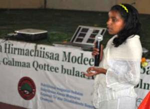
Kalkidan is a 15-year old student at Holeta Primary School. She witnessed how this model created an opportunity for her and her friends to learn a lot from the local elders. At the inauguration she stated the following: “We youngsters didn’t think that elders know, but now, after participating in the construction of this Participatory 3 Dimensional Model, we are convinced that our elders have a deep knowledge about their environment” She recalled that the elders were the main actors on the scene.

At the ceremony Elders locaed their places of origin on the model and talked about them. They couldn’t hide their feeling that their area is becoming degraded and pleaded for concerned bodies to address this problem. The government representatives also endorsed the model and reiterated that it should not be just for looking at and admiring.”

Dr. Tewoldebithan G/Egziabher, Director of the Federal Environmental Protection Authority and Chairman of MELCA’s General Assembly delivered the model to Holeta Town and Wolmera Woreda Administrations on behalf of MELCA. He told to the Administrations to use the model as a reference for taking measures.

According to Million Belay the Director of MELCA related initiatives will follow: There will be an intensive planning process aiming at rehabilitating the Wechecha Mountain complex and we will ensure that the model will be central to it. Schools located at the foothills of the mountain will make use of the model in their curriculum like it is currently happening in Nessuit Kenya, where a similar model has been constructed in 2006. Teachers use it to facilitate pupils learning about their environment, geography and cultural landscapes. In addition, Mr. Belay stated that the 3D model will be used for scientific research, on the relationship between people and the environment, and to study the impacts of land degradation on the livelihood of local communities.

Thursday, October 01, 2009

Francis Kakwetin Lesingo reports on the use of a 1:10,000 scale 3D model in Nessuit Kenya

Mr. Francis Kakwetin Lesingo - a representative from the Ogieks living in the Mau complex (Nakuru,Kenya) - reports back on the use of a 1:10,000 scale georeferenced physical 3d model manufactured by 26 ogiek clans in 2006 and 2007 in Nessuit Kenya. The initiative has benefitted from technical and financial assistance provided by CTA, Ermis Africa, the Indigenous Peoples of Africa Coordinating Committee (IPACC) and the Gaia Foundation UK.

Wednesday, September 16, 2009

Head teacher Julius Sangogo reports on the usefullness of a Participatory 3D Model (P3DM) in Nessuit, Kenya

Head teacher Julius Sangogo reports on the usefullness of a Participatory 3D Model in Nessuit, Kenya from CTA on Vimeo.

Three years after the completion of a Participatory 3D model in Nessuit Kenya, head teacher Julius Sangogo recalls the uses of the model by local, national and international agencies and more importantly by the pupils of the local primary school.

Tuesday, July 21, 2009

Discrete Community Mapping in Sudan

On Wednesday July 22, the Abyei Arbitration Council will announce its “Award”at the Permanent Court of Arbitration in the Hague. Latest act in a train of events since the signing of the Comprehensive Peace Agreement (CPA) of 2005 by Southern and Northern Sudan.

In 2005, the CPA also created the Abyei Arbitration Tribunal (AAT) which issued a Final and Binding Ruling on the north-south border – which could become an international border following a referendum on Southern Sudan independence slated for 2011.

Kharthoum rejected this Ruling, causing a stalemate until May 2008 when the town of Abyei, ancestral centre for the Ngok Dinka, was methodically sacked by a combination of Misseriya militias and troops from Khartoum - displacing 60,000 residents as collateral.

The border delineated by the AAT had been based on exhaustive interviews with elders from the nine Ngok Dinka chiefdoms, coupled with equally exhaustive historical map research. But, none of the sites mentioned by the elders, as evidence of ancestral occupancy, had been geocoded with GPS. The purpose of this mapping project was to rectify that with a repeat performance using GPS.

A legal team, from the US-based Public International Law & Policy Group (PILPG) and London-based WilmerHale, along with Southern Sudanese, colleagues re-interviewed the elders during a week long conference of all nine Ngok Dinka chiefdoms to plan the restoration of Abyei. During that same week, a team of 12 Ngok Dinka were trained in the use GPS units, videos and still cameras. At the same time, the lawyers’ interviews provided the information about the significant historical sites needed by the team to build up a legend. For litigational reasons beyond my understanding it was essential to demonstrate that, by 1905, Ngok Dinka had occupied an area well to the north of Abyei town.

Ngok Dinka memory stretched far further back than 1905. A principle signifier of historical occupancy were sites identified with Names for Age Sets, which were changed every ten years. The elders recited age set names and places going back centuries, the oldest stretched to 1508.
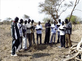
The mapping method was simple. Following the Abyei restoration conference, the team visited each chiefdom in turn and spent a day talking with 25 elders, going over recorded sites and seeking more. They then divided into three units and three vehicles, and selected elders guided them to the sites that had been listed. In two stints over the last winter, the mapping team, covered the disputed area and recorded almost 300 sites. Each evening the mapping log book were written up and emailed to International Mapping, Baltimore, US.

With the critical area covered, it was decided that, for the few days remaining the mapping teams, elders, and lawyers, would travel further north – to sites identified by the elders but outside the area that was critical for the Southern Sudan-Ngok Dinka case.

This brought the project to the attention of officials representing Northern Sudan. They were not too happy about it but all the required data was by then at the cartographers in Baltimore. The last few days were spent either under military escort, or waiting for an escort to materialize, or waiting for it to finish eating somewhere. Three trips were eventually made. To varying degrees they were high on inter-group tension but low on data utility so these data do not appear on the around Abyei. Shortly after, there were rumours of a Kharthoum-driven counter mapping effort, but it was too late.

With only a week of training and field exercises under their belts, the Ngok Dinka mapping team did outstanding work. During the recent Abyei Arbitration Tribunal hearing, lawyers for Kharthoum made a serious effort to dismiss their maps as “tainted data” but in the final exchange, they were outplayed by the legal team for Southern Sudan. For anyone seeking field workers in Southern Sudan, there are now several trained and contactable, but jobless, community information gathering and mapping people in circulation in the Abyei area. The

Verdict will be on this site on Wednesday. http://www.pca-cpa.org/ For a good, detailed account of the Abyei issue visit the Enough Project.

Read also: Dr. Peter Poole 2009. Ngok Dinka Abyei Area Community Mapping Project report, February 2009

Peter Poole, 21 July 2009

Wednesday, June 17, 2009

P3DM after the 2007 World Summit Award

In November 2007 "Participatory 3D Modelling (P3DM) for Resource Use, Development Planning and Safeguarding Intangible Cultural Heritage in Fiji" was proclaimed as one of the four winners of the “Worlds Best e-Content 2007” in the World Summit Award category e-Culture.

Here is an account of what has happened since the exercise was carried out in Fiji.

Since 2005 (year in which the project in Fiji was implemented) Participatory 3D Modelling (P3DM) and been adopted in development contexts in many parts of the world (http://www.p3dm.org/) including Cambodia, Colombia, East Timor, Ethiopia, France, Guyana, Italy, Kenya, Malaysia, Nepal, PNG, Australia and other countries.

The 2007 WSA recognition added value and authority to the method and gave worldwide recognition to its quality and appropriateness.

In Kenya P3DM been used by Ogiek, Yiaku and Sengwer Indigenous Peoples to document their biophysical and cultural landscapes. The objectives of these community-led interventions included enhancing inter-generational information exchange, adding value and authority to local knowledge, improving communication with mainstream society, improving planning on sustainable management of natural resources and addressing territorial disputes.

In Ethiopia P3DM has been used to assist stakeholders in the Bale region to plan out sustainable management of the area, revive their bio-cultural diversity and support local environmental education.

The Indigenous Peoples of Africa Coordinating Committee (IPACC), a pan-African network of 150 organisations adopted the method and is spearheading its adoption in the African Continent to improve awareness at policy-making level on the relevance of location-specific traditional ecological knowledge (TEK) in climate change adaptation and mitigation processes. Read more.

UNESCO has been supporting the adoption of P3DM in Niger and Kenya in the context of the of the Convention for the Safeguarding of the Intangible Cultural Heritage paying specific attention on the opportunity for safeguarding traditional ecological knowledge as part of overall intangible cultural heritage and its integration into the education curricula.

In collaboration with national and regional partner organisations, the Technical Centre for Agricultural and Rural Cooperation EU-ACP (CTA) is supporting the dissemination and adoption of P3DM practice in ACP countries. Regional capacity building exercises are scheduled in Central Africa (Gabon and DCR), West Africa (Niger) and Southern Africa (Botswana) in 2010 and 2011.

In collaboration with a number of development agencies, CTA is spearheading the production of a training kit supporting the spread of good practice in generating, managing, analysing and communicating spatial information. The kit includes a module on participatory 3D Modelling.

Other initiatives include the ongoing online participatory translation of a video documentary on P3DM “Giving the Voice to the Unspoken” using the free platform http://dotsub.com/