Showing posts with label intangible cultural heritage. Show all posts

Monday, June 10, 2013

"A contemporary guide to cultural mapping: An ASEAN-Australia perspective" now available!

The cultural mapping process may focus on the past, the present and also the future. Cultural mapping can be used to monitor change in material culture as well as intangible cultural heritage. A cultural map may be created as an end in itself or provide an input into other endeavours.

Many methods and technologies are used to create cultural maps; some are simple and ephemeral such as drawing in the sand. Others use the latest technologies to locate cultural phenomenon spatially using geographic information systems. Whatever methods are used to map culture or cultural products, the map most often takes a physical form (a list, matrix, chart, diagram, design, website, sound recording, video, drawing, painting, textile, sculpture or model) where information is gathered, arranged and presented physically or virtually. In this context the authors use the term map as a mental model and mapping as mental model making as they explore the body of knowledge associated with this expanding field.

The Guide is available free of charge due to the generous support of The Australian National University, the Australian Department of Foreign Affairs and Trade, The National Museum of Australia and The ASEAN Secretariat, Jakarta. It is hoped the Guide will be available online in July/August 2013.

Artlab Australia is co-managing the distribution of hard copies of the Guide. There is a limited print run so if you want a copy we recommend that you place an order immediately. A payment is required to cover the costs of packaging and postage. Postal charges vary enormously depending on destination. To order, please email: artlab@dps.sa.gov.au

For general information about the Guide please contact the authors:

Ian Cook: ianlcook@bigpond.net.au
Ken Taylor: k.taylor@anu.edu.au

Tuesday, August 31, 2010

Update on the protection of Phiphidi Fall Sacred Site, Venda, South Africa

The story so far…

The story began in 2005 when some of the women in the Venda community began to take action to revive their rich traditions. They initiated a number of activities with elder women and men knowledge holders to analyse and reflect on the past, what is happening to their way of life now and what they could do about the problems they face. Out of this process they identified the degradation of sacred sites and the obligatory practices associated with them as one of the root causes for the disorder in their community. They intensified their work to revive the knowledge and practices with the sacred sites guardians, who formed Dzomo la Mupo (voice of the Earth) - a sacred sites committee led by the Makhadzis (elder women custodians) in 2008, to have an organisational base from which to coordinate the growing movement with communities around this work.

Over the past 2 years the Ramunangi traditional practitioners, who are part of Dzomo la Mupo, made many attempts to communicate with traditional leaders and local authorities about the picnic site in Phiphidi Fall Sacred Site, which had resulted in deforestation, littering and a gate which prevented the custodians from entering their site freely. According to the custodians, who have been acknowledged as the guardians of Phiphidi Waterfall since before records began, such public activities in a sacred site are a violation of traditional law. This tourist site has prevented the Ramunangi from carrying out their rainmaking rituals, which are a vital part of the ritual cycle connected to the network of other sacred sites and the territory as a whole. Their appeals were ignored.

In November 2009 - benefitting from support provided by CTA, the Gaia Foundation and the African Biodiversity Network (ABN) - the Mupo Foundation (which formed in 2007 to support this work), hosted an eco- cultural mapping process, in which Dzomo la Mupo and a number representatives of other communities were involved. Together they mapped the network of sacred sites embedded in the sacred territory of Venda.


The Makhadzis have continued the mapping process with each of the communities since, as a way of deepening the collective knowledge and understanding of communities about their territory and the ecological laws embedded in it and reflected in their traditions.

In April 2010, bulldozers moved into Phiphidi Sacred Site. Why? To build a tourist complex with accommodation, roads and a bar to serve alcohol. This is obviously unacceptable.

The Ramunangi custodians were left with no choice but to take the matter to court. They were supported by Dzomo la Mupo – as the violation of one sacred site affects the viability of the whole network of sacred sites as well as the territory. Hence their strong solidarity in working together to protect all the Venda sacred sites as a system.

Court interdict – moral and legal victory

On 25th June 2010 Dzomo la Mupo and the Ramunangi custodians applied for an urgent court interdict which the High Court heard on 6th July. Over 80 members of Dzomo la Mupo and the Ramunangi, all proudly wearing traditional dress and their Dzomo la Mupo badges, attended a packed court.

One of the Defendants, ‘king’ Tshivhase’s Foundation Development Trust, denied the site was sacred, and denied that the Ramunangi are the custodians entrusted with the duty to take care of Phiphidi Waterfall. Chief Kennedy Tshivhase also denied that the Ramunangi have legal standing in court. After a full and emotional first day, the judge agreed to the respondents’ request for an 'inspection in loco' - to inspect the development in the sacred site. Respondents argued that the development in no way impinged on the actual sacred site, and should not be stopped.

On 7th July, Judge Mann of the High Court, granted the urgent court interdict and ordered development on the Phiphidi Sacred Site to stop, and also for the respondents not to purport to represent the community in decisions relating to customary use of land, or grant land rights over the sacred site. The judge granted the irrevocable order pending application by the custodians for a full court hearing.

The judge agreed with the custodians that the whole site is sacred - ‘In the same way a church building is regarded by some as a holy place, even though the rituals are done only at the altar’, and that building chalets would cause grave offence to those worshipping at the holy place.

Testimonials from the Ramunangi Makhadzi and Dzomo la Mupo, expert witness statement, evidence such as the community eco-maps, and explicit recognition on Government websites, significantly influenced this decision. The judge also recognised the Ramunangi as the custodians of this site with legal standing, acting on behalf of their particular religious or spiritual community and also in the public interest. The judge recognised their cultural and spiritual rights under the South African Constitution and their right to environmental protection under national law. Further the judge also found the permission to develop had expired and the development planned presented an obvious and imminent threat to the integrity of the sacred site.

Following the verdict, members of Dzomo la Mupo celebrated together with the many local people who had gathered. Mphatheleni Makaulule, from Dzomo la Mupo, said:

We are ululating from today for up to a month. We won the interdict after the high court spent two days focusing on sacred site protection versus developers. Finally after the judge visited the site and witnessed Makhadzis of Ramunagi performing rituals, the judge said the sacred site must not be disturbed…The judge could see for himself that the whole forest was sacred, like a church, where not only the altar but the whole surroundings is sacred. The ancestors are with us, the development must stop. The truth of Mupo cannot be buried down.

On 4th August, the custodians and legal team formally applied to the High Court to challenge and set aside the permission granted to develop Phiphidi Sacred Site and assert their custodianship rights and responsibilities. The respondents have been served notice and have yet to provide important information on the name of the developer and a copy of the EIA. The court process could take up to 2 years. Development continued even after the court interdict but has now stopped after a warning that this would be in contempt of court and would lead to further court proceedings.

This case so far has affirmed two important principles:

  • respect for custodians’ cultural, spiritual and traditional rights and responsibilities to protect their network of sacred sites and to continue their traditional practices
  • the ‘King’ is not above the law.
Other dimensions of the story...

Custodians - strong and united

The Makhadzis are now stronger and more confident in their commitment to protect and heal the interconnected network of sacred sites. Empowered by the eco-mapping training and court verdict, the custodians are reviving and practicing their rituals with growing local support. Community dialogues, meetings and intergenerational learning processes continue to strengthen community cohesion. Dzomo la Mupo are increasingly recognized as the traditional custodians by the local people and the relevant authorities, and their membership and profile is growing.

Local and international media coverage raises public awareness and support

The whole proceeding of the court case was covered by the local radio station, which is listened to widely. There has been a high level of public participation with live public phone ins. The public heard the “ king’s” advocate deny that the Phiphidi falls is a Sacred Site. This caused outrage as it is widely recognized as such and is in all the government tourist information.

The story of the destruction of Venda’s network of sacred sites, by tourism development and broader context of land grabbing, received wide media coverage in South Africa, UK, US, Canada and Australia. It was covered in print, radio, online and on television, including African news, Pambazuka and the BBC World news.

‘King’ Tshivhase is not king

Chief Kennedy Tshivhase has been claiming that he is the legitimate king of the Venda people in a battle for kingship that has gone on for many years. A commission was set up by the South African Government some years ago to look into issues of kingship in the country, as similar disputes exist in other communities in South Africa.

Much to everyone’s surprise President Zuma announced the results of the Nhlapo Commission on the 29th July 2010, without much warning that he was going to do so. He announced that ‘king’ Tshivhase was not the legitimate king of the Venda people. The VhaVenda kingdom would remain a paramount chieftaincy with Toni Mphephu-Ramabulane as the paramount chief. As the announcement came shortly after the Ramunangi/Dzomo la Mupo had won the interdict to stop the development of the Tshivhase’s project in Phiphidi, many have associated the two. The Venda people believe the courage of the Ramunangi clan and Dzomo la Mupo custodians in challenging the untouchable ex-king, through working with their ancestors, is now being rewarded.

The public discourse on the radio showed that people admired the custodians for challenging Chief Kennedy Tshivhase, as no one had dared to previously, for fear of intimidation. The Ramunangi and Dzomo la Mupo had not been daunted by the intimidation they were subjected to. The local people freely spoke about the corruption and how the commercial interests of Chief Kennedy Tshivhase are destroying “ Mupo.” The Makhadzis are thrilled to hear the powerfully significant word “Mupo “ coming back into public use through this series of events.

International Solidarity

There has been wide support for the Ramunangi and Dzomo la Mupo which was very important at certain critical junctures along this path - there is still further to travel! They are very appreciative of the solidarity they have received from around the world. Many supporters have written statements, which have been used in community meetings and in the court case, and are now on the web.

Others have provided much needed financial support - more is still required for the next phase.

Various networks have circulated information and helped with media coverage and technical support, all of which became important to ensure the custodians’ case was in the public domain as a deterent to further intimidation.

Next Phase

  1. The date of court hearing is still to be announced for the custodians’ application to permanently stop the tourism development by setting aside the authorisation for development and asserting their custodianship rights and responsibilities. The process could take up to 2 years.
  2. Continue communication with traditional leaders and local authorities to reach an understanding and a way forward.
  3. Dzomo la Mupo is continuing to grow as more custodians come on board encouraged by this case. Public support and interest is also increasing and Dzomo la Mupo is strengthening its capacity to respond.
  4. Paralegal training for the communities and local authorities to understand their rights and responsibilities for the protection of sacred sites and regenerating the resilience of the Venda territory, and thereby Mupo.
  5. Registration and legal recognition and protection of the network of sacred sites and the wider territory, under national and international law, learning lessons from others in assuring confidential knowledge and the traditional laws of sacred sites networks are respected.
  6. Development of community ecological governance plans that reflect traditional customary law.
  7. Continue working with custodians to distill the ethical principles underpinning the work to protect sacred sites networks and territories in the present context of growing threats and growing awareness and interest, which itself can result in new challenges.
  8. Strengthen international solidarity to develop and refine strategies to protect sacred sites networks and territories.
  9. For the next phase further funding will be required and any ideas and support are welcome.

Prepared by Gaia Foundation on 26th August 2010

Saturday, October 24, 2009

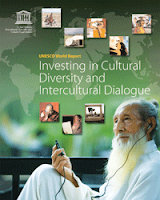
The UNESCO World Report on Cultural Diversity makes reference to P3DM done by Ogiek Peoples

The 420-page UNESCO World Report on Cultural Diversity has been launched by the Director-General, to the attention of the Permanent Delegates to the 35th session of the General Conference, on Tuesday 20 October 2009.

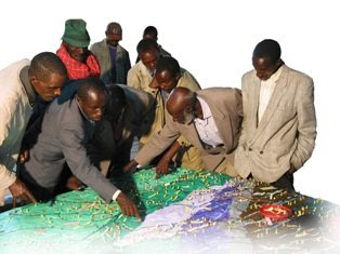
The use of participatory three-dimensional modelling (P3DM) by the Ogiek Peoples in Kenya is cited in section 2.4 as an example of local Empowerment (see page 52 of the report).

Specifically the report makes reference to the article published by Rambaldi et al. on Information Development in 2007: Through the eyes of hunters-gatherers: Participatory 3D modelling among the Ogiek indigenous peoples in Kenya.

It is worth noting that the power of participatory mapping coupled with Web 2.0 commnunication tools (ppgis list, blog, YouTube, etc) coupled with actions undertaken by concerned stakeholders, have raised the concerns faced by a minority group like the Ogiek at the forefront of public opinion.

Saturday, October 17, 2009

Educational Video ob CyberTracker - Tracking in the Cyber Age

The CTA recently released an educational video on CyberTracker technology. The video has been produced in the context of the development of a training kit aimed at supporting the spread of good practice in generating, managing, analysing and communicating spatial information. This 8-min video on CyberTracker covers a number of uses to which geospatial information technology (GIT) can be put to work in the contexts of development and conservation.

CyberTracker is an open-source software developed in South Africa by the Cybertracker Conservation with financial support initially provided of by the European Commission. It can be installed on a GPS-enabled handheld device such as a Personal Digital Assistant (PDA) or a Smartphone to collect geo-referenced data with detailed digital notation. It is a highly efficient way to gather large quantities of geo-coded field observations at a speed and level of detail not possible before. CyberTracker allows users to customise the interface to meet data collection needs. Screen designs can combine text and icons to optimise efficiency and customisation. The CyberTracker icon interface was originally designed for trackers who could not read or write. Nowadays all users including scientists and conservationists benefit from the icon-based interface because it enables significantly faster data entry.

Thursday, October 01, 2009

Ogiek Appeal to the Kenya Government Notice to vacate Mau Forest Complex and other water towers

Joseph K. Sang, representative from the Ogiek community in Nessuit Kenya, launches an appeal to the Government of Kenya following an eviction notice published on all mayor newspapers on August 25, 2009 and concerning the vacation of the Mau Forest Complex by all illegal occupants.

Wednesday, June 17, 2009

P3DM after the 2007 World Summit Award

In November 2007 "Participatory 3D Modelling (P3DM) for Resource Use, Development Planning and Safeguarding Intangible Cultural Heritage in Fiji" was proclaimed as one of the four winners of the “Worlds Best e-Content 2007” in the World Summit Award category e-Culture.

Here is an account of what has happened since the exercise was carried out in Fiji.

Since 2005 (year in which the project in Fiji was implemented) Participatory 3D Modelling (P3DM) and been adopted in development contexts in many parts of the world (http://www.p3dm.org/) including Cambodia, Colombia, East Timor, Ethiopia, France, Guyana, Italy, Kenya, Malaysia, Nepal, PNG, Australia and other countries.

The 2007 WSA recognition added value and authority to the method and gave worldwide recognition to its quality and appropriateness.

In Kenya P3DM been used by Ogiek, Yiaku and Sengwer Indigenous Peoples to document their biophysical and cultural landscapes. The objectives of these community-led interventions included enhancing inter-generational information exchange, adding value and authority to local knowledge, improving communication with mainstream society, improving planning on sustainable management of natural resources and addressing territorial disputes.

In Ethiopia P3DM has been used to assist stakeholders in the Bale region to plan out sustainable management of the area, revive their bio-cultural diversity and support local environmental education.

The Indigenous Peoples of Africa Coordinating Committee (IPACC), a pan-African network of 150 organisations adopted the method and is spearheading its adoption in the African Continent to improve awareness at policy-making level on the relevance of location-specific traditional ecological knowledge (TEK) in climate change adaptation and mitigation processes. Read more.

UNESCO has been supporting the adoption of P3DM in Niger and Kenya in the context of the of the Convention for the Safeguarding of the Intangible Cultural Heritage paying specific attention on the opportunity for safeguarding traditional ecological knowledge as part of overall intangible cultural heritage and its integration into the education curricula.

In collaboration with national and regional partner organisations, the Technical Centre for Agricultural and Rural Cooperation EU-ACP (CTA) is supporting the dissemination and adoption of P3DM practice in ACP countries. Regional capacity building exercises are scheduled in Central Africa (Gabon and DCR), West Africa (Niger) and Southern Africa (Botswana) in 2010 and 2011.

In collaboration with a number of development agencies, CTA is spearheading the production of a training kit supporting the spread of good practice in generating, managing, analysing and communicating spatial information. The kit includes a module on participatory 3D Modelling.

Other initiatives include the ongoing online participatory translation of a video documentary on P3DM “Giving the Voice to the Unspoken” using the free platform http://dotsub.com/

Monday, May 04, 2009

Participatory 3D Modelling in Bale, Ethiopia

MELCA Mahiber, an Ethiopian NGO member of the African Biodiversity network (ABN), facilitated the construction of a large Participatory 3D Model covering 1,575 sq. km (at a 1:12,500-scale) in Bale and West Arsi, Ethiopia.

The exercise has been done to assist local communities in planning out a more sustainable management of the area, reviving local bio-cultural diversity and supporting local environmental education.

More information on the exercise is found here.

Thursday, March 12, 2009

Written In the Land, the Life of Queenie McKenzie

This very visual book tells the story of the life of an indigenous ‘law woman’ from the East Kimberley area of Western Australia, Queenie McKenzie. Queenie was recognised as an Australian Living Treasure before she passed away in late 1998 for her cultural leadership and contribution to the arts. What is different with this book is that the story of Queenie’s life is placed within the landscape that she knew as her traditional land. The cover image, is a topographic map of the women’s sacred dreaming site that no longer exists, it is now a diamond mine. Each of the five chapters is spatially located within the landscape of Texas Downs, Queenie and her peoples traditional lands that were ‘settled’ in the late 1880’s by white settlers who claimed the land.
The story is told often in Queenie’s own words and shows the many ways that indigenous people are connected to the land, it discusses issues such as mining of sacred sites, dreaming sites, skin groups - the Australian indigenous governance system, rainbow snake, massacres and parts of the history of growing up as an indigenous child during the impacts of white settlement. As Queenie was an acclaimed artist it also contains many images of her artwork, her maps of her country and sacred sites.When Queenie passed away these traditional ‘law’ practices ceased. Many years before Queenie had revived these annual practices after they were stopped during the settlement time, it was in the 1980’s that she insisted that they begin again. It has been 10 years since her death and the work on the book began between the author and the female elders, to keep Queenie’s legacy strong. Funds from the book are returned to the community for that purpose. It is a tragic reality that Queenie’s generation are the last remaining elders of the area who hold the land based knowledge of sacred sites, these people will all be gone within 2 years yet this is not seen as an urgent need in Australia by the Government, to provide resources and training to indigenous people to map these sacred locations and the associated knowledge.

For more information about the book go to http://www.writtenintheland.com/ or http://www.culturalmapping.com/

Monday, January 12, 2009

Trading Bows and Arrows for Laptops

Chief Almir Surui asked Google for help with preserving his Amazon tribe's culture and protect his indigenous territory from deforestation. In June 2008, a team of Googlers led by Rebecca Moore of the Google Earth Outreach team went to the Amazon to train over 20 indigenous tribes on using the internet to preserve their land and their way of life.

Sunday, November 09, 2008

Indigenous Peoples and Protected Areas: Conservation Through Self-Determination

Indigenous Peoples and Protected Areas: Conservation Through Self-Determination
Annual Meeting of the Association of American Geographers
Las Vegas, Nevada; March 22-27, 2009

Co-sponsored by the Indigenous Peoples Specialty Group, the Cultural and Political Ecology (CAPE) Specialty Group, and appropriate regional specialty groups
Session(s) organized and chaired by Stan Stevens, Associate Professor of Geography, Department of Geosciences, University of Massachusetts, Amherst 01003
Contact: sstevens@geo.umass.edu

Deadline to contact session chair with abstract: October 9, 2008
Conference registration and abstract deadline: October 16, 2008

Papers are invited for an AAG session on the interwoven politics and political ecologies of Indigenous rights and protected area-based conservation. This is the sixth consecutive year that the Indigenous Specialty Group has sponsored and organized such sessions at the AAG annual meetings. These sessions provide a continuing venue at the AAG for discussion of conservation, difference, and social justice and for analyses of the diverse political ecologies created by the establishment of protected areas by Indigenous peoples, states, and NGOs in Indigenous peoples' territories. Participants in this year's session are invited to join previous participants in contributing theoretical and case study chapters to an edited book. Both theoretical and case study contributions are welcome.

The organizer is particularly interested in papers on the following topics:
  • New Paradigm Protected Areas. Establishment, operation, and effectiveness of inclusive, participatory, new paradigm protected areas. These may include diverse types of protected areas in which Indigenous peoples' land use and participation in management is recognized.
  • Critiques of Old Paradigm Protected Areas. Analyses of coercively imposed exclusionary "wilderness" or Yellowstone-model protected areas and "fortress conservation" from the standpoints of violations of human/indigenous rights; displacement; loss of access to and/or management of natural resources, cultural resources, and cultural sites; accompanying changes in land/water use and management; and consequent ecological change.
  • "Hand-backs," "Hand overs," and other Reconciliation and Restitution. Case studies of redress, compensation, or restitution for past injustices against Indigenous peoples caused by the creation or management of protected areas.
  • False Representations of "Progressive" Protected Areas. Analyses of protected areas which have inappropriately represented as participatory and community-based by states, intergovernmental agencies, or NGOs .
  • Rights-Based Conservation. Analyses of protected area governance and management in cases where this is explicitly based on recognition of constitutional, human, and/or Indigenous Rights.

Saturday, September 06, 2008

Information and Communication Technology and Peacebuilding: Summary of a Workshop

Those who would use information and communication technology (ICT) in the cause of peace need to be cognizant of the risks as well as the benefits. ICT can facilitate positive dialogue but also hate speech. It can be used to fight corruption but also facilitate it. Simply giving people more information does not necessarily lead to predictable or positive results. As people become more informed, they may become more motivated to change their circumstances and to do so violently.

On December 14, 2007, the National Academy of Engineering (NAE) convened a group of experts in diverse fields to consider the role of ICT in promoting peace and conflict resolution. The one-day workshop was designed to consider current and emerging technologies and strategies for employing them in conflict management and diplomacy. Giacomo Rambaldi presented a case study on "GIS and Participatory 3-D Modeling in Land-Use Negotiation" . The workshop also aimed to explore how organizations with a role in promoting peace, like the U.S. Institute of Peace, can most effectively leverage technology in carrying out their missions.

"Information and Communication Technology and Peacebuilding: Summary of a Workshop" reviews the group's discussions on number of key issues, illuminates certain practitioner needs, and suggests possible next steps.

The proceedings can be downloaded for free via this link.

Sunday, August 31, 2008

African Indigenous Peoples’ Workshop on effective use of GITs and ICTs in advocacy

I have just come back from Namibia where I attended the "African Indigenous Peoples’ Workshop on effective use of GITs and ICTs in advocacy" (Windhoek, 25-28 August 2008)

The workshop has been organised by the Indigenous Peoples of Africa Coordinating Committee (IPACC) with technical and financial assistance provided by the Technical Centre for Agricultural and Rural Cooperation (CTA), ERMIS-Africa, Cybertracker Conservation, Shalin Ry and the Rainforest Foundation UK.

Indigenous African leaders and technology intermediaries have shared experiences on how geo-spatial information technologies (GIT) are used by indigenous peoples to express their traditional ecological knowledge to decisions makers for the purposes of securing recognition and rights. Key case studies presented included participatory mapping by ToCADI and San groups in Botswana, Participatory 3 Dimensional Modelling (P3DM) by hunter-gatherer peoples in Kenya, GPS-based mapping experiences from Cameroon, DR Congo, Namibia and South Africa.

The workshop included also capacity building sessions on the use of Cybertracker and online mapping (Google Earth and Google Maps) and web 2.0 (web2fordev) applications like blogging, online video sharing, and use of electronic discussion groups including [ppgis]).

Web 2.0 applications have been presented and adopted as adds-on to GIT in support to networking, communication, alliance building and remote collaboration for advocacy.

Tuesday, July 08, 2008

Ethics and Anthropological Research and Practice

In this concise introduction to anthropological ethics, Whiteford and Trotter provide current and prospective researchers and practitioners with a solid foundation of ethical concepts and issues, including respect for persons, beneficence, and justice. They take into account both national and international discussions and practice of ethics. Together with equipping readers with essentials about ethics, the authors explore ethical problems common among anthropologists. Ethical challenges often arise from the unanticipated consequences of a research design, from conflicts among stakeholders, or from the clash of two positive ethical principles--when adherence to one of the principles may violate another. Functioning both as a capstone and a learning tool, the last chapter presents a real-life ethical dilemma and introduces readers to a detailed problem-solving guide. Other pedagogical aids include end-of-chapter questions that inspire deeper thinking about ethical principles, issues, and considerations, and five brief ethical dilemma cases for further enrichment and study. In this concise introduction to anthropological ethics, Whiteford and Trotter provide current and prospective researchers and practitioners with a solid foundation of ethical concepts and issues, including respect for persons, beneficence, and justice. They take into account both national and international discussions and practice of ethics. Together with equipping readers with essentials about ethics, the authors explore ethical problems common among anthropologists. Ethical challenges often arise from the unanticipated consequences of a research design, from conflicts among stakeholders, or from the clash of two positive ethical principles--when adherence to one of the principles may violate another. Functioning both as a capstone and a learning tool, the last chapter presents a real-life ethical dilemma and introduces readers to a detailed problem-solving guide. Other pedagogical aids include end-of-chapter questions that inspire deeper thinking about ethical principles, issues, and considerations, and five brief ethical dilemma cases for further enrichment and study.

Friday, July 04, 2008

African Indigenous Peoples’ Workshop on effective use of GIT/ICTs in environmental advocacy

CTA is supporting an and IPACC-organised pan-African workshop of indigenous peoples' organisations / leadership to review case studies of participatory mapping and other geospatial information technology (GIT) applications by indigenous peoples related to their intangible / oral traditional ecological knowledge, and how this can be effectively used in advocacy, both directly on environmental / natural resource issues, but also on human and civil rights associated with lands, territories and cultural sustainability.

IPACC partner organisations will give feed back on P3DM application in three mountain forest communities. Southern Africa will relay experiences of using Cybertracker. Cameroon will give a presentation on forest mapping by communities and Botswana and Namibia will present their experience of mapping land use and natural resources.

There will be a report emanating from the meeting which will be made acailable on IPACC and CTA web sites. The workshop will take place from 26 to 28 August in Namibia. Indigenous delegates will be coming from Morocco, Algeria, Niger, Kenya, Tanzania, Gabon, Cameroon, Burundi, Botswana, Namibia and South Africa.

Sunday, May 18, 2008

Launch of the Participatory Mapping Training Kit announced


Participatory mapping and development practitioners, activists and researchers identified the lack of training materials as a major constraint in the spread of good participatory mapping / PGIS practice. An initiative launched by CTA and other development partners will lead to the production of a modular, multimedia and multilingual training kit for trainers. The kit will ensure that participatory mapping and communication practices evolve and spread in an ethically conscious manner, ensuring that indigenous and other marginalised communities are effective in documenting, representing, and communicating their spatial knowledge, while taking a high degree of control over the process. It is understood that good practice would add value and authority to local knowledge, facilitate inter-generational knowledge exchange, contribute to building and supporting a cohesive community identity, and support sustainable planning through collaborative decision-making.

Saturday, May 17, 2008

Participatory 3D Modelling among Ogiek Indigenous Peoples in Kenya

In their article "Through the Eyes of Hunter-gatherers: Participatory 3D Modelling among Ogiek Indigenous Peoples in Kenya" publlished on Information Development and now freely available for download, Giacomo Rambaldi and his colleagues describe a participatory process by which Ogiek Indigenous Peoples in the Mau Forest Complex in Kenya rendered their spatial memories through the making of a georeferenced three dimensional model covering part of their ancestral territory. The paper focuses on the course of action and related human dynamics which led to the production of the map legend via deep reflections and intense negotiations among elders of different clans. The 3D mapmaking process proved to be a catalyst in stimulating memory, articulating tacit knowledge and creating visible and tangible representations of the physical, biological and cultural landscapes of the area in the 1920s. Elaborating and negotiating agreement on the elements of the map legend allowed the participants to gain greater clarity on meanings and relationships between natural and cultural features. Once completed, the model selectively displayed both the tangible and the intangible heritage of the Ogiek people. The composition of the legend and the making of the model stimulated collegial learning and community cohesion. The process has been perceived as a milestone for Ogiek clans in terms of working together towards a common goal, and in realizing the value and potential authority of their spatial knowledge once it was collated, georeferenced, documented and visualized.

Monday, May 12, 2008

Giving Voice to the Unspoken: Video on Participatory 3D Modelling (P3DM)

"Giving Voice to the Unspoken" is a 20-minute video production showing the hands-on aspects of Participatory 3D Modelling (P3DM). P3DM is a PGIS/PPGIS method. The video supports all practical aspects of P3DM described in the resource book "Participatory 3-Dimensional Modelling: Guiding Principles and Applications" and documents in detail an exercise conducted within the Pu Mat National Park, a protected area in Vietnam.

Tuesday, April 22, 2008

Small Grants Program - Anthropology & Environment

The goal of the Anthropology & Environment Section's Small Grants Program is to foster collaboration among practicing and academic anthropologists, grassroots activists, and/or organizations and inspire innovative solutions to environmental issues.
For more information have a look at Funding opportunities for NGOs and researchers

Friday, April 18, 2008

2008 Call for grant applications from indigenous peoples’ organizations and their communities

The Indigenous Peoples Assistance Facility invites applications from indigenous peoples’ organizations and communities, as well as organizations that work with them, for grants to fund projects, innovative approaches and partnerships that promote the development of indigenous peoples and help them fulfil their aspirations.
Grants range from US$10,000 to US$30,000. Applicants must meet specific requirements and their proposals should respond to the needs of indigenous peoples in any of IFAD’s Member States.
E-mail and mail your applications to IFAD. The closing date for applications is 30 June 2008. IFAD will not accept applications after that date.
A panel made up primarily of indigenous members will work closely with IFAD staff to review proposals and make final recommendations on grant awards. The panel will review grant proposals on the basis of project relevance, feasibility and institutional capacity and make final recommendations on awards.
Activities likely to be considered for funding will build on indigenous culture, identity, knowledge, natural resources, intellectual property and human rights. Projects should improve indigenous peoples’ access to decision-making processes, empower indigenous peoples to find solutions to the challenges they face and promote collaboration in the public and private sectors.
Over the years IFAD has learned that entrusting direct management of resources and funds to indigenous communities and their institutions is an effective way to build capacity, self-determined development and ownership of programmes and projects.
To apply for a grant, read the call for proposal, the guideline for completing the application form and complete the application form.