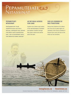
 Lots of place names in Labrador come from the Innu (e.g. Minipi-Lake from Minai-nipi,
meaning ‘burbot lake’), but others were given by pilots, mining companies, settlers and outfitters and were imposed on places that already had Innu names. The website will enable the Innu and members of the general public to start using the Innu place names, to learn about the meaning of the names and how to pronounce them.
Other Aboriginal groups have been doing place name research over the years, and some are in the process of publishing their own websites (e.g. James Bay Cree and Norwegian Sámi). However, Pepamuteiati nitassinat is the first, comprehensive one put on line to date.
Grand Chief Nui pointed out that “Over thirty years of research with our Elders went in to this website. It’s a gift from our Elders to younger Innu people. It’s part of our Elders’ legacy. It’s also an important part of our intangible cultural heritage that will help educate people about the richness of our history and traditions.”
The website was made possible by contributions from many institutions and agencies including multimedia company Idéeclic, Environment Canada, Parks Canada, Memorial University Linguistics, and Canadian Boreal Trust. The Innu Nation wishes to acknowledge the generous financial support of the Department of Canadian Heritage through Canadian Culture Online.
History of the website project
- The Innu place names available on the website were collected in the context of a number of research projects going back to the mid-1970s.
- The biggest source of place names for the site is a 1980 mapping project. Over 500 maps at 1:50,000 scale were cut and taped together to form two giant maps. One was laid on the gym floor at Peenamin McKenzie School in Sheshatshiu and the other in the parish hall in the former community of Davis Inlet. Older hunters were invited to walk about on these maps to point out the locations of place names as well as old travel routes, camp sites, caches, birth places and good hunting and fishing places.
- Only seven of the 34 older hunters who worked on the 1980 mapping project are still living.
- A great deal of validation work was undertaken with respect to the places names which was done by ethnolinguist, José Mailhot, and anthropologist Peter Armitage, with the collaboration of Marguerite MacKenzie, Sebastien Piwas, George Gregoire, Jean-Pierre Ashini, Basile Penashue, Tony Penashue, and several Innu Elders.
- Project managers for the website project were Kanani Penashue and Peter Armitage.
What’s on the website
- The site features a searchable database of over 500 Innu place names.
- Each place name record in the database contains information about the meaning of the name, how to pronounce it, and its location. Site users can click on an audio icon to hear the pronunciation of each place name.
- The site has an interactive map showing the locations of the place names.
- Background information on how Innu place names are constructed is presented.
- Video clips and photographs show people what the named places look like or document land use activities there.
- Audio narratives from Innu Elders and youth tell stories about events and people associated with certain place names.
- Future phases of the website will add more place names, video clips, photos, and audio stories.
Source: Press relase by Natuashish (Labrador), 21.11.08
