Saturday, September 20, 2008
Management Change at UNOSAT
In parallel, UNDP has decided to mainstream satellite applications throughout its network of 166 country offices supported by its 40 regional technical centers to help face the main development challenges. A new trend is emerging within the “territorial approach to development”, where a more local and decentralized way of supporting development efforts in most vulnerable countries is being applied. Although all dimensions of the UNDP development agenda will benefit from mainstreamed satellite applications, environment and energy is the area that has been selected as key entry point, considering the urgent need to help local communities to face climate change challenges with the most appropriate tools including satellite and GIS applications.
Saturday, September 06, 2008
Information and Communication Technology and Peacebuilding: Summary of a Workshop
On December 14, 2007, the National Academy of Engineering (NAE) convened a group of experts in diverse fields to consider the role of ICT in promoting peace and conflict resolution. The one-day workshop was designed to consider current and emerging technologies and strategies for employing them in conflict management and diplomacy. Giacomo Rambaldi presented a case study on "GIS and Participatory 3-D Modeling in Land-Use Negotiation" . The workshop also aimed to explore how organizations with a role in promoting peace, like the U.S. Institute of Peace, can most effectively leverage technology in carrying out their missions.
"Information and Communication Technology and Peacebuilding: Summary of a Workshop" reviews the group's discussions on number of key issues, illuminates certain practitioner needs, and suggests possible next steps.
The proceedings can be downloaded for free via this link.
Sunday, August 31, 2008
African Indigenous Peoples’ Workshop on effective use of GITs and ICTs in advocacy
 I have just come back from Namibia where I attended the "African Indigenous Peoples’ Workshop on effective use of GITs and ICTs in advocacy" (Windhoek, 25-28 August 2008)
The workshop has been organised by the Indigenous Peoples of Africa Coordinating Committee (IPACC) with technical and financial assistance provided by the Technical Centre for Agricultural and Rural Cooperation (CTA), ERMIS-Africa, Cybertracker Conservation, Shalin Ry and the Rainforest Foundation UK.
Indigenous African leaders and technology intermediaries have shared experiences on how geo-spatial information technologies (GIT) are used by indigenous peoples to express their traditional ecological knowledge to decisions makers for the purposes of securing recognition and rights. Key case studies presented included participatory mapping by ToCADI and San groups in Botswana, Participatory 3 Dimensional Modelling (P3DM) by hunter-gatherer peoples in Kenya, GPS-based mapping experiences from Cameroon, DR Congo, Namibia and South Africa.

The workshop included also capacity building sessions on the use of Cybertracker and online mapping (Google Earth and Google Maps) and web 2.0 (web2fordev) applications like blogging, online video sharing, and use of electronic discussion groups including [ppgis]).
Web 2.0 applications have been presented and adopted as adds-on to GIT in support to networking, communication, alliance building and remote collaboration for advocacy.
Tuesday, August 26, 2008
African Indigenous Peoples’ Workshop on effective use of ICTs in environmental advocacy
Tuesday, August 12, 2008
Rebecca Moore from Google Earth Outreach, Geneva layer showcase
Wednesday, August 06, 2008
PPGIS.net on LinkedIn to foster community development among pgis/ppgis practitioners
Since DGroups, the platform hosting [ppgis] offers limited opportunities for members to learn about each other and to e.g. get together on a country basis. Considering this limitations and the opportunities offered by emerging web 2.0 applications, I have created a parallel peer2peer space on LinkedIn. LinkedIn is a social- networking site used by professionals.
Joining this new space will allow you to easily identify and establish contact with other [ppgis] members.
The goal of this new space is to help [ppgis] members:
To easily identify members of the [ppgis] network, learn more about them and eventually establish personal contact;
Accelerate careers/business through referrals from [ppgis] Group members;Put a face and a professional curriculum behind a name or an e-mail address
Below is a short vide explaining how LinkedIn works:
Tuesday, July 08, 2008
Ethics and Anthropological Research and Practice

Friday, July 04, 2008
African Indigenous Peoples’ Workshop on effective use of GIT/ICTs in environmental advocacy
IPACC partner organisations will give feed back on P3DM application in three mountain forest communities. Southern Africa will relay experiences of using Cybertracker. Cameroon will give a presentation on forest mapping by communities and Botswana and Namibia will present their experience of mapping land use and natural resources.
There will be a report emanating from the meeting which will be made acailable on IPACC and CTA web sites. The workshop will take place from 26 to 28 August in Namibia. Indigenous delegates will be coming from Morocco, Algeria, Niger, Kenya, Tanzania, Gabon, Cameroon, Burundi, Botswana, Namibia and South Africa.
Friday, June 06, 2008
PGIS Curriculum Development Workshop
The output of the initiative is intended to increase the capacity of indigenous and other marginalised peoples to engage in effective policy dialogue and advocacy on issues related to the territory. Skills acquired through the deployment of the kit would ensure that indigenous and other marginalised communities are more effective in documenting, representing and communicating their spatial knowledge, while taking a high degree of control over the processes. The initiative is co-funded by CTA and IFAD. Development partners which committed additional resources to the project include the Indigenous Peoples of Africa Coordinating Committee (IPACC); International Institute for Geo-Information Science and Earth Observation (ITC), the University of British Columbia, Okanagan (UBC), UNOSAT and the Ford Foundation Brazil.
The direct beneficiaries of the project are technology intermediaries working in multidisciplinary teams and operating within institutions or organisations already committed to practicing participatory mapping and who are or would be required to deliver training on the practice, or facilitate the process in the field. Ultimate beneficiaries will be adopters from community-based organisations, non-governmental organisations, research institutions, academia, multilateral and bilateral development agencies and other development actors.
The English version of the kit is expected to be available in 2009 followed by versions in other languages.
Wednesday, May 21, 2008
Participatory Ethics - Special Thematic Issue of ACME
Sunday, May 18, 2008
Launch of the Participatory Mapping Training Kit announced
Participatory mapping and development practitioners, activists and researchers identified the lack of training materials as a major constraint in the spread of good participatory mapping / PGIS practice. An initiative launched by CTA and other development partners will lead to the production of a modular, multimedia and multilingual training kit for trainers. The kit will ensure that participatory mapping and communication practices evolve and spread in an ethically conscious manner, ensuring that indigenous and other marginalised communities are effective in documenting, representing, and communicating their spatial knowledge, while taking a high degree of control over the process. It is understood that good practice would add value and authority to local knowledge, facilitate inter-generational knowledge exchange, contribute to building and supporting a cohesive community identity, and support sustainable planning through collaborative decision-making.
Saturday, May 17, 2008
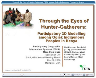
Participatory 3D Modelling among Ogiek Indigenous Peoples in Kenya
Monday, May 12, 2008
Google Maps and San Diego wildfires
Giving Voice to the Unspoken: Video on Participatory 3D Modelling (P3DM)
Tuesday, April 22, 2008
Small Grants Program - Anthropology & Environment
For more information have a look at Funding opportunities for NGOs and researchers
Friday, April 18, 2008
2008 Call for grant applications from indigenous peoples’ organizations and their communities
Grants range from US$10,000 to US$30,000. Applicants must meet specific requirements and their proposals should respond to the needs of indigenous peoples in any of IFAD’s Member States.
E-mail and mail your applications to IFAD. The closing date for applications is 30 June 2008. IFAD will not accept applications after that date.
A panel made up primarily of indigenous members will work closely with IFAD staff to review proposals and make final recommendations on grant awards. The panel will review grant proposals on the basis of project relevance, feasibility and institutional capacity and make final recommendations on awards.
Activities likely to be considered for funding will build on indigenous culture, identity, knowledge, natural resources, intellectual property and human rights. Projects should improve indigenous peoples’ access to decision-making processes, empower indigenous peoples to find solutions to the challenges they face and promote collaboration in the public and private sectors.
Over the years IFAD has learned that entrusting direct management of resources and funds to indigenous communities and their institutions is an effective way to build capacity, self-determined development and ownership of programmes and projects.
To apply for a grant, read the call for proposal, the guideline for completing the application form and complete the application form.
Tuesday, April 15, 2008
A Primer of GIS: Fundamental Geographic and Cartographic Concepts By Francis Harvey

Aboriginal Communities in Google Earth
Monday, April 14, 2008
Through the Eyes of Hunter-Gatherers: Participatory 3D Modelling among Ogiek Indigenous Peoples in Kenya

