MELCA Mahiber, ONG éthiopienne membre du réseau African Biodiversity Network (ABN), a contribué à la construction d'une carte participative en 3D (CP3D) du paysage montagneux historique de Wechecha, dans la région d'Oromia, à côté des woredas de Walmara et Sebeta Awas, en Éthiopie.
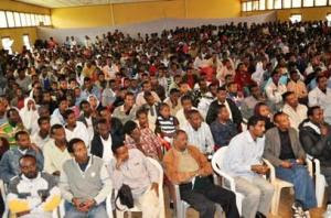
Une fois achevée, la maquette a été inaugurée par un représentant du Président de la République fédérale démocratique d'Éthiopie. Cette cérémonie a réuni plus de 500 personnes, parmi lesquelles des membres du Conseil des représentants des peuples, des membres du gouvernement et des représentants d'organisations internationales, d'organisations de la société civile et de collectivités locales.
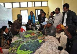
Construite à l'échelle 1:10 000, la maquette reproduit une zone de 24 km sur 28 km. Plus de 40 élèves et membres d'associations de jeunes ont participé à la construction de la maquette initiale, que les habitants de la région, notamment les anciens, ont été invités à enrichir de leurs connaissances géographiques. Au cours du processus, des informations sur le massif ont été échangées entre les différentes générations, mais aussi avec les collectivités locales et d'autres parties prenantes, ouvrant la porte à des débats de fond sur la gestion et la protection durables de la culture et de l'environnement à l'échelle locale. Les gouverneurs de la région se sont montrés extrêmement favorables à ce projet, jouant un rôle actif au sein du processus, aux côté des organisateurs.
Ce projet avait pour ambition de collecter des données sur le savoir écologique traditionnel des communautés de la région pour le valoriser. Ainsi, les autorités externes lui accorderont davantage d'importance lors de la gestion collaborative des ressources naturelles. L'objectif secondaire du projet consistait à améliorer la transmission de ce savoir aux nouvelles générations.
Maintenant que la maquette est achevée, elle servira d'environnement de référence où habitants, membres du gouvernement et différentes parties prenantes pourront débattre de programmes de gestion et de réhabilitation.
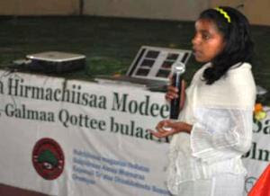
Kalkidan, 15 ans, est une élève de l'école d'Holeta. Elle est consciente que sa génération a appris énormément des anciens de la région grâce à cette maquette. Elle s'est exprimée ainsi lors de l'inauguration : « Nous, les jeunes, ne pensions pas que les anciens en savaient autant. Mais après avoir participé à la construction de cette maquette participative en 3D, nous sommes désormais convaincus que nos anciens sont une mine d'informations sur l'environnement ». Elle a rappelé qu'au cours de ce projet, ce sont les anciens qui ont tenu le premier rôle.
Lors de la cérémonie, des anciens ont montré l'emplacement de leur village d'origine sur la maquette, avec des anecdotes. Ils n'ont pas pu cacher leur désarroi envers la dégradation de la région, et ont demandé aux organismes concernés de tenter de résoudre ce problème. Les membres du gouvernement ont également approuvé la maquette et rappelé qu'elle ne se résumait pas à un simple objet de décoration.
Le Dr Tewoldebithan G/Egziabher, directeur de l'autorité fédérale de protection de l'environnement et président de l'assemblée générale de MELCA, a remis la maquette à la ville d'Holeta et à l'administration du woreda de Walmara au nom de son association. Il a demandé à l'administration d'utiliser la maquette comme référence topographique.
Million Belay, directeur du MELCA, a annoncé de nouvelles initiatives. Un processus de planification à grande échelle sera lancé pour réhabiliter le paysage montagneux de Wechecha, en s'appuyant principalement sur la maquette. Les écoles situées au pied des montagnes intégreront la maquette à leur programme, à l'instar de la région de Nessuit (Kenya), qui possède une maquette comparable depuis 2006. Les enseignants l'utiliseront pour aider les élèves à connaître leur environnement, la géographie et les paysages culturels. Par ailleurs, Million Belay a annoncé que la maquette en 3D servirait à des fins scientifiques, pour étudier d'une part la relation entre habitants et environnement, et d'autre part les conséquences de la dégradation des terres sur les moyens de subsistance des communautés locales.
Auteur : Giacomo Rambaldi


