Showing posts with label climate change. Show all posts

Wednesday, October 10, 2012

P3DM blank model of Tobago ready for accommodating community’s knowledge


SCARBOROUGH, 3 October, 2012. Facilitators working on the blank model for the P3DM of Tobago all agreed that... “it has been challenging!”

The P3DM of Tobago undergoes the smoothing process u
sing crêpe paper cut-outs
Looking at an example of a model during the orientation, they thought that building a model would have been an easy task, but reality turned out to be quite different.  Expressions of relief echo around the workshop area as the blank model is finally complete on day three of the project.  Yet, in the same breath, they also give heartfelt thanks for being among the 'chosen few' selected to be part of the workshop.  Facilitators are from regional and national non-governmental organizations, government agencies, inter-governmental technical agencies and members of academia.

Held in Tobago at the Mt. St George Blenheim Sheep Multiplication and Research Project, the workshop is being conducted by experts from the Caribbean Natural Resources Institute (CANARI) and the University of the West Indies (UWI) with financial and technical assistance from the Technical Centre for Agricultural and Rural Cooperation ACP-EU (CTA) and the UNDP Small Grants Programme of the Global Environmental Facility (GEF-SGP).

CANARI's project concept note of July 2012 states that the workshop’s aim is to get members of the community involved in "climate -related decision making" through a process involving the manufacture and use of Participatory 3D Models.

Confidence soars as the hands-on experience continues

Addana Pigott-Henry, an agricultural scientist working at CARDI, Tobago, says the experience for her was different from expectations, since she had envisaged a more formal lecture-style approach to the workshop.  After the hands-on experiences of the last couple of days though, she says she now feels empowered to assist in conducting a P3DM exercise with the help of experts.  She has learnt a lot from the interactive method and the lessons are invaluable, she says.  Addana, is of course happy that the workshop is being held in Tobago so that the regional and international participants can get a chance to experience the hospitality of Tobagonians and its rich and varied cuisine.

Meteorologist Anthony Moore of Barbados says that he is also fairly confident that if he was to build a P3DM, he would be able to do so as he is now equipped with adequate knowledge and experience.  Representing the Caribbean Institute for Meteorology and Hydrology (CIMH), Anthony says that at the beginning of the workshop he was lost and thought that building the model was a 'huge undertaking'.  His experience with maps and drawing, cutting and layering contours on a daily basis did little to allay his fears.  "A lot has been cleared up because of the hands-on experience," he admits.

Anthony acknowledges the value of a facilitation lesson shared by CANARI's Neila Bobb-Prescott and lists it as a highpoint of the workshop.  As a stakeholder in water resource management, he says the lesson is valuable and will help him to get information from farmers for an impact assessment study.  "Interaction with them would be easier,” he says.

Not unlike Adanna and Anthony, Adam Jehu of the Institute of Marine Affairs in Trinidad (IMA), also feels he now has the ability to construct a P3DM of an area and acknowledges that this approach to mapping is a "very novel way of capturing spatial data from the members of the community, the people who have the knowledge."  Adam is also grateful for the lesson on how to facilitate a P3DM exercise, since although he did know how to use GIS technology, he did not know how to build on community’s knowledge of the landscape.

Community insights

In the middle of one group orientation, a few residents popped in.  They stood around the model, and immediately without prompting, they started pointing out places in the island, the river, the forest and many other things, and recognized features on the blank model.  And almost as quickly, they pointed out features that were lacking on the model: Little Tobago, the reefs, the rocks, the islets.  They began to improve on this omission by contributing the names of the rocks and the islets that lie successively along a chain around the north-eastern tip of Tobago.

“This doesn't cease to amaze me when I see it happen.  Local people can immediately spot errors or omissions on GIS maps and correct them” noted Kail Zingapan.

Crucial lessons 

Participants create the storyboard using yarn, Playdoh
and other materials
Facilitators learned the components of two more aspects of the P3DM exercise on Wednesday.  The first was about monitoring and evaluation of the process.  CANARI’s Executive Director, Nicole Leotaud brought some clarity to the concepts and introduced the tool of participatory video (PV) which will be used in the evaluation process.  Desiree Sampson, videographer, gave tips on the shooting of videos.  This session featured a mix of hands-on training and feedback from trainees.

The facilitators created images of the results they want to achieve from the P3DM process in Tobago with Playdoh, yarn and pins.  They then created a storyboard for the video which will be developed to evaluate the effectiveness of P3DM in realizing these desired outputs.  The storyboard that was developed is a sequence of drawings which depict the shots planned for the video production.

Cassandra Mitchell of Grenada practices using
one of the PV video cams.
As part of the hands-on training, the participants took the cameras outside the building and took turns in learning how to operate them.

On Thursday 4th October, the facilitators will get ready to capture the workshop action on camera as community informants are expected to arrive in droves to ‘transpose their mental maps’ onto the blank model.

On a lighter note...

Though the trainers and experts themselves have been 'on the go' since the beginning of the workshop, they have found time for lighter moments, such as celebrating the birthday of Wellington Martinez from the Dominican Environmental Consortium.  Wellington had the joyful experience of having "Happy Birthday" sung to him in his native language, Spanish.  ¡Cumpleaños feliz, Wellington!"

Tuesday, October 09, 2012

Tobagonians build participatory 3D model of Tobago to plan for the impacts of extreme climatic events


The Caribbean Natural Resource Institute (CANARI) has partnered with the Centre for Agricultural and Rural Cooperation ACP-UE (CTA) and the University of the West Indies among other groups, to build a 3 dimensional model of Tobago, with the aim of advising persons of being proactive regarding climate change.

Saturday, October 06, 2012

Participatory 3D Modelling (P3DM) for Disaster Risk Reduction (DRR)

Participatory 3-Dimensional Mapping (P3DM) consists in building geo-referenced stand-alone large-scale relief models made of locally available and materials (e.g. carton, paper, cork) on which knowledge holders can locate and depict a range of topographic features out of memory. According to work done in the Philippines the method is useful for locating assets and vulnerabilities and plan - in a bottom up manner - for Disaster Risk Reduction (DDR). Features are depicted using push-pins (points), yarn (lines), and paint (polygons). For DDR scales range from 1:1000 to 1:2000 to enable mapping and planning at the household level.

Part 1


Part 2


Read about Participatory 3D Modelling (P3DM) for Disaster Risk Reduction (DRR)
Read about other applications of P3DM consult www.iapad.org

Friday, October 05, 2012

Participatory 3D Modelling in Tobago - key venues

The workshop on Participatory 3D Modelling and Participatory Video organised by CANARI and the UWI in Tobago with assistance provided by CTA and UNDP GEF-SGP will come to an end on October 11. the venue is the Blenheim Sheep Multiplication & Research Center (yellow placemarker). The presentation of the outputs by representatives of participating communities will take place on October 12 in the morning at the Trinidad and Tobago Hospitality and Tourism Institute - Tobago campus (green placemarker)


View P3DM and PV Training in Tobago in a larger map

If you are interested in attending the closing ceremony on October 12, please get in touch with Neila Bobb-Prescott, Senior Technical Officer, The Caribbean Natural Resources Institute (CANARI).

Related posts: 


Caribbean nationals eager to develop P3DM in their countries: "P3DM a unique, totally new experience"


SCARBOROUGH, 1 October, 2012. Trainers and facilitators took up tools on Monday to begin work on a participatory 3D model of Tobago.   Base maps were prepared by a team from the Engineering Faculty of the University of the West Indies (UWI).  The base map must be precisely done, warns Kail Zingapan, a Participatory GIS expert from PAFID an NGO based in the Philippines, otherwise creating the model will incur some serious delays and the model itself will not be an accurate P3DM.
Adanna Pigot-Henry from CARDI, Tobago is hard at work
tracing the map contour onto the cardboard
The process of creating the model involves tracing single contour lines visible on the base map onto cardboard sheets, cutting these precisely along these lines, and thereby creating layers that represent different elevations.  Each cardboard layer is then glued onto the one representing the lower elevation contour.  Kail likens the layering process to that of stacking pancakes.  Each contour layer is “every point of equal elevation”, she explains.  The elevation model of the island and surrounding waters was developed beforehand by Dr. Bheshem Ramlal of the UWI.  Posters listing the layers to be traced were stuck onto the walls of the workshop area to guide the process.

Kenn Mondiai glues a layer onto  the model
After a number of layers are glued on top of each other, crêpe paper and glue are used to smooth the edges of the single layers so the blank model "looks like a terrain", Kail tells participants at the workshop.  She tells them too, that this part of the exercise must be completed by Wednesday evening to allow the paper to dry so that informants’ data can be added to the model, beginning on Thursday.  The informants are community members - for example, elders, fisherfolk, farmers, hunters, environmentalists and other resource users - who are "traditional custodians of spatial knowledge" and who provide information about their neighbourhood and knowledge of its use to be transferred to the map.

During the planning and introduction workshop last Saturday (September 29), participants developed the legend for the map - symbols (points, lines and areas) - to use during the coding process to locate and depict man-made and natural features on the model.  Members of civil society organizations and experts from the Department of Natural Resources and the Environment-Tobago House of Assembly (THA), CANARI and the UWI attended that introductory workshop.

Caribbean participants at the workshop are especially keen to be part of the P3DM  project.  Ingrid Parchment of the Caribbean Coastal Area Management Foundation, which is based in Jamaica, is eager to get community members involved in producing a P3DM of Portland Bight.  She works at Portland Blight which is a protected area.  Ingrid says she is learning a lot from the workshop, as she noted a very helpful video which showed the process of producing a P3DM, step-by-step.

Orisha Joseph (Grenada), Natalie Boodram (Saint Lucia)
and Jacinthe Amyot (Colombia)  working on base map
A papier-mâché of Portland Bight has already been created and Ingrid feels the P3DM would be a step up.  However, she is mindful of the need to have experts involved in the activity.  “Especially a GIS expert”, she emphasizes, with a wink and a smile.

Likewise, Dr. Natalie Boodram who works at the Caribbean Environmental Health Institute (CEHI) - a CARICOM agency with an environmental mandate that is based in Saint Lucia - says that the concept of working with communities to do individual P3DMs is “unique” and a “totally new experience".  She says that the workshop is helping her appreciate the value of community input in creating a 3D model of a given space.

Lessons in facilitation

Farzaana Baksh  explains good facilitator skills on
the "Body map" produced by her group
While precision and attention to detail are crucial to the creation of the P3DM, there are also moments for fun and laughter.   One such moment of light-heartedness was the ‘train the trainers’ session, last Sunday afternoon.   As part of a group exercise, one person laid on a large piece of white paper on the floor and her shape was traced onto the paper.  Her group then ‘mapped’ on different parts of the drawing, the characteristics of a good facilitator.  ‘Body mapping’, as the exercise is called, drew on the lessons the participants learned with the guidance of CANARI’s Senior Technical Officer and workshop coordinator, Neila Bobb-Prescott.

Neila’s sessions helped participants understand the attributes of a good facilitator.  She called the attention to fundamental issues such as “how we dress” and “how we pose” (i.e. body language) and the impact of these issues on how the facilitator is perceived at community level.  She outlined various ways in which good facilitators make every effort to get individuals to express their views.

Lessons in logistics 

Patricia Franco, Administrative Officer at CANARI shares
her insight on logistical planning with workshop participants
Another valuable lesson was taught by CANARI’s Administrative Officer, Patricia Franco.  In introducing Patricia, Neila referred to her as an expert who does detailed coordination and management of information for workshops.  Logistics assist in ensuring the smooth running of an event and therefore every facilitator should have a working knowledge and develop the skill of good logistical planning Neila says.
Pat, as Patricia is fondly called, explained the importance of every component in planning an event.  Using the workshop as an example, she pointed to the many individual activities she had to organize.  These ranged from coordinating participants’ flight plans to housing and feeding participants catering.

Members of the workshop - trainers, students, teachers and experts - are certainly gaining all-round knowledge and skills while working diligently to get the process moving forward.


Wednesday, October 03, 2012

Thailand: Helping build more resilient communities

BANGKOK, 12 June, 2012 – A new United Nations Development Programme (UNDP) documentary demonstrates how a unique approach to community security and social cohesion led to more resilient communities in Northern Thailand.


The film documents the work of a UNDP project in Mae Hong Son, Thailand’s poorest province, with the country’s lowest score on UNDP's Human Development Index. It is home to diverse population, including a large number of displaced people from Myanmar. Economic opportunities can be scarce and access to natural resources and basic services are often inadequate.

Using participatory rural appraisal (PRA) and a Participatory 3D Modelling (P3DM) UNDP, the provincial government and villagers identified a number of issues together, including inadequate water for agriculture, the lack of skills for preserving natural resources, and the extinction of banana from the village forest areas.

Read more >>

Related: Democratic Governance: Sustaining Thailand’s Democratic Practice through Improvement of Inclusive Electoral Process (UNDP)

Participatory 3D Modelling exercise kicks off with much gusto in Tobago


Trinidad and Tobago nationals and their Caribbean counterparts converge for workshop.

SCARBOROUGH, 30 September, 2012. Sixth form students and their teachers from secondary schools across Tobago, members of civil society from Trinidad and Tobago and the Caribbean, along with representatives from the Tobago House of Assembly (THA), Caribbean Natural Resources Institute (CANARI), and the University of the West Indies (UWI) have been merging their skills to construct a 3 dimensional (3D) model of Tobago. The 3D model being constructed will cover an area of approximately 1,152 km² and consist of a 1:10,000-scale version of the island and its waters up to a depth of -100 metres, says CANARI’s Senior Technical Officer, Neila Bobb-Prescott.

The process of building this model involves a varied mix of actively involved people and so it is termed participatory 3D modelling or P3DM. The P3DM of Tobago is taking place during a workshop held over the period September 28th to October 12th 2012 at the Blenheim Sheep Multiplication and Research Project station in Tobago.

Kail Zingapan leads a session to explain the application of
GIS technology to the model building exercise  
The workshop is facilitated by CANARI and the UWI, with financial and technical assistance from the Technical Centre for Agricultural and Rural Cooperation ACP-EU (CTA) and the United Nations Development Programme, Global Environment Facility - Small Grants Programme (UNDP GEF-SGP).  The model building exercise is coached by a team of facilitators which includes specialists from as far as the Philippines and Papua New Guinea.

The 2-week activity is based on a participatory approach which acknowledges the importance of traditional knowledge and builds on it in making decisions about how to cope with climate change, says Dr. Bheshem Ramlal of the UWI.  He adds that the information generated in the mapping exercise can be used for advocacy and informing policy. The participatory approach focuses on learning by doing, exchange of knowledge and collegial data analysis and verification. Data storage and retrieval “must be done by local people or not at all” notes Geographic Information System (GIS) expert Ms. Kail Zingapan from the Philippines.

Student Participation 

Sorting through the kit of materials needed
for the model construction  
On their first day, the students attended an orientation session at which they were briefed on various aspects of  the P3DM process.  For the next couple of days, they will trace contours and cut cardboard to represent the elevation of the land and the depths of the sea.  The contours will be traced using carbon paper on carton board sheets. These will be cut out and glued on the top of each other paying special attention to their correct geo-location.

Jhon-Pierre of the Signal Hill Senior Comprehensive School and Jaidon Lalla of University of the West Indies Open Campus, both teenage students, are eager  to begin construction of the model. They both agree that creating the 3D model of Tobago is an event of historical significance and would help them to appreciate the natural resources of the island. They also see the model being used as a means of helping all stakeholders shape future uses of the resources of Tobago.
The boys were selected by their peers to be interviewed here after the girls in the groups cheerfully chorus “men must rule again”.  The boys' response -“yea, yea” - to this show of encouragement was not very enthusiastic, but they showed that they quite understood the significance of the project in which they were all engaged.

Facilitator training

Neila Bobb-Prescott from CANARI prepares
for her presentation on facilitation 
A crucial element of the workshop consisted in an initial phase of training of professionals from different areas of the Caribbean to become  P3DM  facilitators; these persons will return to their countries each equipped with knowledge and necessary skills for replicating the activity in their respective countries
During one of CANARI’s training sessions, Neila introduced the trainees to key concepts in participatory approaches to natural resource management; she identified the role of stakeholders and the challenges and benefits of their involvement in the process.

Additionally, Bheshem, Kenn Mondiai of Partners with Melanesians (PwM), an NGO based in Papua New Guinea and Kail shared information on the development of the Participatory GIS (PGIS). “PGIS is a method used to compose peoples’ spatial knowledge of their landscape with the use of GIS tools”, said Kail.

Caribbean flavour

Enjoying the Tobago cuisine! 
Katrina Collins and Shawnaly Pascal from St. Vincent and Grenada, respectively, are happy to be in Tobago at the workshop.  They point out the similarities of the physical landscape of the three islands.  Their interests include Tobago’s gourmet cuisine.  Katrina calls for buss-up shot and roti, cocoa tea and coconut bake.  Shawnaly smiles and adds, “Any food I don’t get at home, I want to eat” (sic).  Neila politely smiles and indicates she will try her best to please.  In keeping with the spirit of camaraderie permeating the workshop, the women were advised, by Tobago participant, Adanna Piggott-Henry, of the need to consume fresh cuisine or face dire gastronomical consequences!

Naming the activity in Tobago

The theme, ‘She becomes more beautiful: Capturing the essence of Tobago today for a better tomorrow’, emerged as the winning title to the P3DM activity after a brainstorming session among workshop participants during the introduction and planning workshop.  The first part of the theme, ‘She becomes more beautiful’ is particularly relevant to Tobago as it is the motto for the island’s annual Heritage Festival, and depicts a naked pregnant woman of African descent.  The P3DM exercise will certainly capture where Tobago’s development is taking place and will provide an effective platform on which to plan  community actions and policy development in  the future.


Saturday, September 01, 2012

Tobagonians will build a participatory 3D model of Tobago to plan for impacts of climate change and extreme climatic events


Over 200 residents of Tobago will come together in early October 2012 to build a three-dimensional model of Tobago. The process will contribute to formulating responses and develop action plans addressing the impacts of climate change and extreme climatic events.

The process will be facilitated by the Caribbean Natural Resources Institute (CANARI), the University of the West Indies (UWI), the Tobago House of Assembly (THA), Division of Agriculture, Marine Affairs, Marketing and the Environment (DAME) and the Partners with Melanesians (PwM).  The project is funded by the Technical Centre for Agricultural and Rural Cooperation ACP-EU (CTA) and the United Nations Development Programme and the Global Environment Facility (GEF) Small Grants Programme (SGP).

The project will pilot, for the first time in the region, the use of participatory three-dimensional modelling (P3DM).  P3DM is a tool that can be used across the Caribbean islands to facilitate effective participation by local communities and other stakeholders in the identification of general policy priorities, as well as specific policies and actions needed on the ground  to address the impacts of climate change and extreme climatic events.  P3DM will allow the recognition of the value of traditional knowledge, increase capacity, facilitate coordination and collaboration across sectors, and build buy-in for implementation of plans for resilience to climate change and extreme climatic events.

In this regard, 15 trainees from the Caribbean region (including five from Tobago) will be trained to facilitate the building of the model. Nearly 50 observers from the region will visit during the construction of the model.  Lessons learned and experiences will be documented and shared using a variety of media including participatory video, blogs and policy briefs.

P3DM produced in Boe BoeSolomon Islands
Image courtesy of Javier Leon, University of Wollongong
The physical output of the workshop will consist in a 1:10,000-scale 3D model of the entire island of Tobago and its surrounding waters up to a depth of -100 meters. The model will cover an area of approximately 1,152 km2.


Once the model will be completed island'a representatives will produce a civil society agenda to tackle among others climate change issues in the island.  This activity consisting in a 3-day workshop will be facilitated by CANARI, through the support of grant funding from the Federal Republic of Germany.

CTA will further provide capacity building in the domains of Web 2.0 and Social Media to enhance Information, Communication and Knowledge Management (ICKM) among local stakeholders. 

On 5 and 6 September 2012, UWI, DAME and CANARI will host mobilisation meetings in east and south-west Tobago to sensitise the residents in Tobago about the project and to confirm participation of civil society groups in the exercise.

For further information, please contact: Neila Bobb-Prescott - Manager, Forest, Livelihoods and Governance Programme, Caribbean Natural Resources Institute.


Note: The initiative is supported by CTA in the context of the project "Promoting participatory ICTs for adding value to traditional knowledge in climate change adaptation, advocacy and policy processes in the Caribbean and the Pacific". For information on this project you may contact Giacomo Rambaldi, Sr. Programme Coordinator, ICT4D, CTA


Video collection of P3DM initiatives: http://vimeo.com/channels/pgis
P3DM worldwide: www.p3dm.org

Tuesday, June 12, 2012

Climate Change and African Political Stability dynamic mapping tool released


The Strauss Center’s Climate Change and African Political Stability (CCAPS) program and AidData recently released a dynamic mapping tool that allows for analysis of climate change and conflict across Africa, plus development assistance in Malawi. The mapping tool uses Esri’s ArcGIS platform to enable users to select and layer combinations of CCAPS data onto one map. It also shows how conflict dynamics are changing over time and space. This tool provides an interactive medium for researchers to explore how climate change vulnerability and conflict interact, and in Malawi, to see how aid is distributed across different areas.

CCAPS climate security vulnerability data provides information on four sources of vulnerability: physical exposure to climate-related hazards, population density, household and community resilience, and governance and political violence. Chronic climate security vulnerability is located where these four sources of vulnerability conjoin.

Sunday, May 20, 2012

Combining Traditional Knowledge and Technology for Community led Climate Change Adaptation


21 May 2012, HONIARA. Pacific Islanders will now have a greater voice in climate change decision making and a more direct input in adapting their communities to climate change using a combination of traditional knowledge and technology. This will be made possible through the week-long awareness raising and planning workshop on Participatory Mapping and Community Empowerment for Climate Change Policy Making that started in Honiara today.

Organised jointly by the Technical Centre for Agricultural and Rural Cooperation ACP-EU (CTA), The Nature Conservancy (TNC), United Nations Development Program (UNDP) and Partners With Melanesians (PwM), the workshop aims to promote the adoption of innovative Information and Communication Technology (ICT) tools and approaches to help address development challenges.

Around 80 participants, including community leaders, representatives from non government organisations (NGOs), community based organisations, regional, national and local bodies as well as researchers and technical experts will attend the workshop at the Kitano Mendana Hotel in Honiara.

Participatory three-dimensional modeling (P3DM) is a community based mapping method that used local knowledge with scientific data like the elevation of the land and depth of the sea to produce stand-alone, scaled and geo-referenced relief models.

This method, integrated with more sophisticated tools can enhance resilience to climate change by adding value to traditional knowledge and promoting its integration in adaptation planning and advocacy processes.

The combination of traditional and scientific knowledge not only allows farmers and fishers in Small Island Developing States to have voice in climate change decision-making but can also ensure the implementation of more effective adaptation strategies,” said Giacomo Rambaldi, Senior Programme Coordinator of CTA.

During the workshop, expert presenters and facilitators working in the region will share case studies and lessons learned and discuss the benefits, challenges, and ethical considerations involved in the process. Representatives from Mboemboe village in Choiseul Province (who have already been through the process of manufacturing a coastal P3DM and used it for planning purposes),  will share their experience at the workshop.

Local community members from Honiara will be engaged in the construction of a mini-model. While students will take care of the physical construction, elders will populate the model with spatial data drawn from memory. Participants in the main session will be given the opportunity to interface with the parallel session and get a hands-on experience of P3DM.

The workshop concludes on 26th May.

More information on the event are available here.


An initiative supported by:

Friday, March 16, 2012

Participatory 3D Modelling of Manus Island, PNG


Participatory 3D modelling (P3DM) activity supported by The Nature Conservancy (TNC) and partners in 2011 in PNG to help residents of Manus Island map out the terrestrial, coastal and marine resources and to  plan for adapting to potential impacts due to climate change.

Source: TNC

Friday, January 27, 2012

NASA | Temperature Data: 1880-2011


The global average surface temperature in 2011 was the ninth warmest since 1880.The finding sustains a trend that has seen the 21st century experience nine of the 10 warmest years in the modern meteorological record. NASA's Goddard Institute for Space Studies (GISS) in New York released an analysis of how temperatures around the globe in 2011 compared to the average global temperature from the mid-20th century. The comparison shows how Earth continues to experience higher temperatures than several decades ago. The average temperature around the globe in 2011 was 0.92 degrees F (0.51 C) higher than the mid-20th century baseline.

This video is public domain and can be downloaded at: ‪http://svs.gsfc.nasa.gov/goto?3901

Wednesday, December 21, 2011

Climate Conversations - Combining traditional knowledge and climate science in Chad

Bouba Mal Yaya is a herdsman from the Fulani-Mbororo peoples in Chad. Along with his fellow herders, he had been expecting good grazing for his cattle this year but this has not been the case.


He is confused and frustrated. He had always been able to rely on his people’s age-old knowledge of their ecosystem to sustainably manage grazing. This traditional knowledge has been used by his people to develop strategies to cope with seasonal weather patterns and manage their meagre resources.
The community has typically looked to the elders for predictions on rainfall distribution, drought and other seasonal patterns. Now, it would appear that the reliability of their prediction is undermined by increasingly unpredictable weather and climate conditions. Their livelihoods and future as a culture are under threat.
The cause? Climate change.
Mbororo herders travel over great distances to graze their livestock. The impact of climate change has reduced the capacity of their traditional grazing lands with droughts and dwindling resources pushing them to herd their livestock further afield.
Some have lost their stock and have been forced to change their way of life, becoming semi-nomadic or sedentary. These lifestyle changes are not easy, and the pastoralists experience extreme hardship and loss of culture. The decreasing reliability of the elders’ predictions has had an impact on their trustworthiness within the community, further destabilising life for these people.
The situation is frustrating for everyone involved, especially considering that information which could help the pastoralists maintain their traditional way of life is already at hand. Climate change experts use modern monitoring and forecasting systems to generate a vast amount of information on past, present and future climate scenarios at international, regional and national scales.
The difficulty arises in communicating this information to grassroots level in a language that the people understand and that takes account of their traditional knowledge, prediction methods and existing local approaches to decision-making.
In a bid to adapt to the changing conditions and maintain their customary way of life, the Mbororo peoples are coming together with other pastoralists, meteorologists and African policy makers.
They share information relating to traditional and scientific knowledge and outline their needs. They also look at how to improve the exchange of data, knowledge and information needed to improve policy making to boost resilience to climate change at grassroots level.
Thanks to the contributions of the pastoralists, climate change experts are developing a greater understanding of traditional knowledge. This will enable them to package their information in a more manageable and user friendly way for the local community.
By making use of innovative information and communications technologies and participatory mapping techniques pastoralists hope to provide scientists with valuable insights into local weather and climate patterns and reporting on the impact of climate change. This essential data will enrich the information base available for research and analysis, ultimately developing more nuanced and locally accurate weather forecasts.
This data can then be used by the pastoralists to adapt as necessary to the changing conditions without having to abandon their way of life. Involving indigenous communities like the Mbororo in this process also paves the way for the creation of inclusive and more successful policy.
National Adaptation Programmes of Action (NAPAs) for climate change will have greater value if they recognise the authoritative nature of traditional knowledge.
As part of this process, a meeting was hosted in November 2011 by the Indigenous Peoples of Africa Co-ordinating Committee (IPACC), the Association des Femmes Peules Autochtones du Tchad (AFPAT)  and the Technical Centre for Agricultural and Rural Cooperation ACP-EU (CTA). At the meeting, indigenous people’s representatives from Chad, Niger, Kenya, Namibia and South Africa gathered with meteorologists to discuss these concerns.
In particular, they looked at how traditional knowledge of pastoralism and atmospheric science can be combined to respond to climate change risks. Their findings reinforced the need for both groups to work together to share information, data and knowledge, tackling the climate change issue together.
In follow up to the meeting, a participatory mapping exercise will take place on the edge of Lake Chad in the spring of 2012. By coming together with the experts and policy makers to build a Participatory 3-D model (P3DM) of their land, the two communities aim to bridge the gap between traditional contributions to the understanding of climate change on a local scale and scientific approaches to the challenge involving everyone in this activity.
This is a first for the pastoralist and scientific community. Neither group can solve the climate change problem alone. Together they can make a lasting difference for science and for a traditional way of life.


Read more:

Wednesday, November 16, 2011

Results of High Level Round Table on Pastoralism, Traditional Knowledge, Meteorology and Implementation of Policies of Climate Adaptation

N’DJAMENA, 9 November 2011 - Following the two-day conference on adaptation, a high level panel of two Chadian Ministers and representatives of national and international expert technical agencies contributed to a round table dialogue on adaptation and pastoralism.

The high level panel listened to a report back from African pastoralists on their recommendations and observations, and then took the floor to share their perspectives on key questions related to indigenous pastoralists, traditional knowledge, meteorology and platforms of adaptation policy and implementation. The session was chaired by Mme Hindou Oumarou Ibrahim, member of the IPACC Executive Committee and Director of AFPAT. Mme Oumarou Ibrahim welcomed contributions from the respective Ministers and members of the high level round table in response to the indigenous peoples’ restitution of the two day workshop.

His Excellency, the national Minister of Urban and Rural Hydrology, General Mahamat Ali Abdallah Nassour:

The Honourable Minister noted the current challenges
  • Pastoralist populations are increasing, with a steady southward migration of communities in Chad. And yet grazing lands are progressively shrinking, degrading or being used for other types of land use. How do we find a balance for sustainability in a changing and unstable context? 
  • Pastoralists have a substantial body of traditional knowledge that needs to be taken into consideration in the process of developing adaptation policies. How do we ensure a closer collaboration between pastoralists and scientists?
  • There are increasing conflicts among farmers and pastoralists. How do we ensure a peaceful cohabitation?

The opportunities for government to respond to the challenges include:
  • Adaptation requires recognition of the facts of climate change and vulnerability, and should draw on both science and traditional knowledge to find appropriate responses;
  • Scientific interaction with pastoralists is important for Chad. We are facing policy challenges in a wide range of domains, including the environment, land use, water management, and changes to the overall climate. This nexus creates increased risks of conflict, which we must avoid through effective policy making and full participation of the concerned communities, notably pastoralists;
  • Africa needs to develop adequate policies and deployment of financial resources to overcome the constraints (i.e. conflicts over scarce resources) and ensure a robust and inclusive planning and evaluation process;
  • Atmospheric sciences allow forecasting of weather and seasonal pattern. Efforts need to be made in timely sharing these information with those concerned;
  • Financing is an important element in building the national adaptation platforms. International solidarity, whether in expertise or financing remains very valuable for Least Developed Countries. Part of the challenge for Chad is to accurately cost the adaptation process, identify what national resources are currently available, and what type of gap needs to be addressed.

His Excellency, the national Minister of Agriculture and Irrigation, the Honourable Dr Djime Adoum
  • Traditional knowledge must be included in science because it is itself a form of science;
  • Strongly acknowledges the value of traditional knowledge (e.g. local breeds and traditional varieties of crops are emerging as more resistant and less demanding in terms of husbandry);
  • Most food production systems, farming, pastoralism and fishing in the country are still run at subsistence levels – this reality needs to shape policy making;
  • The introduction of improved, new or hybrid varieties require additional inputs, such as more water or fertilisers, which has cost implications for communities;
  • Traditional varieties and breeds may yield less, but usually they will reliably yield some useful output even under high stress conditions. Under similar high stress conditions modern varieties / breeds may fail leaving no material benefits. The balance of new varieties and traditional varieties needs careful consideration to ensure food security;
  • By having an inclusive approach to national adaptation policy making we create a blue print for adaptive and successful implementation – we can address real challenges that the communities and scientists have jointly identified;
  • Innovative ICTs will be used to capture and document local knowledge in the framework of the project;
  • There is a difference between a drought and a famine. Famine is not always the result of droughts; it is the product of insufficient planning and preparation. 
  • National budgetary procedures need to take into consideration the inter-sectoral impact of climate change, and ensure early planning for adaptation. It is not wise to wait until a crisis unfolds before looking for resources to address it;
  • A new framework for establishing a comprehensive Management Information System (MIS) will be discussed at the Ministry before the end of the year and deployed within 2012. The system will cover different knowledge systems including traditional knowledge.
Further contributions were provided by:
  • Dr Jose Camacho, Scientific Officer, Agricultural Meteorology Division, Climate Prediction and Adaptation Branch (CLPA), Climate and Water Department (CLW)World Meteorological Organisation;
  • Dr Baba El-Hadj Mallah, Director General, Centre National d’Appui à la Recherche et Conseil (CNAR), Ministere de l’Enseignement Superieur;
  • Dr Peggy Oti-Boateng, Senior Research Fellow of the Technology, Specialist for Basic and Engineering Sciences, UNESCO (Nairobi, Kenya);
  • Mr Giacomo Rambaldi, Senior Programme Coordinator, Technical Centre for Agricultural and Rural Cooperation ACP-EU (CTA );
  • Mr Frederick Kihara, Global Environment Facility – Small Grants Projects, Kenya

These contributions are provided in the full report of the N’Djamena conference which can be downloaded from www.ipacc.org.za.

The conference was closed by His Excellency, General Mahamat Ali Abdallah Nassour, Minister of Urban and Rural Hydrology. The Minister noted the valuable work which had been done by the delegates and looked forward to the presentation of the results at the 17th Conference of Parties of the UN Framework Convention on Climate Change, due to take place in Durban, South Africa from 28 November until 10 December, 2011.

Read more:


N’Djamena Declaration on Adaptation to Climate Change, indigenous Pastoralism, Traditional Knowledge and Meteorology in Africa

Hôtel Novotel de N’Djamena, N’Djamena, Republic of Chad, 7-9 November 2011

Climate change poses one of the greatest challenges to humanity. Global warming and associated climatic changes are impacting on pastoralist peoples with increasing frequency and severity. African indigenous peoples’ delegates at the N’Djamena conference on adaptation noted first-hand experiences of droughts, flooding, dislocation of seasonal cycles, changes in the composition of grazing lands, and changes in accessibility and quality of water.

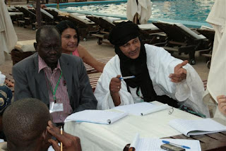
Indigenous herders from five African countries (Chad, Niger, Kenya, Namibia and South Africa) attended a two-day conference in N’Djamena Chad to share with each other and with meteorologists about how traditional knowledge and climate science can be combined to respond to current threats and risks. The conference also considered the need for effective participation of indigenous peoples, including herders, in national adaptation platforms and other national processes to ensure peace, sustainable livelihoods and biological conservation in the face of worsening climate instability.

Indigenous peoples’ delegates worked with the National Meteorological Services of Chad, the National Centre for Support to Research (CNAR), as well as international agencies, including the World Meteorological Organisation (WMO), UNESCO, the Global Environmental Fund (GEF) – Small Grants Projects, and the Technical Centre for Agricultural and Rural Cooperation EU-ACP (CTA). The results of the workshop were shared with the Honourable Minister of Urban and Rural Hydrology, and the Honourable Minister of Agriculture and Irrigation of the Republic of Chad. This declaration constitutes to the key results of the conference and the day of restitution.

Key findings included:
  • Traditional knowledge and climate science are both critically important for adaptation policy and supporting resilience building of rural communities necessary to cope with climate change;
  • Traditional knowledge and climate science need to be shared to create synergies that can inform adaptation policy, monitoring and assessment. It is through a combination of both knowledge systems that we are likely to achieve better synchronisation between forecasting, anticipatory responses, appropriate governance responses and feed-back. Both knowledge systems need to be converted into media that is understandable and usable in national adaptation platforms and for public use;
  • Climate change amplifies social and economic vulnerability, with the risk of serious conflict and poverty. An essential element of climate adaptation is ensuring good governance, human rights and social equity to maintain local, national and regional harmony during times of stress;
  • The United Nations’ Cancún Adaptation Framework, the National Adaptation Programmes of Action (NAPAs) and National Adaptation Plans (NAPs) may be best effected through well designed and funded national adaptation platforms;
  • National adaptation platforms need to include a diverse range of rural and urban communities, with particular attention to participatory approaches to facilitate the contributions of pastoralists, hunter-gathers, farmers and fisherfolk. 
  • National adaptation platforms need to facilitate a two-way flow of ideas, information and strategies for resilience building and equitable sharing of costs and benefits. The inputs to and outputs from the platforms need to be meaningful and relevant. 
Conference summary

Pastoralism evolved in Africa specifically as an adaptive response to climate and environmental conditions which limited the expansion of agriculture. Pastoralism has co-evolved as diverse cultural and economic systems within ecological niches around Africa. The result has been millennia of managing sheep, camels and cattle in different ecosystems and landscapes throughout long cycles of climatic changes. Pastoralism has always been premised on the need to maintain biodiversity as the underpinning of human and livestock well-being.

Climate change in combination with other drivers of declining biodiversity has reduced the effectiveness of pastoral societies to maintain both social harmony and biological resilience. At the same time, the reduction in agricultural capacity will likely lead to increased reliance on pastoralism and agro-pastoralism for African food security.

The N’Djamena conference and Declaration were elaborated as part of IPACC and AFPAT’s support for the Cancún Adaptation Framework, which was adopted by the 16th Conference of Parties to the United Nations Convention on Climate Change, held in Cancun, Mexico in December 2010. IPACC is a contributor to the UN Framework Convention on Climate Change’s Nairobi Work Programme on impacts, vulnerability and adaptation to climate change (UNFCCC NWP).

IPACC and AFPAT were influenced by the World Meteorological Organisation’s World Climate Conference – 3, held in Geneva, Switzerland in 2009. IPACC and AFPAT have initiated cooperation with both WMO and the African Centre for Meteorological Application for Development (ACMAD). The CTAis a partner of IPACC, assisting with building technical, information and policy capacity. CTA and the Open Society in Southern Africa (OSISA) were the principal funders behind the N’Djamena conference. Additional conceptual and policy support has been provided by the Local and Indigenous Knowledge Systems unit of the United Nations’ Educational, Scientific and Cultural Organisation (UNESCO).

The results of climate change include greater vulnerability of ecosystems as well as threatening human social and economic systems. Climate change is impacting negatively on health, livelihoods, peace and security. While the only answer is an urgent, robust and binding global agreement on the reduction of Green House Gas emissions, the reality is that Africa must take urgent steps to adapt to climate instability, reduce vulnerability and build resilience of both natural and human systems.

Despite the very serious risks from climate change, the N’Djamena conference delegates noted that climate change is only one element of the many challenges facing African indigenous pastoralists. Changes in land use and occupancy, different forms of pollution (e.g. radioactive pollution of aquifers), drylands deforestation, the negative impacts of extractive industries and a general decline in biodiversity across Africa are all contributing to growing poverty and vulnerability of indigenous peoples.

The following key issues and recommendations emerged from the consultations.

Knowledge Management

It was agreed by delegates that knowledge management is centrally important to successful adaptation.  Traditional Knowledge (TK) / Indigenous Knowledge Systems are valuable resources for monitoring, analysing and responding to climate change. TK has the benefit of including information on biology and ecosystems, while simultaneously locating this in a landscape approach to sustainability. TK exists in cultural systems which contribute to governance, equity, rights and stewardship responsibilities. TK thus combines knowledge with wisdom, values and social obligations. TK is itself an integration of science, skills and a normative framework for sustainable living.

Delegates noted that atmospheric (meteorological and climatic) science has much to offer rural communities including pastoralists. All participants emphasised that atmospheric science is a vitally important knowledge source that needs to be widely available to all scales of decision-makers. Climatological modelling and early warning systems can help pastoralists make informed decisions about carrying capacity, transhumance, nature conservation, water management and risk reduction.

The challenge for both systems of knowledge - traditional and scientific - is how they can be made usable for decision-makers, and how they can be used in synergy with each other to ensure a robust, shared approach to adaptation. Attention and expertise is required to facilitate the intercultural mediation of science and TK, generating understandable and usable research that helps decision-makers at local, national and regional scales.

Delegates called on African States to recognise the value of combining Traditional Knowledge along with atmospheric sciences to achieve synergies in policy making. Both systems of knowledge need to be interpreted to make them useful in adaptation planning and implementation. Delegates recommended facilitating a sustained dialogue between holders of the different knowledge systems, on-going cooperation, and effective integration of both knowledge systems in national, regional and international platforms.

Delegates noted that there is evidence that local varieties of livestock and plants appear more drought-, flood- and disease resistant than hybrid or alien species. Local varieties may have lower yield or commercial value, but their sustainability means that they provide greater security in the medium and long term. They may also be more appropriate to maintaining biodiversity and ecosystem integrity. Delegates recommended that more research funding and technical support should be provided to help protect indigenous species of plants and livestock.

Traditional knowledge does not exist independently of indigenous institutions. Valorising TK also means recognising how indigenous peoples hold, manage and innovate their knowledge systems. Traditional leaders, religious leaders, shaman, herders, oasis dwellers, metal and leather workers, traditional healers, men and women throughout the society are all important in sustaining and transmitting TK. This implies that it is not enough to have a nominal pastoralist presence in policy-making; there must be a productive interaction between State institutions, research institutions and indigenous peoples’ institutions to achieve coherence and sustainability.

New technologies, particularly information communication technology (ICTs) offer us new means by which to involve holders of traditional knowledge and the conversion of local oral knowledge into information and data which are useful for decision making at different scales. More attention needs to be given to these methods of bridging between orality and information than can feed policy processes. Cybertracker is one example of an African ICT which can assist with linking TK and valuable data required for adaptation planning and monitoring.

Delegates noted the valuable work done by the World Meteorological Organisation and African States to make meteorological services available to rural communities. Delegates encouraged State Parties and agencies to continue developing the use of appropriate technologies, such as participatory mapping, radio, and mobile devices and applications, to provide a two-way flow of climate and weather information that connects national meteorological services with rural communities.

Governance and Rights
Climate change amplifies existing social, economic and environmental problems. Part of adaptation policy making requires addressing issues of rights, equity, fiscal integrity and good governance. Continued widespread problems of corruption, discrimination and marginalisation aggravate the risk of conflicts and vulnerability. Climate change places greater pressure on all Africans, those in State agencies and civil society, to ensure compliance with principles of human rights, good governance and inclusion in decision making.

Delegates noted that discrimination against pastoralists finds its roots in colonialism and European legal biases imported into Africa. This is most evident in the problems of land tenure and resource rights of mobile peoples in Africa today. Traditionally, hunters, herders, farmers and fishing peoples had complementary land and natural resource use and tenure systems. There was coherence between rights to resources and the responsibility of communities for stewardship and conservation. This coherence of rights and responsibilities has been damaged and has not been adequately addressed in the post-colonial context. The current marginalisation of indigenous pastoralists can only be resolved by reforms to land rights, land tenure and access to natural resources legislation and practices.

Land tenure and resources rights need to be reviewed in relation to ecosystem capacity and achieving harmonious and equitable coexistence of communities who have different land use requirements. This too is part of building resilience and adapting to climate change.

IPACC members noted the value of the UN Declaration on the Rights of Indigenous Peoples as a new-generation international standard for promoting indigenous peoples’ rights and institutional engagement between State agencies and indigenous peoples.

Delegates noted that nature conservation is essential for subsistence economies. At the same time, exclusion from some Protected Areas has broken up indigenous territories and resulted in increased vulnerability to extreme weather and unstable climate conditions. Delegates invite State Parties to take a fresh look at the role of Protected Areas in providing remedial territories during droughts and flooding to allow pastoralists to lighten their impact on ecosystems. Protected Areas are important for conservation but should be seen within a wider scope of landscape connectivity and conservation, which includes mobile pastoralism.

The governance issue also speaks to proper assessment of equitable costs and benefits. As noted in the UNEP Green Economy Initiative, the value of rural economies and ecosystems needs to be taken into consideration before other economic decisions are made. Gross Domestic Product cannot be the sole determinant for approving new extractive industries and infrastructure projects. Environmental degradation leads to long-term vulnerability and places greater costs on State treasuries by increasing poverty, urban migration, declining food security and health and the collapse of local economies.

Where mines and tourism exist in pastoralist territories, the revenues from these ventures need to be handled transparently with benefits being shared equitably. Extractive industries need to be actively contributing to ecosystem conservation and resilience, and the costs of climate adaptation.

The value of pastoralism needs to be clearly and correctly assessed, and included in national decision making on resource and land allocations. Pastoralism is a primary livelihood for over 20 million Africans. Climate change is likely to increase this reliance on livestock, and hence pastoralism needs to be considered a core economic system in national planning.

National Platforms
Delegates noted that climate change adaptation requires coordination at global, regional and national levels. It was further noted that the key level of implementation is the creation of national platforms for adaptation policy, planning and monitoring. There are currently three adaptation instruments adopted by Parties to the UN Framework Convention on Climate Change: the National Adaptation Programmes of Action (NAPAs) for least developed countries, the National Adaptation Plans (NAPs) and the Cancún Adaptation Framework (CAF). These instruments and frameworks all need to be realised through effective, well financed, and responsive national adaptation platforms.

Indigenous peoples assert their willingness to be directly involved in national adaptation platforms. The goal is to ensure that farmers, fishing communities, hunter-gatherers and pastoralists act in a harmonious and complementary manner by working together on national and local policy making, in concert with State agencies and technical bodies.

National platforms need to be inter-sectoral in character. Climate adaptation involves decisions about agriculture, lands, water, human development, housing, health, security, education, as well as including technical issues of atmospheric and biological sciences.

National Adaptation Platforms need to concentrate on two-way communication. Pastoralists need early warning of climate crises before they happen. This warning needs to be integrated into other sectoral responses, including assistance with veterinary services, the ability to slaughter surplus animals and sell the products before a full-scale crisis has emerged and animals are unable to be used commercially.

Delegates note that biodiversity and ecosystem resilience is the basis of indigenous economies and cultures. Conservation of biodiversity and ecosystem services is fundamental to food security, health and sustainable living.

National Adaptation Platforms, and the related policy frameworks (e.g. the National Adaptation Programmes of Action / National Adaptation Plans) need to be equipped with participatory methods and tools to allow for effective participation by indigenous peoples and other rural communities. A centralised process which does not have its roots in real communities and real economic and environmental contexts risks missing the mark in responding to current and future needs. Africa needs to pilot innovations in participatory methodologies, new communication tools and citizen science, which in turn can be scaled up to national and regional levels of impact and effectiveness. The conference noted the valuable application of participatory mapping, citizen science, mobile phone technology, and Web 2.0 innovations in the domains of information management and communication.

National Adaptation Platforms will only be viable if they are properly funded and include commitments from the national budget. Adaptation is a lens that is relevant to budgeting and planning in all sectors. All Ministries should be contributing to the costs of adaptation planning, implementation, monitoring and evaluation. If Africa takes seriously its own investment in the National Adaptation Platforms, this will draw the attention and interest of international and regional donors and financial institutions that are looking to invest in robust country-driven initiatives.

Read more: