Showing posts with label webmapping. Show all posts

Tuesday, June 12, 2012

Climate Change and African Political Stability dynamic mapping tool released


The Strauss Center’s Climate Change and African Political Stability (CCAPS) program and AidData recently released a dynamic mapping tool that allows for analysis of climate change and conflict across Africa, plus development assistance in Malawi. The mapping tool uses Esri’s ArcGIS platform to enable users to select and layer combinations of CCAPS data onto one map. It also shows how conflict dynamics are changing over time and space. This tool provides an interactive medium for researchers to explore how climate change vulnerability and conflict interact, and in Malawi, to see how aid is distributed across different areas.

CCAPS climate security vulnerability data provides information on four sources of vulnerability: physical exposure to climate-related hazards, population density, household and community resilience, and governance and political violence. Chronic climate security vulnerability is located where these four sources of vulnerability conjoin.

Friday, December 23, 2011

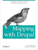
Mapping with Drupal: Navigating Complexities to Create Beautiful and Engaging Maps

Mapping with Drupal is a concise guide shows you how to create custom interactive maps from top to bottom, using Drupal 7 tools and out-of-the-box modules.

You’ll learn how mapping works in Drupal, with examples on how to use intuitive interfaces to map local events, businesses, groups, and other custom data.

Although building maps with Drupal can be tricky, this book helps you navigate the system’s complexities for creating sophisticated maps that match your site design.
  • Get the knowledge and tools you need to build useful maps with Drupal today.
  • Get up to speed on map projections, the ethics of making maps, and the challenges of building them online
  • Learn how spatial data is stored, input by users, manipulated, and queried
  • Use the OpenLayers or GMap modules to display maps with lists, tables, and data feeds
  • Create rich, custom interactions by applying geolocation
  • Customize your map’s look and feel with personalized markers, map tiles, and map popups
  • Build modules that add imaginative and engaging interactions
Mapping with Drupal: Navigating Complexities to Create Beautiful and Engaging Maps

By Alan Palazzolo, Thomas Turnbull
Publisher: O'Reilly Media
Release: December 2011