Thursday, May 21, 2026

Participatory 3D Mapping (P3DM) Workshop in Guiuan, Eastern Samar, Philippines

Despite their ecological and economic importance, #BlueCarbon ecosystems such as #MangroveForests face multiple anthropogenic threats, from aquaculture expansions and pollution, to overexploitation and poorly planned restoration initiatives.


In Eastern Samar, local leaders, fisherfolk, and the youth are taking the lead, sharing the stories of their own communities through a three-day Participatory 3D Mapping (P3DM) Workshop, held February 25 to 27 in Guiuan, Eastern Samar. 

This initiative is led by the Institute for Climate and Sustainable Cities, in partnership with the Philippine Geographical Society of the University of the Philippines Diliman. It is organized under the Enhance Mangrove Ecosystem Restoration and Protection for Growth and Empowerment in Samar Island (EMERGE) Project, a two-year initiative to restore and conserve mangrove ecosystems in target areas in Eastern Samar and establish a sustainable, community-managed ecotourism site.

EMERGE is organized under the Tropical Forest Conservation Fund II (TCFII) of the Forest Foundation Philippines (FFP). 

Video by the Philippine Geological Society of the University of the Philippines Diliman

Wednesday, October 15, 2025

An Introductory Guide to Participatory 3D Modelling for protected and conserved areas lauched at the IUCN World Conservation Congress in Abu Dhabi (10 October 2025)

Launched together with the Handbook on Participatory 3D Modelling for Protected and Conserved areas, this guide describes how Participatory 3D Modelling (P3DM) can support the pathway for improving protected and conserved area (PCA) governance, planning and management towards achieving positive conservation outcomes, including as set out in the IUCN Green List Standard.

Across the guide there are blue boxes that present case studies of real-world applications of P3DM in different contexts, especially those that have supported or been co-led by communities. The green boxes are explaining key concepts or processes

Who is this guide for?

This guide is for anyone interested in learning about how using P3DM can support good practice in protected and conserved areas governance, management and planning. This includes:

  • Governing actors or decision-makers such as PCA site managers and governing bodies, local government officials and policymakers;
  • Local rightsholders including Indigenous peoples and local communities;
  • Other stakeholders such as environmental nongovernmental organisations (NGOs) and civil society organisations (CSOs), researchers and academics.

It is also for any of the above actors who are using the Green List of Protected and Conserved Areas global Standards as a framework to advance in equitable governance, sound design and planning and effective management and would like to know how can P3DM supports them.

Monday, October 13, 2025

P3DM handbook lauched at the IUCN World Conservation Congress in Abu Dhabi (10 October 2025)

This handbook is useful both for people who are experienced in participatory mapping as well as people who are completely new to the practice. 

After gaining some initial understanding of what P3DM practice is all about and its origin, this handbook will help you to deepen your understanding of the implications of practising P3DM especially in the context of collaborative Protected and Conserved Areas (PCA) management.

This handbook primarily targets the following audience:

  • Protected area managers: Government employees and private landowners working in the national PCA system who are directly responsible for the management of such areas.
  • Advisors: Generally, these are expatriates operating in the context of externally funded projects focusing on PCAs.
  • Collaborators: Representatives from civil society organisations having a stake in activities taking place in locations that receive protection because of their recognised natural, ecological or cultural values. 
  • Implementers and project staff: This audience will benefit from this handbook as it details the P3DM processes step-by-step and can help better shape mutual expectations and understanding of the intrinsic value of the process.
  • Conserved areas governance actors and managers: Those actors that conserve their own areas effectively may wish to draw on P3DM as a means to gain recognition and support for their areas. This includes local rightsholders including Indigenous peoples and local communities.

It is also for any of the above actors who are using the Green List of Protected and Conserved Areas global Standard as a framework to advance in equitable governance, sound design and planning, and effective management and would like to know how P3DM can support them. To explore these options in depth, visit the Green List website.

Monday, June 24, 2024

Keynote: The Power of Participatory GIS in the Management of America's Public Lands – Jordan Smith


Participatory GIS has had an immeasurable impact on how we think about, explore, and manage public lands in America. The presentation shares stories of how volunteer cartographers, who were in many cases literal pioneers, shaped our understanding of the vast expanse that was the American West in the 1800s. The presentation also charts the growth of amateur map makers throughout the 20th century, highlighting the many ways they have shaped what we know about, and how we manage, public lands within the country. The presentation culminates with a look forward to how modern-day GIS enthusiasts and scientists are creating and leveraging free, and public geospatial databases, to chart a new path forward for public lands policy and management.
 

Thursday, September 07, 2023

Intervista a Giacomo Rambaldi: La cartografia partecipativa

 L'Università degli Studi di Padova ha intervistato Giacomo Rambaldi nell'ambito del suo programma master sulla GIScience e le nuove tecnologie dell'informazione geografica per la sostenibilità e la cittadinanza inclusiva. Giacomo parla della sua esperienza nel praticare la cartografia partecipativa in paesi in via di sviluppo.

Tuesday, June 20, 2023

Manual de mapeo participativo con proyecciones aumentadas en 3D: Una metodología para innovar la creación de mapas con comunidades


El presente manual describe los pasos y recursos necesarios para realizar mapeos participativos en comunidades usando Proyecciones Aumentadas 3D (PA3D). 

En este manual, estudiantes, profesores, facilitadores y público en general encontrarán información teórica y práctica para familiarizarse y/o profundizar en sus conocimientos sobre mapeo participativo implementando las PA3D. Si bien la organización de contenidos es secuenciada, el lector tiene la posibilidad de explorarlos de acuerdo con sus intereses, necesidades y habilidades. 

Además, en los casos de estudio, se ilustra el uso de esta herramienta en comunidades, mostrando sus ventajas en términos de la participación, de la generación de nuevo conocimiento y de los retos para su implementación.

DOI: https://doi.org/10.22201/ciga.9786073076593e.2023

Tuesday, May 23, 2023

‘We are our land’— Ogiek of Mount Elgon, Kenya: securing community tenure as the key enabling condition for sustaining community lands

Published in Oryx – the international journal of conservation – this open access article also highlights how this community control is under constant threat until and unless national law and practice recognizes the collective tenure rights of such communities.

"We outline how securing the community tenure rights of forest peoples can create a rapid, rights-based route to the effective and sustainable conservation of their forests. We draw on the different skillsets and experiences of the authors (long-term fieldwork, mapping and monitoring, and a lifetime of experience) to identify the conditions that enable the Ogiek of Chepkitale, Mount Elgon, Kenya, to sustain and be sustained by their lands. 

We also identify the conditions that drive the disruption of this sustainable relationship through an appropriation of Ogiek resources by external interests that threaten to degrade, alienate and destroy their ecosystem. It is increasingly recognized that securing sustainable conservation outcomes can be best achieved through the deep knowledge, connection and commitment that ancestral communities have regarding their lands. 

Evidence from Mount Elgon and more broadly shows that Indigenous Peoples are better guardians of their forests than international or state protection agencies. This challenges the idea that evicting forest peoples is the best way to protect forests. Other studies, including those conducted by the Kenyan governmental Taskforce on Illegal Logging, highlight the way Kenyan state agencies such as the Kenya Forest Service have been responsible for the severe depletion of Indigenous forests. 

We examine how de facto collective community control can enable decisions to be made in line with taking care of community lands over the long term, but also highlight how this ability is under constant threat until and unless national law and practice recognizes the collective tenure rights of such communities."

Friday, May 19, 2023


Wednesday, May 10, 2023

Evaluating Participatory Mapping Software

Evaluating Participatory Mapping provides a framework for evaluating geospatial software for participatory mapping. The evaluation is based on ten key indicators: ethics, cost, technical level, inclusiveness, data accuracy, data privacy, analytical capacity, visualization capacity, openness, and accessibility (i.e., mobile friendly or offline capabilities). 

Each application is evaluated by a user and cross analyzed with specific case studies of the software’s real-world application. This framework does not discriminate against assessing volunteered geographic information (VGI) applications, as a form of participatory mapping, in circumstances that its application is spearheaded by underrepresented groups with the intent to empower and spark political or behavioral change within formal and informal institutions. 

Each chapter follows a strict template to ensure that the information within the volume can be updated periodically to match the ever-changing technological environment. 

The book covers ten different mapping applications with the goal of creating a comparative evaluation framework that can be easily interpreted by convening institutions and novice users. 

This will also help identify gaps in software for participatory mapping which will help to inform application development in the future and updates to current geospatial software.

Friday, April 14, 2023

Saamaka People in Suriname suffer from illegal logging within their land

Stand with the Saamakans from Federico Rambaldi on Vimeo.

The Saamaka tribe is an Afro-descendant community that has inhabited the Suriname river watershed for over 300 years. They have a deep spiritual and cultural connection with the land and have preserved it through their customary laws and traditions.

However, over the past 30 years, Saamaka communities have struggled to defend their land against intrusive logging and gold mining activities. In the 1990s, the Government of Suriname granted logging concessions to multinationals in their territory without consulting them. For almost a decade, the forest was exploited, causing the destruction of agriculture fields and pollution of drinking water sources.

In the year 2000, the Saamaka decided to stand up and defend their territory against these threats and fights for the legal recognition of their land rights. They organized themselves into the Association of Saamaka Authorities and filed a petition to the Inter-American Court of Human Rights. The petition asked for support to stop human and land rights violations in their territory. This led in November 2007, to the issuance of a binding judgement by the Inter-American Court of Human Rights in favor of the Saamaka people, known as ‘Saamaka judgement’. It required the State of Suriname to legally recognize their land rights and stop any logging and infrastructure development inside the Saamaka territory and fully apply Free Prior Informed Consent procedures.

However, 15 years have passed since the ruling of the court, and the Government of Suriname still does not comply with the Saamaka judgment. On the contrary, their land rights are still not legally recognized, and logging concessions continue being granted without Free Prior Informed Consent.

Moreover, the issuance of community forest concessions is another violation of Saamaka rights. These areas, granted to individuals from the communities, are presented by the government as a way to legitimate Saamaka people's rights to the forest. However, in practice, these forest concessions delegitimize and violate Saamaka communal systems of property, creating internal conflicts, elite capture, and internal corruption.

Since one year ago, Saamaka communities have been struggling again to protect their land against a new destructive intrusion. A logging company has gained access to their concession on the east side of the Saamaka territory. Despite opposition from the Association of Saamaka Authorities, the logging company, with the support of few Saamaka individuals, who disregard the community’s stand, has built a pontoon to mobilize heavy machinery across the river and has begun road work without obtaining the Saamaka’s Free Prior Informed Consent.  As a result of this access, thousands of valuable logs are exploited illegally. This road poses now a significant threat to the livelihoods and sustainable use of forest resources maintained by the Saamaka. More importantly, the forest itself has customary and spiritual value for them. The road would facilitate access for illegal gold miners and more loggers, causing widespread habitat destruction.

With human and recurrent land rights’ violations, the Saamaka people are taking fresh action to advocate for the legal recognition of their ancestral land rights and demand that the Government of Suriname fully complies with the ‘Saamaka judgment’. 

As stewards of more than one million hectares of tropical rainforest, the Saamaka people ask the international community to support their efforts to protect their land.

Monday, January 31, 2022

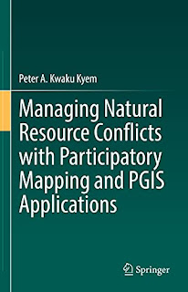
Managing Natural Resource Conflicts with Participatory Mapping and PGIS Applications (English Edition)

This book integrates spatial analysis into the study and management of conflicts, and offers a model in conflict studies that incorporates theoretical explanations of conflict, its causes, and impacts, with a geospatial strategy for intervening in disputes over allocation and use of natural resources (connects theory and practice). Alongside a theoretical analysis of resource conflicts and an account of Participatory Mapping and PGIS development, this book provides a case study of GIS applications in conflict mediation. 

The book also lays out a practical and straightforward demonstration of PGIS applications in conflict management using a real-world case study, and traces the Participatory Mapping and PGIS movements evolution, compares PPGIS and PGIS practices, and makes distinctions between traditional GIS applications and PGIS practice. The approach embodies the enhanced use of spatial information and media, sets of tools for analysing, mapping, and displaying spatial data and a platform for participatory discussions that enhances consensus-building. 

The book, therefore, contributes to the search for novel approaches for managing current and emerging conflicts. With this book, resource managers, development practitioners, students, and scholars of Participatory Mapping and PGIS applications and conflict studies will be equipped with the principles, skills, and the tools they need to manage non-violent resource conflicts and keep the disputes from slipping into violence. The book will also be a valuable text for basic and advanced studies in Participatory Mapping and PGIS applications, Conflict Resolution and Conflict Management.

Tuesday, December 10, 2019

How mapping changed behaviour

A study of the Samoan experience of participatory three-dimensional modelling (P3DM), a practice which has been widely promoted by CTA, has shown that it has led to better natural resource management, helped local communities become more resilient to climate change and brought about significant changes in the relationship between governments and local communities.

P3DM is a mapping progress which enables local communities to ‘populate’ geo-referenced relief models with their own knowledge about physical features, such as rivers and villages, and the way in which their territory is used, for example for hunting, fishing and growing crops. The maps help to enhance a sense of belonging and local knowledge and many communities have used them to assert their rights, identify resources and opportunities, and devise new strategies for managing the land.

Giacomo Rambaldi, who has led CTA’s work on P3DM, was contacted in 2016 by Barbara Dovarch, a PhD candidate from the University of Sassari, Italy. She was keen to look at the effectiveness of P3DM and Rambaldi suggested she carry out her fieldwork in Samoa. Here, a 5-year project funded by the Global Environment Facility and carried out by the Samoan Ministry of Natural Resources and Environment, had used P3DM to sensitise local communities to climate change. Rather than being initiated by the local communities and their partners, as normally happens, P3DM was introduced by a government department as a way to reach communities and gain their trust.

Dovarch found that prior to the introduction of P3DM, community representatives tended to adopt a very passive attitude during consultations with the authorities. “Government officials usually adopted a lecturing style in meetings with community members, using PowerPoint presentations and information leaflets, often without success,” noted Dovarch in her report. However, the P3DM process provided local communities with the opportunity to express their own understanding about their land and take a more active role in resource management. The building of the models also enabled young and old people to talk to one another and exchange knowledge about nature, culture and history.

According to community members who spoke to Dovarch, the process encouraged the government to change the way it behaved towards local people. Now it is much more willing to ‘listen’ rather than ‘teach’. Government officials moved away from ‘consultations’ towards active participation, which helped to build trust on both sides. As far as the government officials were concerned, the P3DM process – in Dovarch’s words – “completely changed the attitude and approach of communities towards their own environment and land management.”

The government of Samoa was initially exposed to P3DM techniques through CTA’s ICT4Ag activities. Since then, it has not only contributed to the development of 19 P3DM models over a 4-year period, but also committed itself to playing an important role in popularising the technique in other parts of the Pacific region, beginning with Tonga. Dovarch described her findings in a CTA working paper in the ICTs for agriculture series, Participatory 3D modelling in Samoa: Triggering behavioural changes in climate change resilience.

Tuesday, June 18, 2019

An innovation from the Philippines: Light-Based Participatory 3D Mapping for Disaster Risk Reduction

In 2004, four consecutive typhoons brought disruption to coastal provinces in the Philippines, including Aurora. Havoc suffered by the province caused massive displacement of indigenous groups residing in the mountainside, such as the Dumagats. In the face of such vulnerability, the need for participatory disaster risk management and improvement of spatial awareness through community-centred innovations is direr now than ever before.

The Prod.Jx, a collective of professionals and artists coming from multiple disciplines – social sciences, environmental sciences, design and the arts; and the Dumagats of Dinggalan, Aurora developed the LIGTASPAD – a Light-Based Participatory 3D (P3D) Mapping Project.


While P3D Mapping is an existing methodology practised by geographers, Prod.Jx employed a rather unique take to further innovate their product – integrating the community’s language for learning, leveraging on its team members’ technical capacities and life experiences, as well as consistently improving their design for local adaptability.

This is from the experience of TUKLAS Innovation Labs which is implemented by Plan International, Action Against Hunger, CARE Philippines, and the Citizens’ Disaster Response Center. TUKLAS is part of the Disasters and Emergencies Preparedness Programme Innovation Labs managed collaboratively by Start Network and CDAC Network, and funded by UK Aid.

The TUKLAS Central and Southern Luzon Lab is led by CARE Philippines.

Source: https://tinyurl.com/y4mw2m5z