A 3D model of the Mutton Hole Wetlands near Normanton has been developed as a starting point for community consultation and discussion about how best to preserve and use the Mutton Hole Wetlands.
The Mutton Hole Wetlands are situated just to the North and West of Normanton, and are a part of the Southern Gulf Aggregation, the largest continuous wetland of its type in northern Australia. Being vital for bird migration routes across northern Australia, the Southern Gulf Aggregation is considered to be of state, national and international significance.
In the past the wetlands formed part of the neighbouring Mutton Hole cattle station, but the area was declared a Conservation Park in 2004. Currently managed by Queensland Parks and Wildlife, Carpentaria Shire Council has been considering managing the park themselves. As a part of this consideration the Northern Gulf Resource Management Group has gained funding to write a management plan for the wetland.
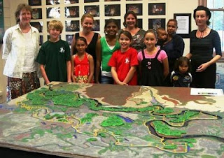
The management plan will highlight Aboriginal culture as well as the environmental values of the wetland in a plan to conserve it for future generations. There is strong support from the scientific and local community for use of the wetlands for bird watching, teaching and eco-tourism. As a step towards greater community consultation a model of the wetland area was built and is now located in the Normanton Visitor Information Centre (Burns Philp Building).
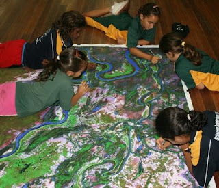
Over six weeks in April and May 2009 students and staff from Normanton State School and the Gulf Christian College worked together with Dr Isla Grundy of
CSIRO to construct a 3D model of the Mutton Hole Wetlands, using a technique called
Participatory 3D Modelling (
P3DM).
The model was made by first tracing the image of the wetlands from a 1:9500 satellite image onto a large piece of cardboard, then other features were added on or cut out. Finally, the rest of the landscape was painted onto the cardboard and the boundary of the Conservation Park marked with thread.
P3DM is a relatively new technique developed in the Philippines to support collaborative resource use and management, aimed to facilitate community participation in problem analysis and decision-making. This is the first time this participatory technique has been used to make a landscape model from cardboard in Australia.
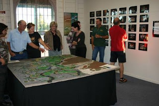
Since mid-May 2009 the model has been displayed at the Normanton Visitors Information Centre and on Thursday 21st May there was a formal public opening when students, parents and interested community members came to see what the schools had been working on. The exhibition was opened by Vicki Jones of Northern Gulf, along with Isla Grundy of
CSIRO and Agnes Hughes from Normanton State School. The forty or so people who attended were able to take a closer look at the model and discuss wetland history and potential use. The community at large was invited to give it’s opinions and ideas on how the Mutton Hole Wetlands should be managed and used in the future through individual community consultations and group discussions held at the Information Centre.
Source:
Dr Isla GrundyCommunity Agro-Ecologist CSIRO Sustainable Ecosystems,
JCU /
CSIRO Tropical Landscapes Joint Venture
Australian Tropical Forest Institute, James Cook University, Cairns, QLD 4870


 In April 2016 Djiru people began implementing a participatory 3-dimensional model (P3DM) covering close to 60,000 hectares (576 sq km) of land and sea, and including areas such as World Heritage, National Parks, freehold tenure.

