Showing posts with label pgis. Show all posts

Monday, August 01, 2016

Participatory 3D Modeling exercise with pastoralist communities in Karamoja, Uganda

The Technical Centre for Agricultural and Rural Cooperation ACP-EU (CTA) in partnership with the International Institute of Rural Reconstruction (IIRR), ERMIS Africa, ESIPPS International Ltd and Vision Care Foundation (VCF) supported the implementation of a ‪Participatory‬ 3D Modelling (‪P3DM‬) exercise in Northern ‪Uganda‬, within the ‪‎Karamoja‬ Cluster.

The process took place in the framework of the larger CTA-funded “Building resilient Pastoral Communities through Cross-border Livestock Value Chains in the IGAD region” project.

The P3DM exercise, and specifically its training component benefits also from support provided by the UNDP Equator Initiative which sponsored the participation of the director of the Oromia Pastoralist Association (OPA).

Other organisations which attended the process for capacity building purposes included Communication without borders (CwB), SIKOM PeaceNet Development and delegates from the Endorois and Kayas peoples from Kenya.

Those interested in the process can see a series of pictures on @PGISatCTA Twitter account.

All tweets related to the event include the hashtag ‪#‎p3dmUG‬ 

More importantly CTA commissioned the production of a documentary related to the process which will be available on www.vimeo.com/channels/pgis

Participatory 3D Modeling exercise with pastoralist communities in Karamoja, Uganda - Start following now!

The Technical Centre for Agricultural and Rural Cooperation ACP-EU (CTA) in partnership with the International Institute of Rural Reconstruction (IIRR), ERMIS Africa, ESIPPS International Ltd and Vision Care Foundation (VCF) is supporting the implementation of a ‪Participatory‬ 3D Modelling (‪P3DM‬) exercise in Northern ‪Uganda‬, within the ‪‎Karamoja‬ Cluster.

Karamoja Village, Northern Uganda (CC credit: Swiss Frog, Flickr)
The process takes place in the framework of the larger CTA-funded “Building resilient Pastoral Communities through Cross-border Livestock Value Chains in the IGAD region” project.

The P3DM exercise, and specifically its training component benefits also from support provided by the UNDP Equator Initiative which has sponsored the participation of the director of the Oromia Pastoralist Association (OPA).

Other organisations attending the process for capacity building purposes include Communication without borders (CwB), SIKOM PeaceNet Development and delegates from the Endorois and Kayas peoples from Kenya.

Those interested in the process should follow the @PGISatCTA Twitter account for daily updates.

All tweets related to the event will include the hashtag ‪#‎p3dmUG‬ 

More importantly CTA commissioned the production of a documentary related to the process which will be available on www.vimeo.com/channels/pgis

Thursday, July 28, 2016

Mapping local knowledge to drive sustainable natural resource management, influence policy-making and promote climate change adaptation

A new publication from the Technical Centre for Agricultural and Rural Cooperation (CTA) illustrates how local communities in a range of developing countries have developed a bird’s-eye perspective of their land and water resources through Participatory 3D modelling (P3DM). This innovative technique is proving a valuable tool for often voiceless groups, helping them to manage and protect their habitats, influence decision-making and take control of their future.

Improving natural resource management, mapping community rights and bolstering climate change adaptation – participatory 3D modelling can help to do all this and more. Developed in the early 1990s in Southeast Asia, the technique offers communities a tangible way of visualising tacit knowledge, producing stand-alone relief models that depict natural surroundings, but also cultural information, helping groups to assert their rights and protect their traditional knowledge from outside exploitation.

CTA has been in the forefront of P3DM development in African, Caribbean and Pacific countries, launching it in Fiji, Gabon, Kenya and Trinidad and Tobago, and helping to foster South-South cooperation to spread the practice further afield. The Power of Maps: Bringing the Third Dimension to the Negotiation Table documents some of the achievements obtained so far. All twelve of the case studies presented show how the process of building 3D maps has led to positive changes.

“Traditional knowledge is gaining recognition at the international level, but at the local level, government officials and technocrats tend to dismiss it as anecdotal and scientifically unproven,” said CTA P3DM expert and Senior Programme Coordinator ICT Giacomo Rambaldi. “The process documented in this book enables knowledge holders to visualise and georeference their traditional knowledge and to engage outsiders in a peer-to-peer dialogue.

Building a P3DM model generally involves the entire community, with the elders supplying their traditional knowledge and children taking charge of the actual construction, using cardboard, paints, pushpins and yarn. An important part of the exercise is the way it brings generations together, giving value to the contributions of each and making people feel a sense of pride – in their surroundings and heritage and in the map itself.

On the Pacific island of Ovalau, a P3DM initiative led farmers and fishers to adopt more sustainable land use and fisheries practices, with significant increases in production as a result. Impacts included a doubling of fish stocks, a sizeable increase in crop output and a rise in the number of tourists visiting the island. In Madagascar, the creation of a 3D map drew an initially sceptical community into a watershed planning process, with people quickly seeing the benefits in terms of improved resource management and income generation.

Members of a pygmy community displaced to make way for a protected area in the Democratic Republic of Congo used the web of knowledge displayed on their 3D map to regain access to traditional lands and claim a role in managing them. Meanwhile, in Kenya, a three-dimensional mapping exercise helped the Ogiek tribe to document its ancestral land rights and knowledge systems, with far-reaching repercussions – including shaping government policy on indigenous peoples.

Climate change poses a special threat to vulnerable small island states, and on the Caribbean island of Tobago, P3DM has been used to guide community driven disaster risk reduction strategies. In another three-dimensional mapping exercise in the region, the experience of building a climate risk map of Grenada has produced the added spin-off of strengthening the capacity and professional networks of local organisations. One unexpected outcome has been the signing of an international partnership to fund the replanting of mangroves, as part of an ecosystem management strategy to protect the island from persistent hurricanes that are endangering lives and livelihoods.

Further information:

Watch The enabling power of participatory 3D mapping among the Saramaccan Peoples of Suriname (part 1 & 2):
Visit CTA’s PGIS website
Read about the life-changing effect of P3DM
Known locations of P3DM exercises in Africa, the Caribbean and the Pacific
Collection of case studies: www.iapad.org

P3DM on social media:

www.facebook.com/ppgis
www.twitter.com/ppgis
www.vimeo.com/channels/pgis
www.ppgis.net

Order or download the publication (at no cost - eligibility criteria apply):

English version

Saturday, May 21, 2016

The network of NGOs known as BIMTT deploys participatory 3D modelling within its operations in Madagascar

Itasy is the smallest region of Madagascar and is characterised by a high agricultural potential. Nonetheless productivity is challenged by poor communication and limited market outlets and lack of land tenure security.

Close to 90% of the population of this region depends on agriculture. Production systems are diverse due to areas characterized by very high population densities (areas predominantly alluvial and volcanic soils) or by low quality soils (Central, West). Out-migration is high.

The regional plan for development highlights the need for investing in agriculture and related rural livelihoods, communication infrastructure and the establishment effective local administrations.


In order to contribute to improving sustainable resource management in selected villages, FAFAFI / SPAnta, both members of BIMTT (a network of rural trainers within the Christian Churches in Madagascar), has developed a programme focused on strengthening farmers, promoting local initiatives and the collaboration with the local authorities. The initiative is is inclusive and centred on practicing Participatory 3D Modelling (P3DM). P3DM is used to involve all local actors in the process from the documenting and geo-locating socio-economic and environmental realities on the 3D map, to plan future development. As a whole the initiative is aimed at supporting farmers, community based organisations and local authorities acquire skills in adopting the 'theory of change', participatory planning, monitoring and evaluation. 3D mapping at village level has proven to engage and excite  participants, increasing their initiative and commitment in engaging in activities which would benefit the entire community.


As of March 2016 a total of three villages have completed their 3D models. These include Antalata Vaovao and Faliarivo villages in Ampefy Commune, and Marosoka village in Analavory Commune.

The 3D models have been used to develop community-based village development plans.

FAFAFI/SPAnta in collaboration with the General Secretary of BIMTT plan to replicate the P3DM process in all villages benefitting from FAFAFI/SPAnta support in the Itasy region.

Thursday, March 31, 2016

Mapping deep in the jungle: our experience among Saramaccan Peoples

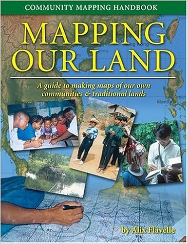
In July 2015 local residents and leaders from 14 indigenous Saramaccan villages, located along the upper Suriname River, collaborated with local and international NGOs to create a physical 3D representation of their traditional land and waters using participatory three-dimensional modelling (P3DM). The mapped area is sparsely populated and characterised by externally-driven logging and mining activities. The mapping process, provided participants with a comprehensive and detailed understanding of the landscape, its interlocked ecosystems, and potential impacts of road development and related extractive activities. This enabled them to formulate informed opinions on how best to develop, preserve and manage the traditional territories.

The process has highlighted how effective P3DM is when it comes to bottom-up and inclusive landscape planning. Helping communities to build a 3D model of their territory is proving to be an effective way for knowledge held by different individuals to be collated, geo-referenced and visualised, thus generating a powerful pool of data mostly unknown to the outside world. If strategically used, this data could shift the balance of power in favour of those who would otherwise not be included in decision-making processes.

The blog below was written by Nicholas Fields (INTASAVE Caribbean/CARIBSAVE) and Gaitrie Satnarain (CARIBSAVE Associate at the Anton de Kom University of Suriname).

CARIBSAVE was invited by Tropenbos International Suriname (TBI) and CTA to participate in a Participatory three-dimensional modelling (P3DM) exercise, conducted on 21–31 July 2015, as part of the above-mentioned project. Our group included representatives from TBI (including persons of Saramaccan origin), students and staff from the Anton de Kom University of Suriname, and ourselves – representing CARIBSAVE. Sponsored by CTA, our participation in the exercise helped us to understand and appreciate the P3DM process and now enables us to replicate it within our own projects in the Caribbean region. It is our intention to share what we have learned with our colleagues and build capacity within our own organisation.

What is P3DM?

P3DM is an inclusive process of building a physical 3D model of a specific area that details how communities use the natural environment – has demonstrated its significance and practicality beyond rudimentary research and data collection purposes. P3DM has proved to be an effective tool for bringing a diverse group of stakeholders, including representatives from the villages, community-based and non-governmental organisations, technical people and policy-makers, to the table to exchange ideas, perspectives and information; strengthen and build new relationships; support decision-making related to land use; and re-invigorate a desire to protect the environment and to use our resources sustainably for the benefit of current and coming generations.

A long journey to a remote location

On the first day we travelled three hours by bus followed by two hours by canoe to the Saramaccan village of Pikin Slee (which means ‘small village’ – although it is, ironically, one of the most inhabited and visited villages in the Upper Suriname basin) and the neighbouring ecolodge, Pasensie. From the river, the village does look deceptively small, but on traversing inland you can see that the landscape is dotted with variously sized dwellings used for domestic and communal activities. Saramaccan way of life is modest, with irregular access to amenities that one would have in the city (with the exception of smartphone/mobile devices, which are abundant).

Mapping the environment

We were warmly welcomed by the villagers upon arrival. The next five days were extremely busy assembling the blank model – that is a plain, white, three-dimensional canvas prior to any painting, drawing or pinning. The blank canvas is comprised of stacked layers of foam board material, with each layer representing an altitude interval, and shaped according to the specific altitude contour. The result is a scaled and geo-referenced three-dimensional canvas of hills, valleys, plains and depressions of the real-life landscape. The actual size of the area modelled was approximately 2,232 km2 and, with a horizontal scale of 1:15,000, the model developed into a rather large construction, involving five tables of approximately 1.6 x 1.2 m each.

Model construction is exciting as well as intensive, and the teenagers from a village-based school who took part in this process would certainly agree on this! The facilitators helped the students to trace each contour onto the foam boards, cutting these accordingly and affixing each layer of board to the model. Once the foam boards were cut according to the contours and stacked, the model was covered with plaster to allow for painting, which is perhaps the most labour-intensive component of the process, requiring precision, accuracy and careful attention to detail. The team had some initial challenges with matching and/or aligning contour maps, foam board pieces and uneven table tops, as well as working with the foam board itself. Understanding the nature of the problems, considering possible corrections and subsequent improvement was an important part of the learning process.

Mapping the knowledge

The next phase of the exercise, which took another 4–4½ days, involved populating the blank model with data on land cover and use (e.g. forests, agricultural land), locations of villages and estimated populations, and types and locations of activities associated with the villages and their inhabitants. The map legend – outlining what features would be located and visualised on the model – was finalised beforehand by the facilitators and representatives from the different villages located within the modelled area.

This stage was the most crucial and sensitive. Local residents and leaders had full autonomy entering data on the model at this point. This helped building buy-in and ownership of the process by the villagers, and minimising interference or perception of bias by the facilitators. Local residents spearheaded the process of identifying and marking features, place names and locations of activities. The facilitators (mainly the TBI team members of Saramaccan origin) offered only moderate guidance, taking care not to influence the direction of discussion except in the interest of maintaining consistency in the use of legend items, scale, focus and time, or mediating diverging opinions when these arose. Only agreed data were placed on the model. Specific locations and activities of cultural, spiritual or – in some cases – economic significance were not visualised, in the locals’ interest of protecting their security and inviolability.


Despite the fact that locals were given autonomy at this stage, some of them were distrustful of the process, fearing possible coercion, exploitation and vested interests by outsiders. The presence and interaction of the Saramaccan facilitators in the TBI team helped to alleviate most of these fears. Still, it was intriguing to observe the sometimes animated dialogue between locals as they detailed various parts of the model – indicating primary and secondary forest areas, tracks and paths, and places of work, domestic and recreational use.

We learned a lot there by observing and implementing the P3DM activity. And the strong multi-cultural element added another dimension. The indigenous Maroon groups were working with their own set of norms, practices and structures, which were very different to those that the external facilitators were used to. Including the participants and facilitators, the 10-day exercise brought together people of at least five nationalities and ethnic groups. At any given time during the activities, there were at least three languages at play: chief of these being Saramaccan, Dutch and English, with intercessions in Spanish and Arkans. While there were some slight communication barriers, none was too difficult to overcome – in fact, this made the experience much more amusing, and there were several side-lessons in foreign language vocabulary. There is no doubt that the group of facilitators also learned much over the two weeks, and established new personal and working relationships to build on in the future.

This P3DM exercise took dedication and was a large undertaking. Significant time and resources were required to co-ordinate and complete the model, particularly when the diversity of players and relative remoteness of the beneficiary groups are taken into consideration. However, the benefits of the exercise – first-hand participation in P3DM, learning and exchanging new information, connecting with people and building new rapports – were outstanding and will be long-lasting. The students’ participation also played an important educational role. We hope that they were able to appreciate the purpose of the model and will take forward what they learned from this process as they become leaders in the future.

Further impact: applying the knowledge gained

Since taking part in the exercise, CARIBSAVE has incorporated the P3DM methodology into one of its project proposals. It is planning to use the P3DM methodology for a participatory flooding hazard mapping and zoning exercise, as part of a larger comprehensive disaster management initiative. Through this exercise, community residents would produce a model that details flooding risk areas, vulnerable persons, infrastructure and emergency facilities as the basis for developing a community response plan.

Gaitrie Satnarain from Anton de Kom University intends to further what she has gained from the exercise by incorporating P3DM as a research tool within her upcoming doctoral study proposal. At the Anton de Kom University of Suriname, the Infrastructure Department in the Faculty of Science and Technology will also discuss potential opportunities with TBI to incorporate and promote P3DM for landscape planning research. CARIBSAVE will continue to explore and incorporate the P3DM methodology into its future projects to support building knowledge and capacity in climate change adaptation, disaster risk reduction and sustainable ecosystem protection and management – especially to benefit vulnerable and otherwise-marginalised groups it works with.

Who is involved?

P3DM in Suriname is led by TBI, as part of a joint multi-scale initiative to model ecosystem services and land-use scenarios in the Upper Suriname River basin (see here), in conjunction with WWF Guianas, the University of Utrecht, and the Association of Saramacca Authorities (Vereniging van Saramakaanse Gezagsdragers [VSG]). The initiative is supported by CTA and the UNDP GEF-Small Grant Programme. Through this initiative, TBI aims “to contribute to improved understanding of the impacts of modern-day human interventions on forests, landscapes and people”. One of the project's results was the construction of a number of physical 3D models to visualise and assess human-environment interactions, particularly in the Upper Suriname River basin, which is inhabited by several indigenous Maroon villages and is also the focus of local and external logging and mining extractive activities.


The enabling power of participatory 3D mapping among the Saramaccan Peoples of Suriname (part 1 & 2) from CTA on Vimeo.

Online resources on Participatory Geographic Information Systems (PGIS), including Participatory 3D Modelling (P3DM)


  • View an interactive map of the world with locations and details of known P3DM exercises
  • Visit the website on Integrated Approaches to Participatory Development (IAPAD).

Stay connected


  • Join the e-discussion around PGIS in English, French, Spanish and Portuguese
  • Are you interested in promoting the use of PGIS for adding value to traditional knowledge, empowering grassroots and conducting participatory land use planning in African, Caribbean and Pacific countries? Join us on Twitter @PGISatCTA and like our Facebook page.

Thursday, March 24, 2016

Being on a map means to exist: the Saramaccan experience

Saramaccan communities in Suriname seek government’s recognition of their traditional knowledge

On 23 February 2016, 18 Saramaccan community representatives from the Brownsweg and Upper Suriname River areas met in the capital city, Paramaribo, with key stakeholders and policymakers. The meeting was organised by the Saramaccan Peoples to share the results of a two-year process which led to the visualisation and documentation of their traditional environmental knowledge over a vast area.

Maps generated using data extracted from the 1:15000 scale participatory 3D model of the Brownsweg area (manufactured in November 2015), combined with the digital elevation model obtained from the Foundation for Forest Management and Production Control, Suriname.
It is said that a picture is worth a thousand words and maps may be even more effective in conveying messages when it comes to resource distribution and access. In fact the outcome of the process – which the Saramacca delegates proudly presented at the meeting – consisted of a series of community-generated physical and digital maps.

The maps and various data sets were produced in Saramaccan, English, and Dutch languages as a result of three Participatory 3D modelling (P3DM) exercises that took place in 2014 and 2015, involving 220 residents, including women, youth and the elderly. A film documentary about the process was released in 2015 in Saramaccan, English, and French.


Saramaccan leaders highlighted the uniqueness of the data the communities were able to collate, geo-reference and visualise using highly sophisticated technology, including Geographic Information Systems (GIS). Benefitting from external technical support, knowledge-holders were able to share their mental maps and memories which were used to populate blank 3D models.

The Saramaccan representatives drew attention to the relevance and accuracy of the data, and its accessibility to third parties, provided free prior informed consent for their use was given. "We made the map for it to be used. We want other people to make use of it. We only ask that the data is not used without involving us, the Saramaccan Peoples," concluded a community representative.

The Saramaccan delegates welcomed the use of the data for spatial planning purposes and called on the government and private investors to recognise them as key stakeholders and fully involve them when planning logging activities, protected area management and gold mining concessions within traditional Saramaccan lands.

They urged for the replication of P3DM processes in the rest of the Saramaccan territory so that a complete map of traditional Saramacca lands could be generated. To achieve this, they called on the government, development organisations, private sector, and NGOs present at the meeting to raise the necessary funds.

The event was hosted by Tropenbos International Suriname, WWF Guyanas and the Association of Saamaka Authorities.

In addition to Tropenbos International Suriname, project sponsors included the UNDP-GEF Small Grant Programme and CTA. Contributions by both organisations were duly acknowledged, with participants stating that their valuable contribution established a 'fertile ground' for community empowerment via P3DM which they considered to be a very innovative process. Participants also acknowledged that the P3DM process had inspired other communities who were now requesting support to deploy the P3DM process in their areas.


Wednesday, March 09, 2016

River partners: Managing environment and disaster risk in the Democratic Republic of the Congo


River partners: Managing environment and disaster risk in the Democratic Republic of the Congo is a video report on the disaster risk reduction project being implemented by the United Nations Environment Program, the Government of DRC and local communities, with the support of the European Union.

Flooding and soil erosion are major hazards that threaten the Lukaya River basin in the Democratic Republic of the Congo. Located in the outskirts of Kinshasa, this basin is an important source of water supply for the capital. This pilot project will demonstrate how ecosystem-based disaster risk reduction (eco-DRR) can be integrated into c devel
opment planning. Upstream and downstream river users are brought together to tackle disaster risk and development planning in a more integrated manner. Participatory 3D Modelling (P3DM) is used in the process.

Partenaires de la Rivière: Gestion de l'environnement et des risques de catastrophes en République Démocratique du Congo est une vidéo sur le projet de réduction de risques de catastrophes mis en oeuvre par le Programme de Nations Unies pour l'Environnement, le Gouvernement de la RDC et les communautés locales, avec le soutien de l'Union Européenne.

Les inondations et l'érosion du sol sont des aléas majeurs qui menacent le bassin de la rivière Lukaya en République Démocratique du Congo. Situé en périphérie de Kinshasa, le bassin est une source importante d'approvisionnement en eau pour la capitale. Ce projet pilote démontrera comment la réduction de risque de catastrophes à base d'écosystèmes (RRC-éco) peut être intégrée à la planification du développement de bassins-versants. Les usagers de la rivière en amont et en aval sont réunis pour aborder ensemble les problèmes de risque de catastrophes et de planification du développement, d'une manière plus intégrée. La cartographie participative en trois dimensions (MP3D) a été utilisée dans le processus.

Monday, January 11, 2016

Di mbei di dee Saamaka sëmbë mbei di ageesi kaita de seei u de sa seeka sondi u de (video voiced in Saamaka)


Feifi teni jaa pasa kaa, di wan feifi dusu Saamaka sёmbё so bi abi u voloisi di de mbei di dan. De bi abi u kumutu disi di kamian te ka dee gaan sёmbё u de bi ta libi a di Saamaka lio. Te ku di daka u tide di voloisi aki dё a de pakisei eti. Dee Saamaka sёmbё dee ta de a moo libasё u di Saamaka lio ta abi umёni boöko hedi, we bika de an feni leti u di matu jeti. So seei pasi ta mbei ta ko a di kamian te ka de ta libi. Di mbei u di ageesi kaita u di tan kamian u de, ta konda fa de seei ta si di libi u de, fa de ta woko ku di matu, so sei di kaita sa heepi de u gaan lanti sa fusutan de moo bunu u de ta sa a wan taki a dee sondi di ta pasa a di konde.

Version française: http://goo.gl/ggXyw5
English version: http://goo.gl/hS5nKb

Saturday, January 09, 2016

Speaking of Home - The story of the Mount Elgon Ogiek


The Ogiek peoples live on the slopes of Mount Elgon in Kenya. This documentary shows the Ogiek's relationship to their homeland and to the world.

As indigenous peoples without official minority status in Kenya, the Ogiek have gone through evictions from their native land for decades. Time after another they have returned to their land to continue living in the forest.

The documentary is the Ogiek's story, in their own words, of their hopes before the 2013 Kenyan elections. It was filmed in Chepkitale, Mt. Elgon in 2012 during a 3D mapping workshop.

Through developing a 3D map of their land, the Ogiek not only strengthen their cultural identity, but can show that the land said to belong to someone else, is rightfully theirs.

Credits: The film has been produced by SHALIN Suomi Ry and has been featured at the Helsinki African Film Festival.

More on the case is found here.

Knowledge and cultural transmission in Kenyan participatory 3D mapping

This film interview of Dr. Nigel Crawhall, Director of Secretariat at the Indigenous Peoples of Africa Co-ordinating Committee (IPACC), is his explanation of the intergenerational ecological knowledge transmission in participatory 3-dimensional modelling (P3DM). Crawhall discusses his observations on intergenerational interaction when the Ogiek community of Nessuit, Kenya, built a geo-referenced 3D model of their mountain forest landscape in 2006.


The mapping exercise was attended by representatives from 21 Ogiek clans, and an area of 52,800 hectares (ha) was mapped at a scale of 1:10,000. Participants included close to 120 representatives from the different clans, both men and women. Elders populated the model with their memories dating back to 1925 and reconstructed the landscape as it was at that time. The model displays 64 data layers including different types of areas, points, and lines. In 2008, the Ogiek people expanded the coverage of the model to include further 40,000 ha.

This kind of physical 3D model creation can serve the community for the following:

  • Generating spatial geo-referenced data based on a community perspective on land use, vegetation cover, resource distribution, tenure, etc;
  • Storing and displaying such data at a community level;
  • Supporting intra- and inter-generational knowledge exchange;
  • Adding value and authority to local knowledge;
  • Involving communities in developing resource use and management knowledge;
  • Conducting preliminary collaborative research on distribution of species;
  • Monitoring jointly with the concerned stakeholders' changes in land use, vegetation cover, human settlement, infrastructure development, and other features;
  • Serving as a benchmark; and
  • Supporting the learning of local geography and resource use.

The purpose of the model was to record traditional territory and land use patterns, as well as memory and history from a land use and environmental perspective. As reported here, through map building and coding, the clan experienced participatory community enthusiasm and cooperation between elders, young adults, and youth on intergenerational knowledge, language, and heritage transfer, tapping knowledge otherwise lost over time. The 3D style of the map encouraged explanation of the clan’s historical land use patterns and included creating a key or legend to increase understanding of the interrelationships of land, vegetation, altitude, and layers more of information, leading to more complex environmental knowledge that other methods, for example walking on the land, might not provide.

In addition, young people gave attention to the process and listened while elders debated historical use patterns from their memories. A linguistic dimension, which evolved due to the use of English, Kiswahili, and Ogiek, drew out more explicit meaning of vocabulary in Ogiek. Intergenerational knowledge transfer affirmed the elders' lived experience, and the process transferred to the younger members of the community the realisation of the complexity of their environment and the depth of knowledge available to them through their elders.

Source: The Communication Initiative

More information on the case is found here.

Friday, December 18, 2015

The enabling power of participatory 3D mapping among the Saramaccan Peoples of Suriname (Video)


Fifty years ago, some 5000 Saramaccan Peoples of Suriname had to leave their traditional lands along the Suriname River due to the construction of a major dam. The wounds of this transmigration are still felt today. Meanwhile, the Saramaccans who live in the Upper Suriname River area face new challenges since their territorial rights are not yet officially recognized and road infrastructure to access the area is improving. Creating a 3D model of the area that tells the inside story of their traditions and land use can help them to overcome their sense of being misunderstood by decision-makers and rediscover their voice.

Language versions:
Version française: http://goo.gl/ggXyw5
Saramaccan version: http://goo.gl/9XC2Jb

The 15 min video production "The enabling power of participatory 3D mapping among the Saramaccan People of Suriname" has been launched on October 9 at the 13th Caribbean Week of Agriculture in Paramaribo. The launch occurred during the session "Maps as media in policy processes: Bringing the 3rd dimension to the negotiating table" in the presence of representatives from the Saramaccan community.

The launch was followed by reflections done by Saramaccan representatives Mr Godfried Adjako, one of the captains of the village of Kaajapati, and Ms Debora Linga who spent her infancy with her grandparents on their farm on the shores of the Brokopondo Reservoir and later on kept visiting them in Ginginston village along the banks of the Upper Suriname River.

Mr Godfried Adjako recalled that in the process of populating the 3D model the community, especially the youth, learned a lot from the elders. "The map now shows our life, the Earth we live on, the Earth we walk on, the Earth without which we cannot live."

"We can use the map to take decisions on where to locate future developments", he added. Both men and women contributed to the map. "Women know a lot about the surrounding of the villages, while men who use to go hunting, know the most about far away areas."

Mr Adjako stated that when developing the legend ahead of the mapping exercise, the community decided to omit sensitive and confidential information. Therefore the data contained in the model and currently being digitised by Tropenbos international Suriname should be considered as publicly available.

The P3DM process has been a discovery journey for young Debora. "In the 60's my grandparents had to resettle because their village had been submerged by the rising waters of the Brokopondo Reservoir . They resettled along the Upper Suriname River in a village called Ginginston where I grew up. I could not understand the reason why my grandfather kept on navigating a long way along the river to reach the shores of the lake where he was growing watermelon" she said. "I discovered the reason while chatting with an elder who explained to me that transmigrating families were welcome by Saramaccan villages uphill the lake, but were granted limited access to resources. In fact they were sort of borrowing the land from people who occupied it for generations. Thus they only had access to small farming areas. In Saramaccan this is how you feel: they were living on somebody else's land."

Friday, December 11, 2015

Socially engaging, user-friendly, and user-useful approaches in ecosystem service research

Participatory 3D modelling was presented as a ground breaking approach to use in participatory ecosystem service research during the 8th Ecosystem Service Partnership Conference, held in Stellenbosch, South Africa from the 9th to the 13th of November 2015. The Conference saw the participation of around 380 scientists from around the globe.


The presentation by Sara Ramirez A socially engaging, user friendly and user-inspired approach in ecosystem research took place within the workshop “Indigenous peoples in their ecosystems’’. An ecosystem service research project was designed and implemented in Suriname, which used Participatory 3D Modelling (P3DM) to engage local communities in a process of co-producing knowledge about ecosystem services and competing land uses.

P3DM is an effective tool to involve scientist and local knowledge holders in an equally and transparent co-production of salient and legitimate knowledge about ecosystem services. Parallel to research outputs (of main interest to the researcher), a P3DM approach yields directly tangible outputs for the local communities which makes research inclusive and legitimate. Attendees during the session participated actively through questions and feedback.

Friday, November 06, 2015

Facilitating climate smart adaptation through the use of Participatory 3D Modelling by Neila Bobb-Prescott at the Caribbean-Pacific Agri-Food Forum in Barbados


Participatory 3D Modelling or P3DM in short, is a community-based mapping method which is spreading in the Caribbean Region. It facilitates planning and action-taking on climate change related issues. Considering the potentials of the process, efforts are needed to promote the success stories of its use to date. This presentation at the Caribbean Pacific Agri-Food Forum in Barbados (206 November 2015) is an important step in promoting the practice in the region.

Neila Bobb-Prescott's participation in the 2nd Agribusiness Forum has been supported by the Technical Centre for Agricultural and Rural Cooperation ACP-EU (CTA)

Participatory mapping processes for data generation and exchange in SIDS by Aly DeGraff at the Caribbean-Pacific Agri-Food Forum in Barbados


Participatory mapping is the solicitation and incorporation of geospatially focused local knowledge in bottom-up decision-making processes. It provides a wide decision-making base, taking into consideration the collaborative collection and validation of data while building ownership in the generated data. Participatory mapping can be used as a powerful tool to strengthen public participation in governance and social change in agribusiness communities.

Aly DeGraff delivered her talk at the Caribbean-Pacific Agri-Food Forum in Barbados organised by CTA and partners.

Thursday, October 29, 2015

Samoa’s Ministry of Natural Resources and Environment receives award for engaging civil society via participatory mapping

On 25 September 2015 the Forestry Division of the Ministry of Natural Resources and Environment of Samoa (MNRE) received a Public Service Innovation and Excellence Award in the Environmental Friendly/Sustainable Development Initiative team category for the successful implementation of the Integration of Climate Change Risk and resilience into Forestry management in Samoa (ICCRIFS) Project.

The ICCRIFS Project is a 4 year project funded by the Global Environment Facility (GEF) through the United Nations Development Program (UNDP). The goal of the project is to integrate climate change risks into forestry management in Samoa. After being trained by the Technical Centre for Agriculture and Rural Development (CTA) in practising Participatory Three-Dimensional Modelling (P3DM) in 2012, staff of the ICCRIFS Project successfully facilitated a total of 18 P3DM exercises with communities in various sectors including water, forestry, tourism. The first P3D Model to be implemented (covering villages from Laulii to Falevao) became a very effective planning tool. It helped engaging the community by building capacity, knowledge and skills on environmental management, and ways to adapt and mitigate climate change.

The 2015 Public Service Innovation and Excellence Awards ceremony, took place on the 25th of September 2015 as part of the 4th annual Public Service Day. The Public Service Day is held to commemorate, celebrate and recognize the public sector’s contribution and service into achieving the national development of Samoa. Close to 50 Government Ministries and Public Bodies took part in this year’s celebrations.

These Awards are used to recognize the dedication of public servants in achieving their respective Ministry’s and Office’s objectives. Nominations of potential awardees were solicited from the general public in August and were thereafter assessed by an independent panel consisting of 3 members: the Chamber of Commerce President on behalf of the private sector, SUNGO Interim President Vaasilifiti Moelagi Jackson on behalf of the civil society, and the Chairman of the Commission.

The general public as well as schools were invited to take advantage of the opportunity to engage with Government agencies to gain an in-depth understanding of the functions and roles of each of the participating agencies and how these relate to their everyday life.

Related postTop UN officials Helen Clark and Naoko Ishii praising outcome of P3DM activities in Samoa

More information on the P3DM process and case studies are found here and here.

Wednesday, October 21, 2015

Community-based Disaster Risk Reduction in the Philippines


With the support of UNICEF and the University of the Philippines, children in Camarines Norte help their communities in locating the hazard risks in their areas and plan disaster preparedness measures using a Participatory 3D Model (P3DM).

Sunday, September 20, 2015

We have wings to fly - Join the uav4ag community

The use of unmanned aerial vehicles (UAVs) or drones for management of crops, livestock, fisheries, forests and other natural resource-based activities represents a new technological frontier and opens up a range of exciting opportunities. UAVs offer also opportunities for grassroots’ involvement in monitoring use of and access to the resources their livelihoods depend on.

A community has been established on www.uav4ag.org to cater for practitioners, researchers, farmers, entrepreneurs, service providers operating in developing countries and who are interested in the topic.  Members of the community share their experiences in developing UAV technologies and related software applications and more importantly in making use of small UAVs to improve the assessment and management of crops, fishing grounds and other resource-based activities. Relevant events, capacity building opportunities and other resources are signalled as soon as these are known by members of the community.

Being the use of UAVs for agricultural purposes a recent phenomenon, national aviation authorities and potential users are facing new challenges linked to the use of UAVs within their skies. Hence this Community focuses also on existing and forthcoming policies, laws and regulations governing their use.

Sunday, August 23, 2015

Mapping Our Land: A Guide to Making Your Own Maps of Communities and Traditional Lands


Communities all over the world are discovering that maps provide a valuable tool for recording local knowledge and discussing land-use issues. In a participatory approach to mapping, community members design the mapping project and make maps according to their own needs.

Mapping Our Land describes all stages of the community mapping process from setting the goals of the project to completion of the maps.

Alix Flavelle has taught mapping to aboriginal peoples around the world. She outlines the range of themes that communities choose to address and offers examples of how they have presented their local knowledge on maps. A variety of map-making techniques are explored, as well as guidelines for choosing which techniques best suit the purpose of the mapping project.

Clear step-by-step instructions are provided for:

  • Basic principles of map-making
  • Exploring cultural elements of maps
  • How to organize the community
  • Making sketch maps on paper or mylar
  • Using topographic maps
  • Making three-dimensional models
  • How to do a compass survey
  • Using a Global Positioning System (GPS)
  • Interpreting aerial, radar and satellite images
  • Drawing the final map
  • Land rights, resource management and protecting local knowledge.

Accessible and full of practical information and ideas, this book is a toolbox intended to help communities design and complete a mapping project that fits their unique culture, landscape and situation, and their purpose for making maps.

Available from Amazon: Mapping Our Land

Wednesday, August 19, 2015

Mapping for Change: Practice, technologies and communication - 10 years have passed - publication still valid and available

This CD “Mapping for Change: Practice, technologies and communication” includes a selection of papers presented at the “Mapping for Change: International Conference of Spatial Information Management and Communication” held in Nairobi, Kenya, on 7th-10th September, 2005 and published in Participatory Learning and Action (PLA) 54 in April 2006. Guest editors of PLA 54 are Giacomo Rambaldi; Jon Corbett; Mike McCall; Rachel Olson; Julius Muchemi; Peter Kwaku Kyem; Daniel Wiener and Robert Chambers.

The CD contains PDF versions of the articles published in PLA 54 translated in the following languages: Arabic, Bangla, Chinese (traditional and simplified), French, Hindi, Persian-Dari, Portuguese, Spanish, Swahili and Tamil as well as the English versions. The CD includes additional resources (mainly in English), including a video of the Conference and key literature on the practice, including UNESCO Conventions on Cultural Mapping.

Available (for free) to residents in Africa, Caribbean and Pacific (ACP) countries via CTA Publishing.

Credits for Translations, layout and typesetting 
  • Arabic: Translation by Dr. El-Hussaini Yehia, Center for Development Services, Cairo, with thanks to Ali Mokhtar
  • Bangla: Translation by Enamul Huda and Taifur Rahman, PRA Promoters’ Society, Bangladesh
  • Chinese (Simplified): Translation by Liu Xiaoqian, Yang Fang , Li Fang, Li Xiaoyun, China Agricultural University, Beijing
  • Chinese (Traditional): Translation by Wang Yaohui, National Linkou Senior High School, Linkou Township, Taiwan with special thanks to Hsiao Ya Wen, National Changhua University of Education, Changhua City, Taiwan (Chapters 1 and 2); Lin Mei Jhih, Shengang Junior High School, Shengang Township, Taichung County, Taiwan (Chapter 4); Chuang Yu Chun, National Yangmei Senior High School, Yangmei Township, Taoyuan County, Taiwan (Chapter 7); Shen Tsui Mei, National Linkou Senior High School, Linkou Township, Taipei County, Taiwan (Chapter 9); Jhang Yu Jing, National Sihu Senior High School, Sihu Township, Changhua County, Taiwan (Chapter 12); Lin Wen-Xin, Kaohsiung Municipal Chung-Cheng Industrial Vocational High School, Cianjhen District, Kaohsiung City, Taiwan (Chapter 15)
  • French: Translation by Maryck Nicolas, with thanks to Marie Jaecky of IIED for proofreading
  • Hindi: Translation by Meera Jayaswal, with thanks to Dr. Neela Mukherjee, Director, Development Tracks, Delhi, India, and to Mr.K.K.Singh, Ujjawal Kumar and Sanjay Das for page layout and typesetting
  • Persian-Dari: Translation by Reza Nobacht, with thanks to CENESTA, Tehran for technical support, to Esmaeel Hamidi and Jeyran Farvar for copy editing and proof reading, to Pooya Ghoddousi for coordination and Jeyran Farvar for page layout and typesetting
  • Portuguese: Translation by Francis Sahadeo, with thanks to Ines Fortes for copyediting
  • Spanish: Translation by María Isabel Sanz Bonino, with thanks to Alejandra Larrazábal and Mike McCall for copyediting and Tanya Pascual for proofreading
  • Swahili: Translation by Catherine Wanjiku Gichingi and Margaret Njeri Gichingiri (ERMIS Africa) with thanks to Julius Muchemi, Executive Director and Bancy Wanjiru, Programme Administrator
  • Tamil: Translation by John Devavaram and his team at SPEECH, Madurai, India, including Arunodayam

Friday, July 10, 2015

‘Participatory data’ and the formulation of Tourism Development Area Management Plans in Samoa

Developing agriculture to better serve tourism markets in the Pacific is knowledge intensive. The first step is to determine the tourism market’s demands for agricultural produce and then to match this with what is available from local production. But much of this information is not currently readily available.

Bridging this information gap was a key objective of the recent Agribusiness Forum: Linking the agrifood sector to the tourism-related markets coordinated by CTA and the Pacific Islands Private Sector Organisation (PIPSO) with support from the Secretariat of the Pacific Community (SPC), the Pacific Agriculture Policy Programme (PAPP) and the intra-ACP Agricultural Policy Programme (Intra-ACP APP). This event, held in Fiji from 1 to 3 July 2015, brought together experts from government agencies, farmers’ organisations, community-based organisations, remote sensing and research bodies to identify the data gaps and discuss how to go forward.


Giving a community perspective, Amia Luatua from the Samoa Tourism Authority, shared Samoa’s work on tourism planning, showing how communities have used participatory 3D modelling (P3DM) to collect data that have been used to inform tourism developments.