Showing posts with label mapping. Show all posts

Saturday, November 21, 2009

Ogieks will not be evicted from the Mau forest


As reported by NTVKenya on October 24, 2009 , it is emerging that members of the Ogiek indigenous community will not be affected by the eviction notice. the Mau task force committee says the indigenous forest dwellers will not be moved when the evictions start soon. The announcement came as the Prime Minister gunned for more financial support for the Mau in Europe.

Related news and actions on PPgis.Net Blog:

Ogiek Appeal to the Kenya Government Notice to vacate Mau Forest Complex and other water towers

The 2009 UNESCO World Report on Cultural Diversity makes reference to the Ogiek 3D Mapping

Francis Kakwetin Lesingo reports on the use of a 1:10,000 scale 3D model in Nessuit Kenya

Head teacher Julius Sangogo reports on the usefulness of a Participatory 3D Model (P3DM) in Nessuit, Kenya

Dr. Nigel Crawhall, director of the Indigenous Peoples of Africa Coordinating Committee (IPACC) thoughts about P3DM in Mau, Kenya

More on indigenous mapping by Ogiek People in the Mau Forest

Friday, November 13, 2009

Peter Poole reports on his experience with community mapping


In this interview, Peter Poole traces the evolution of a map-making methodology which commenced with his introduction of GPS to the Inuit community of Pangnirtung in 1989 and was incubated throughout the 1990’s by a series of ‘tenure mapping’ projects in the Amazon the Arctic and Asia. Tenure maps depict indigenous names, resources and special places on scaled maps, intended as evidence in negotiating land settlements.

Most tenure mapping methods rely upon external cartographic expertise. The “no-name” method enables communities to control the complete information cycle: gathering raw data, their conversion to information, its application.

The interview describes the search for cheap, simple, appropriate geomatic technology.

During several tenure mapping projects in the Amazon, a two-tier arrangement evolved whereby community-based teams would gather raw field data, the most critical task, and indigenous associations or support NGO’s, set up mapping units to serve the field teams.

The interview shifts focus to an overview of global community mapping completed by Peter Poole. In this, he concluded that, in terms of expertise, accessibility and accomplishment, the Philippines. He also drew a broad distinction to tenure mapping in America, a continent whose indigenous peoples sharing a in common ‘500 years since Columbus’ experience, and Africa, where this model does not work and where community mapping is taking off in a refreshing variety of directions.

The interview concludes with three lessons learned:
  • Yes, communities can make their own scaled maps.
  • The most successful of emerging mapping centres are those whose services are accessible to all communities.
  • This capacity-building approach to map making equips and inspires people to diversify their skills in environmental information management. These skills will be wasted unless provisions are made to follow up tenure mapping projects with either further training or employment.

Friday, October 23, 2009

Dr. Robert Chambers elaborates on Participatory GIS (PGIS) practice


Dr. Robert Chambers from the Institute of Development Studies (IDS), UK, reflects on the intersection of participatory development and Geographic Information Systems (GIS) and on the resulting good and bad practices. In the interview Dr. Chambers calls on practitioners and development agencies to ensure that good practice is put in place to avoid the repetition of the misuse of PRA (i.e. Participatory Rural Appraisal) done in the 80's and 90's.

Thursday, October 22, 2009

The future of environmental law mapping

Laurent Granier from ecocy recently wrote an essay on the future of environmental law mapping where he argues GIS and mapping tools are transforming our vision of legal data, “from vertical books to horizontal maps”. Drawing on examples of online mapping tools and representations, including participatory GIS, he shows a tendency for law and policy makers to aggregate administrative and legal layers in maps, towards more and more legally binding tools.

Saturday, October 10, 2009

Participatory 3D Modelling: a Review ...

Giacomo Rambaldi makes a summary of his involvement in the improvement, development, promotion and dissemination of a participatory mapping method better known asl Participatory 3D Modelling (P3DM).


Participatory 3D Modelling (P3DM) is a community-based mapping method which integrates local spatial knowledge with data on elevation of the land and depth of the sea to produce stand-alone, scaled and geo-referenced relief models. Essentially based on local spatial knowledge, land use and cover, and other features are depicted by informants on the model by the use of pushpins (points), yarns (lines) and paints (polygons). On completion, a scaled and geo-referenced grid is applied to facilitate data extraction or importation. Data depicted on the model are extracted, digitised and plotted. On completion of the exercise the model remains with the community. More information on the method are available at iapad.org

Sunday, October 04, 2009

Participatory 3D Model of the historical Wechecha mountain complex, Ethiopia

MELCA Mahiber, an Ethiopian NGO which is part of the African Biodiversity Network (ABN) facilitated the construction of a Participatory 3 Dimensional Model (P3DM) of the historical Wechecha mountain complex, which is found in Oromiya Regional State, adjacent to Wolmera and Sebeta Awas Woreda in Ethiopia.

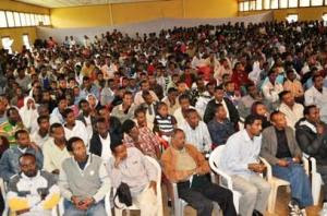
Once completed the model has been inaugurated by a Representative of the President of Federal Democratic Republic of Ethiopia. Over 500 people participated in the ceremony including members of the House of People Representative Councils, governmental officials and representatives from international organizations, CSO and local communities.

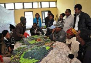
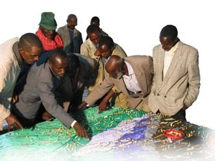
The 1:10.000 scale model covers an area of 24 km by 28 km. Over 40 students and representatives from youth groups constructed the blank model. Residents of the area, especially elders, were invited to populate the map with their spatial knowledge. In the process information about the mountain area has been shared across generations and between local communities and other stakeholders, opening the door for deeper discussions on the sustainable management and safeguarding of both local culture and environment. The local Governors were very supportive. They played an active role in the process together with the organisers.

The objective of the exercise was to document the Traditional Ecological Knowledge (TEK) of resident communities, and add value and authority to it in order to increase the value external authorities would attach to it when it comes to collaborative natural resource management. A second objective of the exercise was to enhance the transfer of TEK the younger generations.

Now thet the model is completed it will as a reference environment where local people, government officials and other stakeholders can discuss management and rehabilitation plans.

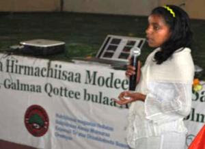
Kalkidan is a 15-year old student at Holeta Primary School. She witnessed how this model created an opportunity for her and her friends to learn a lot from the local elders. At the inauguration she stated the following: “We youngsters didn’t think that elders know, but now, after participating in the construction of this Participatory 3 Dimensional Model, we are convinced that our elders have a deep knowledge about their environment” She recalled that the elders were the main actors on the scene.

At the ceremony Elders locaed their places of origin on the model and talked about them. They couldn’t hide their feeling that their area is becoming degraded and pleaded for concerned bodies to address this problem. The government representatives also endorsed the model and reiterated that it should not be just for looking at and admiring.”

Dr. Tewoldebithan G/Egziabher, Director of the Federal Environmental Protection Authority and Chairman of MELCA’s General Assembly delivered the model to Holeta Town and Wolmera Woreda Administrations on behalf of MELCA. He told to the Administrations to use the model as a reference for taking measures.

According to Million Belay the Director of MELCA related initiatives will follow: There will be an intensive planning process aiming at rehabilitating the Wechecha Mountain complex and we will ensure that the model will be central to it. Schools located at the foothills of the mountain will make use of the model in their curriculum like it is currently happening in Nessuit Kenya, where a similar model has been constructed in 2006. Teachers use it to facilitate pupils learning about their environment, geography and cultural landscapes. In addition, Mr. Belay stated that the 3D model will be used for scientific research, on the relationship between people and the environment, and to study the impacts of land degradation on the livelihood of local communities.

Wednesday, September 16, 2009

Head teacher Julius Sangogo reports on the usefullness of a Participatory 3D Model (P3DM) in Nessuit, Kenya

Head teacher Julius Sangogo reports on the usefullness of a Participatory 3D Model in Nessuit, Kenya from CTA on Vimeo.

Three years after the completion of a Participatory 3D model in Nessuit Kenya, head teacher Julius Sangogo recalls the uses of the model by local, national and international agencies and more importantly by the pupils of the local primary school.

Tuesday, September 01, 2009

Qualitative GIS: A Mixed Methods Approach

'Qualitative GIS is coming of age, and this definitive collection explains why it deserves broad attention. These carefully selected essays by leading researchers, organized around a broad conception of qualitative GIS that extends beyond multi-media data integration to embrace new software tools and interpretive, situated epistemologies, will push readers to rethink not only their preconceptions about qualitative GIS, but also about GI science and critical GIS. GIS researchers, practitioners, observers and users will find much to chew on here' - Professor Eric Sheppard, University of Minnesota, USA

Geographic Information Systems are an essential tool for analyzing and representing quantitative spatial data. Qualitative GIS explains the recent integration of qualitative research with Geographical Information Systems

With a detailed contextualising introduction, the text is organised in three sections:

Representation: examines how researchers are using GIS to create new types of representations; working with spatial data, maps, and othervisualizations to incorporate multiple meanings and to provide texture and context. This section includes a chapter by Jon Corbett and Giacomo Rambaldi dealing with participatory mapping by the title: "Geographic information technologies, local knowledge, and change (pages 75-91).

Analysis: discusses the new techniques of analysis that are emerging at the margins between qualitative research and GIS, this in the wider context of a critical review of mixed-methods in geographical research

Theory: questions how knowledge is produced, showing how ideas of 'science' and 'truth' inform research, and demonstrates how qualitative GIS can be used to interrogate discussions of power, community, and social action

Making reference to representation, analysis, and theory throughout, the text shows how to frame questions, collect data, analyze results, and represent findings in a truly integrated way. An important addition to the mixed methods literature, Qualitative GIS will be the standard reference for upper-level students and researchers using qualitative methods and Geographic Information Systems.

Available from Amazon.com (US) and Amazon.co.uk (Europe)


Wednesday, June 17, 2009

P3DM after the 2007 World Summit Award

In November 2007 "Participatory 3D Modelling (P3DM) for Resource Use, Development Planning and Safeguarding Intangible Cultural Heritage in Fiji" was proclaimed as one of the four winners of the “Worlds Best e-Content 2007” in the World Summit Award category e-Culture.

Here is an account of what has happened since the exercise was carried out in Fiji.

Since 2005 (year in which the project in Fiji was implemented) Participatory 3D Modelling (P3DM) and been adopted in development contexts in many parts of the world (http://www.p3dm.org/) including Cambodia, Colombia, East Timor, Ethiopia, France, Guyana, Italy, Kenya, Malaysia, Nepal, PNG, Australia and other countries.

The 2007 WSA recognition added value and authority to the method and gave worldwide recognition to its quality and appropriateness.

In Kenya P3DM been used by Ogiek, Yiaku and Sengwer Indigenous Peoples to document their biophysical and cultural landscapes. The objectives of these community-led interventions included enhancing inter-generational information exchange, adding value and authority to local knowledge, improving communication with mainstream society, improving planning on sustainable management of natural resources and addressing territorial disputes.

In Ethiopia P3DM has been used to assist stakeholders in the Bale region to plan out sustainable management of the area, revive their bio-cultural diversity and support local environmental education.

The Indigenous Peoples of Africa Coordinating Committee (IPACC), a pan-African network of 150 organisations adopted the method and is spearheading its adoption in the African Continent to improve awareness at policy-making level on the relevance of location-specific traditional ecological knowledge (TEK) in climate change adaptation and mitigation processes. Read more.

UNESCO has been supporting the adoption of P3DM in Niger and Kenya in the context of the of the Convention for the Safeguarding of the Intangible Cultural Heritage paying specific attention on the opportunity for safeguarding traditional ecological knowledge as part of overall intangible cultural heritage and its integration into the education curricula.

In collaboration with national and regional partner organisations, the Technical Centre for Agricultural and Rural Cooperation EU-ACP (CTA) is supporting the dissemination and adoption of P3DM practice in ACP countries. Regional capacity building exercises are scheduled in Central Africa (Gabon and DCR), West Africa (Niger) and Southern Africa (Botswana) in 2010 and 2011.

In collaboration with a number of development agencies, CTA is spearheading the production of a training kit supporting the spread of good practice in generating, managing, analysing and communicating spatial information. The kit includes a module on participatory 3D Modelling.

Other initiatives include the ongoing online participatory translation of a video documentary on P3DM “Giving the Voice to the Unspoken” using the free platform http://dotsub.com/

Tuesday, April 07, 2009

PPgis.Net members on LinkedIn

People on the PGIS/PPGIS LinkedIn group support Participatory mapping, Participatory GIS, Public participation GIS practice, and make use of geo-spatial technologies in a participatory mode to support integrated conservation and development, sustainable natural resource management and customary property rights in developing countries and First Nations. The group is affiliated to PPgis.Net

Sunday, January 18, 2009

Funding opportunities for NGOs, CBOs and researchers

IAPAD has recently updated his list of selected funding opportunities for NGOs, CBOs and researchers. The list includes awards, competitions, funding opportunitiers (mostly grants) offered by a number of development agencies, foundations and other development actors. Worth having a look at as it includes also opportunities related to PGIS / PPGIS practice.

Sunday, November 23, 2008

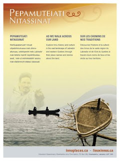
Innu Place Names Website

Labrador Innu launched the first comprehensive cultural website dedicated entirely to Aboriginal place names. Called Pepamuteiati nitassinat (‘As We Walk Across Our Land’), the website gives access to over 500 Innu place names in Labrador, as well as stories, photos, and video clips associated with the names. The website can be explored at http://www.innuplaces.ca/ . Innu Nation Grand Chief, Mark Nui, said, “Place names are very important to our people because they are a gateway to our history on the land. Many younger Innu who have gone through the provincial educational system have never learned these names. We hope that the website will help them learn about their culture and history.”

Lots of place names in Labrador come from the Innu (e.g. Minipi-Lake from Minai-nipi,
meaning ‘burbot lake’), but others were given by pilots, mining companies, settlers and outfitters and were imposed on places that already had Innu names. The website will enable the Innu and members of the general public to start using the Innu place names, to learn about the meaning of the names and how to pronounce them.

Other Aboriginal groups have been doing place name research over the years, and some are in the process of publishing their own websites (e.g. James Bay Cree and Norwegian Sámi). However, Pepamuteiati nitassinat is the first, comprehensive one put on line to date.

Grand Chief Nui pointed out that “Over thirty years of research with our Elders went in to this website. It’s a gift from our Elders to younger Innu people. It’s part of our Elders’ legacy. It’s also an important part of our intangible cultural heritage that will help educate people about the richness of our history and traditions.”

The website was made possible by contributions from many institutions and agencies including multimedia company Idéeclic, Environment Canada, Parks Canada, Memorial University Linguistics, and Canadian Boreal Trust. The Innu Nation wishes to acknowledge the generous financial support of the Department of Canadian Heritage through Canadian Culture Online.

History of the website project

  • The Innu place names available on the website were collected in the context of a number of research projects going back to the mid-1970s.
  • The biggest source of place names for the site is a 1980 mapping project. Over 500 maps at 1:50,000 scale were cut and taped together to form two giant maps. One was laid on the gym floor at Peenamin McKenzie School in Sheshatshiu and the other in the parish hall in the former community of Davis Inlet. Older hunters were invited to walk about on these maps to point out the locations of place names as well as old travel routes, camp sites, caches, birth places and good hunting and fishing places.
  • Only seven of the 34 older hunters who worked on the 1980 mapping project are still living.
  • A great deal of validation work was undertaken with respect to the places names which was done by ethnolinguist, José Mailhot, and anthropologist Peter Armitage, with the collaboration of Marguerite MacKenzie, Sebastien Piwas, George Gregoire, Jean-Pierre Ashini, Basile Penashue, Tony Penashue, and several Innu Elders.
  • Project managers for the website project were Kanani Penashue and Peter Armitage.

What’s on the website

  • The site features a searchable database of over 500 Innu place names.
  • Each place name record in the database contains information about the meaning of the name, how to pronounce it, and its location. Site users can click on an audio icon to hear the pronunciation of each place name.
  • The site has an interactive map showing the locations of the place names.
  • Background information on how Innu place names are constructed is presented.
  • Video clips and photographs show people what the named places look like or document land use activities there.
  • Audio narratives from Innu Elders and youth tell stories about events and people associated with certain place names.
  • Future phases of the website will add more place names, video clips, photos, and audio stories.

Source: Press relase by Natuashish (Labrador), 21.11.08

Saturday, September 20, 2008

Management Change at UNOSAT

According to Alain Retiere, Director of UNOSAT, the programme has reached the required maturity to become independent from the administrative management of UNOPS and become fully part of the new United Nations Institute for Training and Research that the Secretary-General has entrusted ASG Dr. Carlos Lopes to lead together with the United Nations Staff College, in full coordination with the United Nations University. This process will bring to UNOSAT further training activities, which will increasingly be carried out by the United Nations under a unified management. UNOSAT will enjoy the additional opportunity of developing applied research on satellite solutions, and consolidate the UN training offer on satellite applications for key issues ranging from emergency response to sustainable recovery.

In parallel, UNDP has decided to mainstream satellite applications throughout its network of 166 country offices supported by its 40 regional technical centers to help face the main development challenges. A new trend is emerging within the “territorial approach to development”, where a more local and decentralized way of supporting development efforts in most vulnerable countries is being applied. Although all dimensions of the UNDP development agenda will benefit from mainstreamed satellite applications, environment and energy is the area that has been selected as key entry point, considering the urgent need to help local communities to face climate change challenges with the most appropriate tools including satellite and GIS applications.

Sunday, August 31, 2008

African Indigenous Peoples’ Workshop on effective use of GITs and ICTs in advocacy

I have just come back from Namibia where I attended the "African Indigenous Peoples’ Workshop on effective use of GITs and ICTs in advocacy" (Windhoek, 25-28 August 2008)

The workshop has been organised by the Indigenous Peoples of Africa Coordinating Committee (IPACC) with technical and financial assistance provided by the Technical Centre for Agricultural and Rural Cooperation (CTA), ERMIS-Africa, Cybertracker Conservation, Shalin Ry and the Rainforest Foundation UK.

Indigenous African leaders and technology intermediaries have shared experiences on how geo-spatial information technologies (GIT) are used by indigenous peoples to express their traditional ecological knowledge to decisions makers for the purposes of securing recognition and rights. Key case studies presented included participatory mapping by ToCADI and San groups in Botswana, Participatory 3 Dimensional Modelling (P3DM) by hunter-gatherer peoples in Kenya, GPS-based mapping experiences from Cameroon, DR Congo, Namibia and South Africa.

The workshop included also capacity building sessions on the use of Cybertracker and online mapping (Google Earth and Google Maps) and web 2.0 (web2fordev) applications like blogging, online video sharing, and use of electronic discussion groups including [ppgis]).

Web 2.0 applications have been presented and adopted as adds-on to GIT in support to networking, communication, alliance building and remote collaboration for advocacy.

Monday, April 07, 2008

Journey of our Life


A 14-minute participatory video production by PAFID - Mindanao documenting a journey to the land of the ancestors of Higaonon Indigenous Peoples living in Portulin, Bukidnon, Philippines. The virtual journey recreates experiences lived up by the members of the community in using a physical participatory 3D model (P3DM) to document, share across generations and safeguard their intangible cultural heritage.

Friday, April 04, 2008

2008 Indigenous Planning Conference "Leading Change: Blending Indigenous and Western Planning Tools" (1-3 October 2008, Anchorage, Alaska, USA)

The Leading Change conference (1-3 October 2008, Anchorage, Alaska, USA) is sponsored by the American Planning Association’s (APA) Alaska and Hawaii Chapters and the Indigenous Planning Division. The three-day conference will bring together planners, tribal leaders, and community members to share local experiences, planning tools and practices that reflect a commitment to honoring history, cultural identity, tradition, and land tenure. Conference participants will share stories from their own communities organized around general topic areas including land use and natural environment; governance, nation building and leadership; local control, community sustainability, and resilience; culture, education, and community services; economy; and infrastructure, public services, and facilities.

Sunday, March 16, 2008

Google Earth Outreach

Hundreds of millions of people now use Google Earth and Google Maps to explore the world around them. Google Earth Outreach gives non-profits and public benefit organizations the knowledge and resources needed to perform participatory mapping activites online. Click here to see how other organizations have benefited from Google Earth Outreach, then learn how to create maps and virtual visits to your projects.


Sunday, February 24, 2008

An Atlas of Radical Cartography

An Atlas of Radical Cartography published by The Journal of Aesthetics and Protest, makes an important contribution to a growing cultural movement that traverses the boundaries between art, cartography, geography and activism. It pairs writers with artists, architects, designers and collectives to address the role of the map as political agent (rather than neutral document). Ten mapping projects dealing with social and political issues such as migration, incarceration, globalization, housing rights, garbage and energy issues, are complemented by 10 critical essays and dialogues responding to each map. The maps themselves are printed as posters, unbound for leisurely perusal. Among the contributors are artists Trevor Paglen, John Emerson, Ashley Hunt and Pedro Lasch, and essayists Avery Gordon, Heather Rogers, Alejandro De Acosta and Jenny Price.

Saturday, December 01, 2007

Locating Participatory 3D Models on Earth

I have created an interactive world map working both on Google Maps and Google Earth displayng georeferenced P3DM exercises. You can now use P3DM Where? to locate Participatory 3D Models worldwide.


View Larger Map

Thursday, November 22, 2007

Participatory Geographic Information Systems: More than maps

At the Annual meeting of the Society for Applied Anthropology on March 25 - 29, 2008, Memphis Marriott, USA, there will be a session relating the practice of PGIS and applied anthropology by the title: Participatory Geographic Information Systems: More than maps.
In their Call for Papers the session organisers wrote: "Most activities that we undertake, either as academics or practitioners, require producing tangible outputs as part of the work process. Outputs serve as metrics to evaluate progress and determine future direction. Mention of a Participatory Geographic Information System (PGIS) invariably elicits numerous requests to see the maps, and fewer questions regarding the process that went into their development. The "P" in PGIS has its roots in the development literature and in Participatory Rural Appraisal and Participatory Learning and Action in particular, which stress the importance of process. The relationship is not one way however, and in this session we would like to draw attention to the contributions that PGIS experiences offer to the larger development community. Our objective is to reflect on a variety of experiences with PGIS and focus the discussion on positive externalities and the intangible benefits that arise through process."

The theme for the Annual Meeri is The Public Sphere and Engaged Scholarship: Opportunities and Challenges for Applied Anthropology. The full description can be found at http://www.sfaa.net/sfaa2008.html .