 |
| Maps like this one will help the communties to have a better understanding of resources when developing their management plans; Photo: Irma Juan Carlos |
Mesoamerica Coordinator
Source: Global Diversity Foundation Update; Issue 4, July 2010
 |
| Maps like this one will help the communties to have a better understanding of resources when developing their management plans; Photo: Irma Juan Carlos |
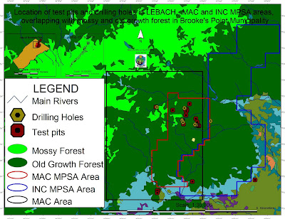 |
| Location of test pits and drilling holes within the mining concessions and their overlap with mossy and old growth forest in Brook's Point Municipality |
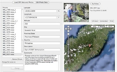 |
| Cornerstone of a CADT (Certificate of Ancestral Domain Title) |

 A contemporary follow-up to the bestselling Power of Maps, this book takes a fresh look at what maps do, whose interests they serve, and how they can be used in surprising, creative, and radical ways.
In March 2006, the Philippines’ President Gloria Macapagal-Arroyo has called for a revitalization of mining nation-wide. The future of Palawan, known as the Philippines’ “Last Frontier” is now under serious threat. The island was declared a “Man and Biosphere Reserve” by the UNESCO and it is also the home of vanishing and isolated indigenous communities. Despite the numerous policies and laws establishing the entire province as a protected area, Palawan is becoming one of the most attractive mining investments destinations. This documentary is the outcome of a joint effort of indigenous communities, farmers, local NGOs and international institutions.
 Biocultural Diversity Conservation:
 Geographical Information Systems (GIS) have developed rapidly in recent years and now provide powerful tools for the capture, manipulation, integration, interrogation, modelling, analysis and visualisation of data -- tools that are already used for policy support in a wide range of areas at almost all geographic and administrative levels. This holds especially for emergency preparedness and health risk reduction, which are all essentially spatial problems. To date, however, many initiatives have remained disconnected and uncoordinated, leading to less powerful, less compatible and less widely implemented systems than might otherwise have been the case. The important matters discussed here include the probabilistic nature of most environmental hazards and the semi-random factors that influence interactions between these and human exposures; the effects of temporal and spatial scales on hazard assessment and imputed risk; the effects of measurement error in risk estimation and the stratification of risks and their impacts according to socioeconomic characteristics; and the quantification of socioeconomic differences in vulnerability and susceptibility to environmental hazards. GIS are powerful analytical tools in their own right, but what is needed is much more effective communication between the many disciplines, professions and stakeholders concerned -- something which this book helps to achieve.
 Computer-mediated participation is at the crossroads. In the early heady days of the digital revolution, access to "high" technologies such as GIS promised the empowerment of marginalized communities by providing data and information that was previously hidden away from public view. To a great extent, this goal has been achieved at least in the U.S. and Western Europe – data about a range of government initiatives and raw data about different aspects of spatial planning such as land use, community facilities, property ownership are available a mouse-click away. Now, that the public, have access to information, are we able to make better plans for the future of our cities and regions? Are we more inclusive in our planning efforts? Are we able to foster collaborative governance structures mediated by digital technologies?
Digital Cartography from dynamicmediainstitute.org on Vimeo.
By Andrew Ellis, Alexander Wang, Students at the Dynamic Media Institute, Massachusetts College of Art and Design
Digital Cartography is a short documentary film on the transition of maps into their digital form. In this film we speak with programmer and mapmaker Jeffrey Warren from the MIT Media Lab and Dietmar Offenhuber from SENSEable City Lab at MIT. We explore the cultural, economic and technical aspects of mapmaking and how they affect the way we communicate with one another.
In our interviews with Jeffrey and Dietmar we learn about the social and geographical ramifications of building maps and how designers can implement their literacy in communication design to explore different avenues for mapping. Participatory mapping such as Open Street Maps and psychogeography and the virtual dérive are some of the themes discussed around the history and future of mapping in the digital age. Jeffrey gives us a demonstration on low cost arial photography using a helium balloon and a consumer digital camera to stitch photos onto google maps.
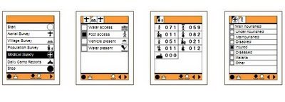 The CyberTracker software can be installed on GPS-enabled Windows Mobile smartphones.
 The establishment of this linkage took place right at the time when indigenous peoples of the Amazonian Peru had began various forms of open resistance against hydrocarbon extraction in their traditional territories. The solidarity link between the IPs of Peru and Palawan is being consolidated through the collaboration of the Ancestral Land/Domain Watch (ALDAW), the Peoples and Plants International (PPI) and, specifically, through the personal efforts of Dr. Miguel Alexiades (CBCD staff and PPI co-director). Such exchange promotes the sharing of experiences as a way of 1) fostering reflection and joint actions through the establishment of strategic alliances; and 2) addressing common problems regarding indigenous links, rights and claims over ancestral homelands and cultural landscapes.
 The envisaged goal is to enable the production of jointly produced video materials that could be used to exert pressure at a national and international policy level.
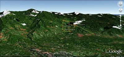 The mission’s actual ‘matching’ of collected GPS data to photographs shows that the Mineral Production Sharing Agreements (MPSA) of two mining firms [MacroAsia and Celestial Nickel Mining and Exploration Corporation (CNMEC) now operated by Ipilan Nickel Corporation (INC)] overlap with precious watersheds endowed with numerous creeks, springs and waterfalls providing potable water to the local indigenous communities and lowland farmers. More importantly, under the ECAN Guidelines of the Strategic Environmental Plan for Palawan (Republic Act 7611), such areas constitute the so called “core zones” of maximum protection where industrial extractive activities are not allowed.
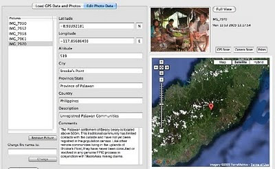
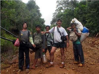
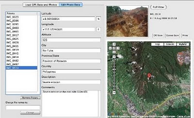 In spite of its unique ecological features, the Bulanjao range has been subjected to mineral exploration and development by the Rio Tuba Nickel Mining Corporation (RTNMC). RTNMC is a Filipino-Japanese partnership holding a mining concession area of about 5,265 hectares.
 Starting at an elevation of about 40m ASL, the ALDAW/CBCD mission followed the mining road to reach the highest portions of the Bulanjao range. Geo-tagging evidence indicates that erosion on the Bulanjao mining road is occurring also at low elevations. During the rainy season the water creates deep clefts on the roadsides, hence penetrating the soil and fostering road collapse. No mitigating measures have been put into place to reduce erosion. A huge crater-like excavation has been found at 566m ASL. and land slides, induced by road construction, have been documented around the sources of the Sumbiling river, at almost 900m ASL. The latter is the most important water source for both lowland farmers and indigenous communities.
 Mission’s findings have now been compiled into a geo-tagged report, which is being used by local indigenous communities to support their legal struggle against mining in Bulanjao.
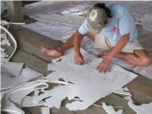 Expanded EVA / PE closed-cell foam or sponge is usually made out of a blend of Ethylene Vinyl Acetate copolymer (also known as EVA) and polyethylene. The product is a lightweight foam material which has a smooth surface and does not absorb water. Generally EVA sheeting is priced competitively, compared with other blown materials and is available in different densities, thicknesses and colours.
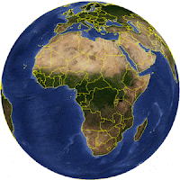 Google Earth Outreach in Africa was recently launched with the objective of enabling non-profit and public benefit organizations in the continent to access the knowledge and resources they need to organize their data, build their maps, tell their stories through geographic visualization.
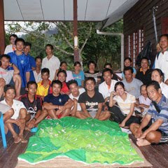 Community members and park naturalists have completed a participatory 3-dimensional scaled model of the Buayan-Kionop area showing areas important for community livelihoods. The pproject, funded by the Darwin Initiative, is designed to contribute to the nomination of the Crocker Range Biosphere Reserve. Work began in August 2009 with local partners and 10 indigenous communities. Local researchers from Buayan-Kionop are sharing their skills with neighbouring communities to document and map community livelihood patterns for the entire Ulu Papar area. They have been using a range of techniques, including participatory GIS and participatory 3-dimensional modelling (P3DM) to show areas important for cultivation, hunting, fishing and gathering of forest products. Over the next 3 years, we will build on the participatory research results in Buayan-Kionop and create spaces for community dialogue on balancing conservation and sustainable resource use in the Crocker Range.
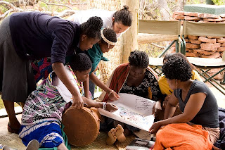 With support from CTA, women, men and youth from Tshidzivhe community, in Limpopo province, northern South Africa, spent six days exploring ways to ‘map’ their traditional knowledge and practices for managing their natural resources. As the different maps were finished, the local people celebrated their new capacity to express traditional environmental knowledge in an appropriate way for gaining recognition, reviving traditional practices and securing their rights.
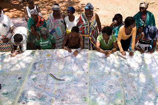 Four maps and two ecological calendars were produced, covering what the local population refers to as “Venda territory” and with special attention to the main sacred sites. The maps show the changes and alterations to the land - the past, present and future visions - and the importance of recovering traditional practices and rituals.