Showing posts with label mapping. Show all posts

Friday, December 23, 2011

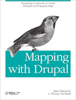
Mapping with Drupal: Navigating Complexities to Create Beautiful and Engaging Maps

Mapping with Drupal is a concise guide shows you how to create custom interactive maps from top to bottom, using Drupal 7 tools and out-of-the-box modules.

You’ll learn how mapping works in Drupal, with examples on how to use intuitive interfaces to map local events, businesses, groups, and other custom data.

Although building maps with Drupal can be tricky, this book helps you navigate the system’s complexities for creating sophisticated maps that match your site design.
  • Get the knowledge and tools you need to build useful maps with Drupal today.
  • Get up to speed on map projections, the ethics of making maps, and the challenges of building them online
  • Learn how spatial data is stored, input by users, manipulated, and queried
  • Use the OpenLayers or GMap modules to display maps with lists, tables, and data feeds
  • Create rich, custom interactions by applying geolocation
  • Customize your map’s look and feel with personalized markers, map tiles, and map popups
  • Build modules that add imaginative and engaging interactions
Mapping with Drupal: Navigating Complexities to Create Beautiful and Engaging Maps

By Alan Palazzolo, Thomas Turnbull
Publisher: O'Reilly Media
Release: December 2011

Wednesday, December 21, 2011

Climate Conversations - Combining traditional knowledge and climate science in Chad

Bouba Mal Yaya is a herdsman from the Fulani-Mbororo peoples in Chad. Along with his fellow herders, he had been expecting good grazing for his cattle this year but this has not been the case.


He is confused and frustrated. He had always been able to rely on his people’s age-old knowledge of their ecosystem to sustainably manage grazing. This traditional knowledge has been used by his people to develop strategies to cope with seasonal weather patterns and manage their meagre resources.
The community has typically looked to the elders for predictions on rainfall distribution, drought and other seasonal patterns. Now, it would appear that the reliability of their prediction is undermined by increasingly unpredictable weather and climate conditions. Their livelihoods and future as a culture are under threat.
The cause? Climate change.
Mbororo herders travel over great distances to graze their livestock. The impact of climate change has reduced the capacity of their traditional grazing lands with droughts and dwindling resources pushing them to herd their livestock further afield.
Some have lost their stock and have been forced to change their way of life, becoming semi-nomadic or sedentary. These lifestyle changes are not easy, and the pastoralists experience extreme hardship and loss of culture. The decreasing reliability of the elders’ predictions has had an impact on their trustworthiness within the community, further destabilising life for these people.
The situation is frustrating for everyone involved, especially considering that information which could help the pastoralists maintain their traditional way of life is already at hand. Climate change experts use modern monitoring and forecasting systems to generate a vast amount of information on past, present and future climate scenarios at international, regional and national scales.
The difficulty arises in communicating this information to grassroots level in a language that the people understand and that takes account of their traditional knowledge, prediction methods and existing local approaches to decision-making.
In a bid to adapt to the changing conditions and maintain their customary way of life, the Mbororo peoples are coming together with other pastoralists, meteorologists and African policy makers.
They share information relating to traditional and scientific knowledge and outline their needs. They also look at how to improve the exchange of data, knowledge and information needed to improve policy making to boost resilience to climate change at grassroots level.
Thanks to the contributions of the pastoralists, climate change experts are developing a greater understanding of traditional knowledge. This will enable them to package their information in a more manageable and user friendly way for the local community.
By making use of innovative information and communications technologies and participatory mapping techniques pastoralists hope to provide scientists with valuable insights into local weather and climate patterns and reporting on the impact of climate change. This essential data will enrich the information base available for research and analysis, ultimately developing more nuanced and locally accurate weather forecasts.
This data can then be used by the pastoralists to adapt as necessary to the changing conditions without having to abandon their way of life. Involving indigenous communities like the Mbororo in this process also paves the way for the creation of inclusive and more successful policy.
National Adaptation Programmes of Action (NAPAs) for climate change will have greater value if they recognise the authoritative nature of traditional knowledge.
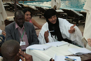
As part of this process, a meeting was hosted in November 2011 by the Indigenous Peoples of Africa Co-ordinating Committee (IPACC), the Association des Femmes Peules Autochtones du Tchad (AFPAT)  and the Technical Centre for Agricultural and Rural Cooperation ACP-EU (CTA). At the meeting, indigenous people’s representatives from Chad, Niger, Kenya, Namibia and South Africa gathered with meteorologists to discuss these concerns.
In particular, they looked at how traditional knowledge of pastoralism and atmospheric science can be combined to respond to climate change risks. Their findings reinforced the need for both groups to work together to share information, data and knowledge, tackling the climate change issue together.
In follow up to the meeting, a participatory mapping exercise will take place on the edge of Lake Chad in the spring of 2012. By coming together with the experts and policy makers to build a Participatory 3-D model (P3DM) of their land, the two communities aim to bridge the gap between traditional contributions to the understanding of climate change on a local scale and scientific approaches to the challenge involving everyone in this activity.
This is a first for the pastoralist and scientific community. Neither group can solve the climate change problem alone. Together they can make a lasting difference for science and for a traditional way of life.


Read more:

Wednesday, November 16, 2011

Results of High Level Round Table on Pastoralism, Traditional Knowledge, Meteorology and Implementation of Policies of Climate Adaptation

N’DJAMENA, 9 November 2011 - Following the two-day conference on adaptation, a high level panel of two Chadian Ministers and representatives of national and international expert technical agencies contributed to a round table dialogue on adaptation and pastoralism.

The high level panel listened to a report back from African pastoralists on their recommendations and observations, and then took the floor to share their perspectives on key questions related to indigenous pastoralists, traditional knowledge, meteorology and platforms of adaptation policy and implementation. The session was chaired by Mme Hindou Oumarou Ibrahim, member of the IPACC Executive Committee and Director of AFPAT. Mme Oumarou Ibrahim welcomed contributions from the respective Ministers and members of the high level round table in response to the indigenous peoples’ restitution of the two day workshop.

His Excellency, the national Minister of Urban and Rural Hydrology, General Mahamat Ali Abdallah Nassour:

The Honourable Minister noted the current challenges
  • Pastoralist populations are increasing, with a steady southward migration of communities in Chad. And yet grazing lands are progressively shrinking, degrading or being used for other types of land use. How do we find a balance for sustainability in a changing and unstable context? 
  • Pastoralists have a substantial body of traditional knowledge that needs to be taken into consideration in the process of developing adaptation policies. How do we ensure a closer collaboration between pastoralists and scientists?
  • There are increasing conflicts among farmers and pastoralists. How do we ensure a peaceful cohabitation?

The opportunities for government to respond to the challenges include:
  • Adaptation requires recognition of the facts of climate change and vulnerability, and should draw on both science and traditional knowledge to find appropriate responses;
  • Scientific interaction with pastoralists is important for Chad. We are facing policy challenges in a wide range of domains, including the environment, land use, water management, and changes to the overall climate. This nexus creates increased risks of conflict, which we must avoid through effective policy making and full participation of the concerned communities, notably pastoralists;
  • Africa needs to develop adequate policies and deployment of financial resources to overcome the constraints (i.e. conflicts over scarce resources) and ensure a robust and inclusive planning and evaluation process;
  • Atmospheric sciences allow forecasting of weather and seasonal pattern. Efforts need to be made in timely sharing these information with those concerned;
  • Financing is an important element in building the national adaptation platforms. International solidarity, whether in expertise or financing remains very valuable for Least Developed Countries. Part of the challenge for Chad is to accurately cost the adaptation process, identify what national resources are currently available, and what type of gap needs to be addressed.

His Excellency, the national Minister of Agriculture and Irrigation, the Honourable Dr Djime Adoum
  • Traditional knowledge must be included in science because it is itself a form of science;
  • Strongly acknowledges the value of traditional knowledge (e.g. local breeds and traditional varieties of crops are emerging as more resistant and less demanding in terms of husbandry);
  • Most food production systems, farming, pastoralism and fishing in the country are still run at subsistence levels – this reality needs to shape policy making;
  • The introduction of improved, new or hybrid varieties require additional inputs, such as more water or fertilisers, which has cost implications for communities;
  • Traditional varieties and breeds may yield less, but usually they will reliably yield some useful output even under high stress conditions. Under similar high stress conditions modern varieties / breeds may fail leaving no material benefits. The balance of new varieties and traditional varieties needs careful consideration to ensure food security;
  • By having an inclusive approach to national adaptation policy making we create a blue print for adaptive and successful implementation – we can address real challenges that the communities and scientists have jointly identified;
  • Innovative ICTs will be used to capture and document local knowledge in the framework of the project;
  • There is a difference between a drought and a famine. Famine is not always the result of droughts; it is the product of insufficient planning and preparation. 
  • National budgetary procedures need to take into consideration the inter-sectoral impact of climate change, and ensure early planning for adaptation. It is not wise to wait until a crisis unfolds before looking for resources to address it;
  • A new framework for establishing a comprehensive Management Information System (MIS) will be discussed at the Ministry before the end of the year and deployed within 2012. The system will cover different knowledge systems including traditional knowledge.
Further contributions were provided by:
  • Dr Jose Camacho, Scientific Officer, Agricultural Meteorology Division, Climate Prediction and Adaptation Branch (CLPA), Climate and Water Department (CLW)World Meteorological Organisation;
  • Dr Baba El-Hadj Mallah, Director General, Centre National d’Appui à la Recherche et Conseil (CNAR), Ministere de l’Enseignement Superieur;
  • Dr Peggy Oti-Boateng, Senior Research Fellow of the Technology, Specialist for Basic and Engineering Sciences, UNESCO (Nairobi, Kenya);
  • Mr Giacomo Rambaldi, Senior Programme Coordinator, Technical Centre for Agricultural and Rural Cooperation ACP-EU (CTA );
  • Mr Frederick Kihara, Global Environment Facility – Small Grants Projects, Kenya

These contributions are provided in the full report of the N’Djamena conference which can be downloaded from www.ipacc.org.za.

The conference was closed by His Excellency, General Mahamat Ali Abdallah Nassour, Minister of Urban and Rural Hydrology. The Minister noted the valuable work which had been done by the delegates and looked forward to the presentation of the results at the 17th Conference of Parties of the UN Framework Convention on Climate Change, due to take place in Durban, South Africa from 28 November until 10 December, 2011.

Read more:


N’Djamena Declaration on Adaptation to Climate Change, indigenous Pastoralism, Traditional Knowledge and Meteorology in Africa

Hôtel Novotel de N’Djamena, N’Djamena, Republic of Chad, 7-9 November 2011

Climate change poses one of the greatest challenges to humanity. Global warming and associated climatic changes are impacting on pastoralist peoples with increasing frequency and severity. African indigenous peoples’ delegates at the N’Djamena conference on adaptation noted first-hand experiences of droughts, flooding, dislocation of seasonal cycles, changes in the composition of grazing lands, and changes in accessibility and quality of water.

Indigenous herders from five African countries (Chad, Niger, Kenya, Namibia and South Africa) attended a two-day conference in N’Djamena Chad to share with each other and with meteorologists about how traditional knowledge and climate science can be combined to respond to current threats and risks. The conference also considered the need for effective participation of indigenous peoples, including herders, in national adaptation platforms and other national processes to ensure peace, sustainable livelihoods and biological conservation in the face of worsening climate instability.

Indigenous peoples’ delegates worked with the National Meteorological Services of Chad, the National Centre for Support to Research (CNAR), as well as international agencies, including the World Meteorological Organisation (WMO), UNESCO, the Global Environmental Fund (GEF) – Small Grants Projects, and the Technical Centre for Agricultural and Rural Cooperation EU-ACP (CTA). The results of the workshop were shared with the Honourable Minister of Urban and Rural Hydrology, and the Honourable Minister of Agriculture and Irrigation of the Republic of Chad. This declaration constitutes to the key results of the conference and the day of restitution.

Key findings included:
  • Traditional knowledge and climate science are both critically important for adaptation policy and supporting resilience building of rural communities necessary to cope with climate change;
  • Traditional knowledge and climate science need to be shared to create synergies that can inform adaptation policy, monitoring and assessment. It is through a combination of both knowledge systems that we are likely to achieve better synchronisation between forecasting, anticipatory responses, appropriate governance responses and feed-back. Both knowledge systems need to be converted into media that is understandable and usable in national adaptation platforms and for public use;
  • Climate change amplifies social and economic vulnerability, with the risk of serious conflict and poverty. An essential element of climate adaptation is ensuring good governance, human rights and social equity to maintain local, national and regional harmony during times of stress;
  • The United Nations’ Cancún Adaptation Framework, the National Adaptation Programmes of Action (NAPAs) and National Adaptation Plans (NAPs) may be best effected through well designed and funded national adaptation platforms;
  • National adaptation platforms need to include a diverse range of rural and urban communities, with particular attention to participatory approaches to facilitate the contributions of pastoralists, hunter-gathers, farmers and fisherfolk. 
  • National adaptation platforms need to facilitate a two-way flow of ideas, information and strategies for resilience building and equitable sharing of costs and benefits. The inputs to and outputs from the platforms need to be meaningful and relevant. 
Conference summary

Pastoralism evolved in Africa specifically as an adaptive response to climate and environmental conditions which limited the expansion of agriculture. Pastoralism has co-evolved as diverse cultural and economic systems within ecological niches around Africa. The result has been millennia of managing sheep, camels and cattle in different ecosystems and landscapes throughout long cycles of climatic changes. Pastoralism has always been premised on the need to maintain biodiversity as the underpinning of human and livestock well-being.

Climate change in combination with other drivers of declining biodiversity has reduced the effectiveness of pastoral societies to maintain both social harmony and biological resilience. At the same time, the reduction in agricultural capacity will likely lead to increased reliance on pastoralism and agro-pastoralism for African food security.

The N’Djamena conference and Declaration were elaborated as part of IPACC and AFPAT’s support for the Cancún Adaptation Framework, which was adopted by the 16th Conference of Parties to the United Nations Convention on Climate Change, held in Cancun, Mexico in December 2010. IPACC is a contributor to the UN Framework Convention on Climate Change’s Nairobi Work Programme on impacts, vulnerability and adaptation to climate change (UNFCCC NWP).

IPACC and AFPAT were influenced by the World Meteorological Organisation’s World Climate Conference – 3, held in Geneva, Switzerland in 2009. IPACC and AFPAT have initiated cooperation with both WMO and the African Centre for Meteorological Application for Development (ACMAD). The CTAis a partner of IPACC, assisting with building technical, information and policy capacity. CTA and the Open Society in Southern Africa (OSISA) were the principal funders behind the N’Djamena conference. Additional conceptual and policy support has been provided by the Local and Indigenous Knowledge Systems unit of the United Nations’ Educational, Scientific and Cultural Organisation (UNESCO).

The results of climate change include greater vulnerability of ecosystems as well as threatening human social and economic systems. Climate change is impacting negatively on health, livelihoods, peace and security. While the only answer is an urgent, robust and binding global agreement on the reduction of Green House Gas emissions, the reality is that Africa must take urgent steps to adapt to climate instability, reduce vulnerability and build resilience of both natural and human systems.

Despite the very serious risks from climate change, the N’Djamena conference delegates noted that climate change is only one element of the many challenges facing African indigenous pastoralists. Changes in land use and occupancy, different forms of pollution (e.g. radioactive pollution of aquifers), drylands deforestation, the negative impacts of extractive industries and a general decline in biodiversity across Africa are all contributing to growing poverty and vulnerability of indigenous peoples.

The following key issues and recommendations emerged from the consultations.

Knowledge Management

It was agreed by delegates that knowledge management is centrally important to successful adaptation.  Traditional Knowledge (TK) / Indigenous Knowledge Systems are valuable resources for monitoring, analysing and responding to climate change. TK has the benefit of including information on biology and ecosystems, while simultaneously locating this in a landscape approach to sustainability. TK exists in cultural systems which contribute to governance, equity, rights and stewardship responsibilities. TK thus combines knowledge with wisdom, values and social obligations. TK is itself an integration of science, skills and a normative framework for sustainable living.

Delegates noted that atmospheric (meteorological and climatic) science has much to offer rural communities including pastoralists. All participants emphasised that atmospheric science is a vitally important knowledge source that needs to be widely available to all scales of decision-makers. Climatological modelling and early warning systems can help pastoralists make informed decisions about carrying capacity, transhumance, nature conservation, water management and risk reduction.

The challenge for both systems of knowledge - traditional and scientific - is how they can be made usable for decision-makers, and how they can be used in synergy with each other to ensure a robust, shared approach to adaptation. Attention and expertise is required to facilitate the intercultural mediation of science and TK, generating understandable and usable research that helps decision-makers at local, national and regional scales.

Delegates called on African States to recognise the value of combining Traditional Knowledge along with atmospheric sciences to achieve synergies in policy making. Both systems of knowledge need to be interpreted to make them useful in adaptation planning and implementation. Delegates recommended facilitating a sustained dialogue between holders of the different knowledge systems, on-going cooperation, and effective integration of both knowledge systems in national, regional and international platforms.

Delegates noted that there is evidence that local varieties of livestock and plants appear more drought-, flood- and disease resistant than hybrid or alien species. Local varieties may have lower yield or commercial value, but their sustainability means that they provide greater security in the medium and long term. They may also be more appropriate to maintaining biodiversity and ecosystem integrity. Delegates recommended that more research funding and technical support should be provided to help protect indigenous species of plants and livestock.
Traditional knowledge does not exist independently of indigenous institutions. Valorising TK also means recognising how indigenous peoples hold, manage and innovate their knowledge systems. Traditional leaders, religious leaders, shaman, herders, oasis dwellers, metal and leather workers, traditional healers, men and women throughout the society are all important in sustaining and transmitting TK. This implies that it is not enough to have a nominal pastoralist presence in policy-making; there must be a productive interaction between State institutions, research institutions and indigenous peoples’ institutions to achieve coherence and sustainability.

New technologies, particularly information communication technology (ICTs) offer us new means by which to involve holders of traditional knowledge and the conversion of local oral knowledge into information and data which are useful for decision making at different scales. More attention needs to be given to these methods of bridging between orality and information than can feed policy processes. Cybertracker is one example of an African ICT which can assist with linking TK and valuable data required for adaptation planning and monitoring.

Delegates noted the valuable work done by the World Meteorological Organisation and African States to make meteorological services available to rural communities. Delegates encouraged State Parties and agencies to continue developing the use of appropriate technologies, such as participatory mapping, radio, and mobile devices and applications, to provide a two-way flow of climate and weather information that connects national meteorological services with rural communities.

Governance and Rights
Climate change amplifies existing social, economic and environmental problems. Part of adaptation policy making requires addressing issues of rights, equity, fiscal integrity and good governance. Continued widespread problems of corruption, discrimination and marginalisation aggravate the risk of conflicts and vulnerability. Climate change places greater pressure on all Africans, those in State agencies and civil society, to ensure compliance with principles of human rights, good governance and inclusion in decision making.

Delegates noted that discrimination against pastoralists finds its roots in colonialism and European legal biases imported into Africa. This is most evident in the problems of land tenure and resource rights of mobile peoples in Africa today. Traditionally, hunters, herders, farmers and fishing peoples had complementary land and natural resource use and tenure systems. There was coherence between rights to resources and the responsibility of communities for stewardship and conservation. This coherence of rights and responsibilities has been damaged and has not been adequately addressed in the post-colonial context. The current marginalisation of indigenous pastoralists can only be resolved by reforms to land rights, land tenure and access to natural resources legislation and practices.

Land tenure and resources rights need to be reviewed in relation to ecosystem capacity and achieving harmonious and equitable coexistence of communities who have different land use requirements. This too is part of building resilience and adapting to climate change.

IPACC members noted the value of the UN Declaration on the Rights of Indigenous Peoples as a new-generation international standard for promoting indigenous peoples’ rights and institutional engagement between State agencies and indigenous peoples.

Delegates noted that nature conservation is essential for subsistence economies. At the same time, exclusion from some Protected Areas has broken up indigenous territories and resulted in increased vulnerability to extreme weather and unstable climate conditions. Delegates invite State Parties to take a fresh look at the role of Protected Areas in providing remedial territories during droughts and flooding to allow pastoralists to lighten their impact on ecosystems. Protected Areas are important for conservation but should be seen within a wider scope of landscape connectivity and conservation, which includes mobile pastoralism.

The governance issue also speaks to proper assessment of equitable costs and benefits. As noted in the UNEP Green Economy Initiative, the value of rural economies and ecosystems needs to be taken into consideration before other economic decisions are made. Gross Domestic Product cannot be the sole determinant for approving new extractive industries and infrastructure projects. Environmental degradation leads to long-term vulnerability and places greater costs on State treasuries by increasing poverty, urban migration, declining food security and health and the collapse of local economies.

Where mines and tourism exist in pastoralist territories, the revenues from these ventures need to be handled transparently with benefits being shared equitably. Extractive industries need to be actively contributing to ecosystem conservation and resilience, and the costs of climate adaptation.

The value of pastoralism needs to be clearly and correctly assessed, and included in national decision making on resource and land allocations. Pastoralism is a primary livelihood for over 20 million Africans. Climate change is likely to increase this reliance on livestock, and hence pastoralism needs to be considered a core economic system in national planning.

National Platforms
Delegates noted that climate change adaptation requires coordination at global, regional and national levels. It was further noted that the key level of implementation is the creation of national platforms for adaptation policy, planning and monitoring. There are currently three adaptation instruments adopted by Parties to the UN Framework Convention on Climate Change: the National Adaptation Programmes of Action (NAPAs) for least developed countries, the National Adaptation Plans (NAPs) and the Cancún Adaptation Framework (CAF). These instruments and frameworks all need to be realised through effective, well financed, and responsive national adaptation platforms.
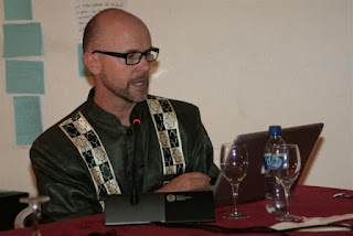
Indigenous peoples assert their willingness to be directly involved in national adaptation platforms. The goal is to ensure that farmers, fishing communities, hunter-gatherers and pastoralists act in a harmonious and complementary manner by working together on national and local policy making, in concert with State agencies and technical bodies.

National platforms need to be inter-sectoral in character. Climate adaptation involves decisions about agriculture, lands, water, human development, housing, health, security, education, as well as including technical issues of atmospheric and biological sciences.

National Adaptation Platforms need to concentrate on two-way communication. Pastoralists need early warning of climate crises before they happen. This warning needs to be integrated into other sectoral responses, including assistance with veterinary services, the ability to slaughter surplus animals and sell the products before a full-scale crisis has emerged and animals are unable to be used commercially.

Delegates note that biodiversity and ecosystem resilience is the basis of indigenous economies and cultures. Conservation of biodiversity and ecosystem services is fundamental to food security, health and sustainable living.

National Adaptation Platforms, and the related policy frameworks (e.g. the National Adaptation Programmes of Action / National Adaptation Plans) need to be equipped with participatory methods and tools to allow for effective participation by indigenous peoples and other rural communities. A centralised process which does not have its roots in real communities and real economic and environmental contexts risks missing the mark in responding to current and future needs. Africa needs to pilot innovations in participatory methodologies, new communication tools and citizen science, which in turn can be scaled up to national and regional levels of impact and effectiveness. The conference noted the valuable application of participatory mapping, citizen science, mobile phone technology, and Web 2.0 innovations in the domains of information management and communication.

National Adaptation Platforms will only be viable if they are properly funded and include commitments from the national budget. Adaptation is a lens that is relevant to budgeting and planning in all sectors. All Ministries should be contributing to the costs of adaptation planning, implementation, monitoring and evaluation. If Africa takes seriously its own investment in the National Adaptation Platforms, this will draw the attention and interest of international and regional donors and financial institutions that are looking to invest in robust country-driven initiatives.

Read more:
Thursday, October 13, 2011

Forest Governance 2.0: A Primer on ICTs and Governance

This recent publication explores a range of uses of information and communication technology (including PGIS) that can increase public participation and improve law enforcement and economic efficiency to strengthen governance in the forest sector.
Using the World Bank’s analytical framework for forest governance reforms, it draws on current and planned initiatives, from secondary sources and country reports.
The emphasis is on simple, low cost tools that will spur the demand and supply of good governance by increasing the engagement of key stakeholders in the reform process.

Sunday, October 09, 2011

Forest Beekepers - The Ogiek People in Kenya


Source of video: Survival International - The Ogiek

Traditionally the Ogiek People were hunter-gatherers. In the last decades their forests have been cut by loggers or converted into farmland by migrant communities coming from other parts of Kenya.

More on the Ogiek is found here:


Saturday, September 24, 2011

What is Volunteered Geographic Information/Crowdsourcing?


Shawn Simpson explores the definition and use cases for volunteered geographic information in public safety and local government.

Tuesday, September 06, 2011

Mediating voices and communicating realities: Using information crowdsourcing tools, open data initiatives and digital media to support and protect the vulnerable and marginalised


This report published by IDS, investigates how the next generation of information and communication technologies (ICTs) — such as open mapping and open source crowdsourcing platforms — can empower vulnerable communities and build local capacity.

It is based on an investigation of how initiatives such as Map Kibera, an online community information source based in Kenya, contribute to creating shared information resources. The empirical data also provide insights into the hurdles and opportunities facing marginalised communities using these innovative communication tools. The report also presents results from interviews of leaders of ICT initiatives deployed to support post-reconstruction efforts in Haiti.

It outlines the challenges of using ICT for development, including the need to balance short-term individual benefits with longer-term agendas and the responsibility of those in charge to build trusting relationships to diffuse tensions emerging from free information sharing.

The study highlights the role of open-source social entrepreneurs as a new development actor, and the opportunities for collaboration between development and technology practitioners. The report suggests a follow-up research agenda to build upon this initial investigation.

Click here to download the document.

Monday, May 23, 2011

Participatory 3D Modelling for developing climate change adaptation plans in Boe Boe, Solomon Islands

I’d like to thank all the team who made the ten-day ‘Participatory 3D modelling (P3DM) for climate change’ engagement with Boe Boe community, Solomon Islands, such a successful event.
It is the first time that such innovative, yet simple, mapping and communication tools have been used in the context of climate change adaptation.
The team, led by Kenn Mondiai of Partners With Melanesians, and the Solomon Islands’ TNC staff and local partners, were able to hand over a vibrant, illustrated, ‘living’ and accurately-scaled model of the community customary lands and waters, at a ceremony involving Boe Boe village and neighboring communities.
The model took teams of students and volunteers 3 days to build, and then community members added the detail – from their own houses, their gardens, their route through the mangroves, forest paths, conservation areas, and anything else they reckoned important to note.
At the same time, climate vulnerability and adaptive capacity surveys with households, led by Esther Ririmae and Gideon Solo, and follow-up work by the team with community members on a range of key issues, allowed the modeling exercise to focus on community perspectives of climate change impacts, and the villagers’ collective ability to respond to these and other development pressures.
Of real interest, digital and ‘scientific’ modeling provided by TNC GIS folks (Nate Peterson, Seno Mauli) and Javier Leon of University of Wollongong, was seamlessly integrated into the mapping exercise and gave the community additional perspectives on their local knowledge, to aid decision-making.
The exercise has given all those involved, and all the partners in the Australian Government / AusAID supported project ‘Building the Resilience of Communities and their Ecosystems to the Impacts of Climate Change’, a chance to explore how local communities can assess potential climate impacts, be aware of their own capacities and vulnerabilities, and make decisions going forward.
Please find the attached initial write-up of the activity in the 'files' section at this link http://community.eld...  , along with some resources on conducting P3DM. More detailed reports will follow from Partners With Melanesians and other papers on the lessons learned from the exercise.
The guru of P3DM, Giacomo Rambaldi, based at the Technical Centre for Agricultural and Rural Co-operation (CTA) in the Netherlands, has worked with both Kenn and myself before on the tool, and has an online resource kit available at http://pgis-tk-en.cta.int
Next up is 3D modeling at the provincial scale in Manus!

The initiative has been implemented in the framework of the Australian Government / AusAID-funded project ‘Building the Resilience of Communities and their Ecosystems to the Impacts of Climate Change in the Pacific”.

Monday, May 09, 2011

Pacific Cultural Mapping, Planning and Policy Toolkit

This toolkit has been made possible by the generous contribution of the European Commission, through the Structuring the Cultural Sector in the Pacific for Improved Human Development project. The toolkit was drafted following the Cultural Policy Workshop held at the Secretariat of the Pacific Community (SPC) headquarters in Nouméa, New Caledonia from 25–28 March 2010, and is designed to provide guidance to countries and territories carrying out the cultural mapping, planning and policy process.
Culture permeates political, economic and social life across Oceania. Because indigenous peoples and practices have predominated across this region for hundreds – and, in some places, thousands – of years, culture is lived and directly influences the values, decisions and hopes of Pacific Island peoples. Culture in Oceania is primarily understood to reference the people or customs ‘of the land’ but in the 21st century many other ideas, beliefs and practices have now taken root. In addition, Pacific populations are increasingly mobile and have settled beyond their indigenous homelands. Similarly, the Islands have welcomed new migrants from other countries. Culture therefore involves old, new and continuously developing modes of thinking, being and creating.

Globally, this cultural process is of great economic and social importance: many countries in Asia, Europe, the Americas, Africa and the Caribbean prioritise culture for national investment, capacity building, human development, peace and security, economic growth and communal revitalisation. In the international context, culture is increasingly central to ‘creativity’ and ‘innovation’ – two concepts that are at the heart of the cultural or creative industries. In the Pacific Island region, however, these industries are not clearly defined and programmes or policies on culture are still seen to be primarily about promoting or safeguarding tangible and intangible cultural heritage including traditional knowledge.

Source: Secretariat of the Pacific Community (SPC)

Related topics:  Building Critical Awareness of cultural mapping. A Workshop Facilitation Guide. (UNESCO, 2009)

Friday, April 01, 2011

The Role of participatory cultural mapping in promoting intercultural dialogue: We are not hyenas; a reflection paper

Cultural mapping involves the representation of landscapes in two or three dimensions from the perspectives of indigenous and local peoples. It is potentially an important tool for UNESCO in its efforts to help Member States and civil society to create platforms for intercultural dialogue, and increase awareness of cultural diversity as a resource for peace building, good governance, fighting poverty, adaptation to climate change and maintaining sustainable management and use of natural resources.

Cultural mapping, if applied wisely, can help to reach the objectives set out in the UNESCO “Universal Declaration on Cultural Diversity" (2001) and related recent conventions : the “Convention of the Safeguarding of the Intangible Cultural Heritage” (2003) and the “Convention on the Protection and Promotion of the Diversity of Cultural Expressions” (2005). Cultural mapping is furthermore relevant to the World Heritage Convention which dates back to 1972, but has undergone major changes since then, expanding the notion of a cultural site and promoting stronger involvement of populations living on the sites.

The aim of this paper entitled "The Role of participatory cultural mapping in promoting intercultural dialogue: We are not hyenas" is to critically consider how cultural mapping can become a good practice of intercultural dialogue and successfully further the aims of the Universal Declaration and the related conventions.

The paper is meant to assist indigenous and local peoples to consider their options and aspirations, to help civil servants and policy makers evaluate how mapping can be a useful tool in cultural policy and inventory work, and for those who are making maps to reflect on their practices.

Source: Nigel Crawhall, 2010, UNESCO

Saturday, March 26, 2011

Montpellier 2011 - Geomatics and participatory avenues

This is the presentation I delivered at the seminaire « Géomatique et Démarches participatives » which took place on 1 March 2011 in Montpellier (SupAgro, campus de la Gaillarde).

Notre forêt notre dignité : maquette 3D et revendication territoriale


More information on the case is found here.
Read also: Redessiner sa forêt en 3D

Thursday, February 24, 2011

Report Indigenous and Tribal Peoples' Rights over their Ancestral Lands and Natural Resources

Washington, D.C., February 17, 2011—The Inter-American Commission on Human Rights (IACHR) today published its report Indigenous and Tribal Peoples' Rights over their Ancestral Lands and Natural Resources.

The protection of indigenous peoples' right to property over their ancestral lands is an issue of particular importance to the IACHR because the effective enjoyment of that right involves not only protection of an economic unit but also protection of the human rights of a collectivity whose economic, social, and cultural development is based on its relationship with the land, which is the basis for its worldview. As a result, the Commission has long paid particular attention to indigenous and tribal peoples’ right to communal property over their lands and natural resources, as a right in itself, and as a guarantee of the effective enjoyment of other basic rights.

The right to property pursuant to Article 21 of the American Convention on Human Rights thus has singular importance for indigenous and tribal peoples, because the guarantee of the right to territorial property is a fundamental basis for the development of indigenous communities’ culture, spiritual life, integrity and economic survival. It is a right to territory that encompasses the use and enjoyment of its natural resources. It is directly related, even a pre-requisite, to enjoyment of the rights to an existence under conditions of dignity, to food, water, health, life, honor, dignity, freedom of conscience and religion, freedom of association, the rights of the family, and freedom of movement and residence.

The report the IACHR is publishing today compiles and discusses the scope of indigenous and tribal peoples’ rights over their territories, lands, and natural resources. In this regard, it analyses the obligation of the States to consult with indigenous peoples and guarantee their participation in decisions regarding any measure that affects their territories. The State has to consult them on any matters that might affect them, the purpose of such consultations should be to obtain their free and informed consent, and they must be carried out in accordance with their customs and traditions, through culturally adequate procedures and taking into account their traditional decision-making methods.

The report is based on the legal instruments of the Inter-American system, as interpreted by the Commission and the Inter-American Court in the light of developments in general international human rights law. It also aims to point out specific problems, guidelines, and best practices to enhance the enjoyment of human rights by indigenous and tribal peoples across the hemisphere.

A principal, autonomous body of the Organization of American States (OAS), the IACHR derives its mandate from the OAS Charter and the American Convention on Human Rights. The Inter-American Commission has a mandate to promote respect for human rights in the region and acts as a consultative body to the OAS in this matter. The Commission is composed of seven independent members who are elected in a personal capacity by the OAS General Assembly and who do not represent their countries of origin or residence.

Monday, November 29, 2010

From Community Mapping to Critical Spatial Thinking


Director of the University of California, Santa Barbara's Center for Spatial Studies Michael Goodchild discusses "From Community Mapping to Critical Spatial Thinking: The Changing Face of GIS (geographic information systems)" in this National Science Foundation Distinguished Lecture. He discusses how individuals are using distributed, real-time data enabled by social networks to define landscapes that have been suddenly altered by floods, hurricanes and other acts of nature.


Source: National Science Foundation

Wednesday, November 10, 2010

Oil Palm Expansion: A New Threat to Palawan UNESCO Man and Biosphere Reserve

ALDAW, Puerto Princesa - In addition to the alarming expansion of nickel mining on Palawan island  (already reported on previous PLANT TALKS releases) indigenous peoples are now being confronted with the threats posed by the expansion of oil palm plantations. The province of Palawan is part of the “Man and Biosphere Reserve” program of UNESCO and hosts 49 animals and 56 botanical species found in the IUCN Red List of Threatened Species.  It is also the home of isolated and vanishing indigenous communities. 

Agrofuels in Palawan, as elsewhere in the Philippines, have been portrayed as a key solution to lower greenhouse gas emission, achieve energy independence, as well as a tool for poverty eradication.  With these objects in mind, the Provincial Government of Palawan is strongly promoting agrofuels development, without taking into account the socio-ecological impact of such mono-crop plantations. As a result, thousands of hectares of lands in the province have been set aside for jatropha feedstock and oil palm.

Oil palm plantations, in Palawan, are being established by the Agumil Philippines Inc., a joint venture between Filipino and Malaysian investors, that also engages in the processing of palm oil. The LandBank of the Philippines is backing the project financially.

The local indigenous network ALDAW (Ancestral Land Domain Watch), in collaboration with other local organizations and Palawan NGOs, is making a call for the implementation of more restrictive regulations on oil palm expansion to halt deforestation, habitat destruction, food scarcity, and violation of indigenous peoples’ rights.  In addition to this, oil palm plantations are also expanding into the indigenous fallow land (benglay), thus reducing the number of rotational areas needed for the swidden cycle. As of now, the Palawan municipality of Española has the highest percentage of oil palms, and plantations are fast expanding also to other municipalities such as Brooke’s Point, Bataraza, Rizal, Quezon, etc. In some municipalities, oil palms are already competing and taking over cultivated areas (e.g. rice fields), which are sustaining local self-sufficiency.

“LandBank’s contribution to President Aquino’s commitment to develop the rural economy and to raise farmers’ income should not include oil palms development. It is well known that this crop benefits better-off farmers and entrepreneurs, rather then small-scale farmers and indigenous peoples.  We look forward to more sustainable investments for improving agricultural productivity of marginalized farmers. Meanwhile, a moratorium on oil palm expansion should be implemented with haste” said Artiso Mandawa, ALDAW Chairman.

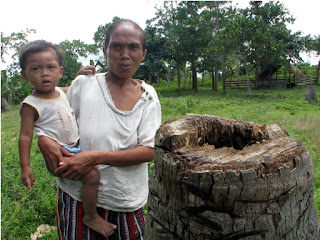
In the community of Iraray II (Municipality of Española) indigenous people complain that a ‘new’ pest has spread from the neighboring oil palm plantations to their cultivated fields devouring hundreds of coconut palms by boring large networks of tiny tunnels into the palms’ trunks. Local indigenous people showed specimens of this pest to ALDAW mission members, and the insect was later identified as the Red Palm Weevil (Rhynchophorus ferrugineus).  The red weevil is reported to be a native of south Asia, however, the Palawan of Iraray II claims that they only began to experience massive pest attacks on their coconut groves, after oil palms were introduced into the area at the expense of the local population of buri palms (Corypha elata). The latter is a popular basketry material for both the local Palawan and farmer communities. The trunk of this palm contains edible starch. The bud (ubud) is also edible raw or cooked, as well as the kernels of the nuts.


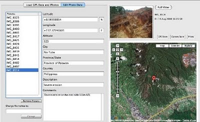
ALDAW preliminary findings, obtained in collaboration with the Centre for Biocultural Diversity (CBCD) – University of Kent, indicate there is a scarcity of public records showing the processes and procedures leading to the issuance of land conversion permits and environmental clearances to oil palm companies, as well as to the local cooperatives created in the various barangays.  Moreover, ALDAW is also in the process of mapping all oil palm locations in Palawan, through the use of geotagging technologies.  Evidence indicates that – in most cases - members of indigenous communities, who have ‘rented’ portions of their land to the oil company, have no clear understanding of the nature of such ‘agreements’ nor they possess written contracts countersigned by the company. There is a risk that members of local communities who have joined the so-called ‘cooperatives’ will soon become indebted with the oil company. In fact they provide very cheap labor and also barrow funds to purchase fertilizer, pesticides and equipment, while the company controls every aspect of production.

Overall, it would appear that land conversion into oil palm plantations is happening with little or no monitoring on the part of those government agencies (e.g. Palawan Council for Sustainable Development) that are responsible for the sustainable management of the Province.

The new trend in the Philippine Market: switching from coconut to palm oil

There is a new trend in the Philippines, leading to the acceleration of oil palm expansion.  National vegetable oil millers and refiners are now keen on selling the cheaper palm oil for the domestic market, so that all coconut oil would be exported. Coconut oil, in fact, commands a higher premium in the international market. However, contrary to oil palms, coconut cultivation is endemic to the Philippines and this palm provides multiple products to local farmers, thus sustaining household based economy.


Since 2005, cooking oil manufacturers have increased imports of the cheap palm oil by 90 percent. The use of the palm oil has progressively increased in the local market as household consumers and institutional buyers have preferred it because of the price difference compared with edible coconut oil. Fast-food giants such as Jollibee Foods Corp., have switched to palm oil for their business.

The General Context of Oil Palm Development

Crude palm oil (CPO) consumption worldwide has doubled between 2000 and 2010 with the main new demand coming from Eastern Europe, India and China. By and large, the price of palm oil has increased almost steadily over the past 20 years. Two countries in South East Asia, Malaysia and Indonesia, produce over 80% of the internationally traded CPO. While significant expansion is occurring in Thailand, Papua New Guinea, Costa Rica, Colombia, Ecuador, Cameroon, the Democratic Republic of Congo and it is now taking over in the Philippines. Currently there are an estimated 4 million hectares of land under oil palms in Malaysia and over 7.5 million hectares in Indonesia. In Peninsular Malaysia, the palm oil frontier has come near to the limits of land availability and most expansion within Malaysia is now in the two Eastern States of Sabah and Sarawak. Much of the investment for oil palm expansion has come from European Banks but, increasingly, funds are being raised from Islamic banks in the Middle East, and from investors from India and China. It has been estimated that about two thirds of the companies opening lands to plant oil palm in Indonesia are majority-owned by Malaysian conglomerates

The economies of scale and the characteristics of oil palm favor the development of large plantations, meaning that land needs to be acquired in large blocks and huge areas converted to monocultures. Obviously, this pressure to acquire land has implications for those who currently own the same areas, who are for the most part ‘indigenous peoples’ and small household farmers. Since 2004, international and local NGOs have produced a series of detailed reports based on field surveys and the direct testimony of affected people, which document the serious human rights abuses resulting from the imposition of oil palm plantations. The publications show that these abuses are widespread, are inherent in the way lands are acquired and estates are developed and continue up to the present day. Among the most persistent problems are the following: acquisition of lands and smallholder schemes violates the rights of indigenous peoples to their property. Their lands are being taken off them without due payment and without remedy. In addition, their right to give or withhold their free, prior and informed consent for these proposed developments is being violated. In Indonesia, those that sign up to join imposed schemes are not informed that this reallocation of lands implies a permanent surrender of their rights in land. The dramatic changes in local landscapes and ecosystems - including the loss of agricultural and agroforestry lands, hunting grounds, game, fish, forests, as well as water for drinking, cooking and bathing - in turn have major consequences and deprive people of their customary livelihoods and means of subsistence.

Unfair processes of land use allocation and land acquisition and the lack of respect for local communities and indigenous peoples’ rights not only result in marginalization and impoverishment but also give rise to long term disputes over land, which all too often escalate into conflicts with concomitant human rights abuses due to repressive actions by company or State security forces.

Generally, when large agricultural firms enter an area, community members loose access to traditional food zones and other NTFP resources. As a result, they end up becoming employers of oil palm plantations. Lacking legal title to their land, deals are often structured so that members of the community acquire 2-3 hectares (508 acres) of land for oil palm cultivation. In Borneo (Eastern Malaysia and Kalimantan) they typically borrow some $3,000-6,000 (at 30 percent interest per year) from the parent firm for the seedlings, fertilizers, and other supplies. Because oil palm takes roughly 7 years to bear fruit, they work as day laborers at $2.50 per day on mature plantations. In the meantime their plot generates no income but requires fertilizers and pesticides, which are purchased from the oil palm company. Once their plantation becomes productive, the average income for a 2 hectare allotment is $682-900 per month. In the past, rubber and wood generated $350-1000 month (see Lisa Curran studies and WWF Germany reports).

Loss of Biodiversity

As of now, scientific evidence indicates that beyond the obvious deforestation that results from clearing lowland rainforest for plantations, there is a significant reduction (on the order of 80 percent for plants and 80-90 percent for mammals, birds, and reptiles) in biological diversity following forest conversion to oil palm plantation. Moreover, the use of herbicides and pesticides used in oil palm plantations heavily pollutes local waterways. Notoriously, further destruction of peat land has increases the risk of flooding and fire.

The Legal Framework

The legal frameworks in the world’s two foremost palm oil producing countries are inappropriate to protect indigenous peoples’ rights and ensure an equitable development process. In spite of innovative environmental and pro-indigenous legislation, also in the Philippines the issue of oil palm expansion with reference to farmers and indigenous peoples’ rights does show a high degree of paucity.

International organizations have begun to pin their hopes of reform on the creation of a global market in carbon to curb deforestation, although whether this will help or harm indigenous peoples is a matter of debate. Indeed, initial calculations based on current prices, in the voluntary carbon trading market, suggest that market-based payments for Reducing in Emissions from Deforestation and Forest Degradation (REDD) will not be enough by themselves to make economies based on maintaining natural forests competitive with oil palm. If, however, there is to be a real moratorium on land clearance then this may provide an important opportunity for the Government to effect reforms in the forestry and plantations sectors, take firm steps to amend the laws so they recognize indigenous peoples’ rights and adopt a more measured approach to rural development that gives priority to local communities’ initiatives and not the interests of foreign backed companies.

In the international arena, civil society is presently engaging with processes of the Roundtable on Sustainable Palm Oil (RSPO), which is an initiative established by businesses involved in the production, processing and retail of oil palm and WWF. Key members include Malaysian and Indonesian palm oil companies and European processing and retailing companies.  RSPO is attempting to agree and apply an industry best practice standard for the production and use of palm oil in socially and environmentally acceptable ways. Civil society engagement in this process has secured: 1) the establishment of the RSPO Task Force on Smallholders, which has Developed Guidance to ensure smallholder engagement; 2) strong social protections and requirements for respect for the rights of indigenous peoples, workers, women in the RSPO Principles and Criteria (the standard); and 3) a certification process that is meant to ensure adherence to the standard.

However, there are major concerns about this process, such as the growing concern that RSPO members are operating to double standards, most indigenous peoples and local communities and smallholders remain unaware of the RSPO and are still unclear how they can use it to secure their rights and fair development outcomes.  Wider awareness needs to be fostered among NGOs to build on the gains, if any, being made at the RSPO, among others. To date, sustained civil society engagement with the industry and national dialogues about oil palm have been limited to Indonesia and to a lesser extent Malaysia. In the Philippines, local actions in addressing oil palm issues have so far been limited and thus, there is a need for greater sharing and concerted action at the local/national and regional levels.

* Section of this report have been extracted from Forest People Programme (FPP) report: “Palm oil and indigenous peoples in South East Asia. Land acquisition, human rights violations and indigenous peoples on the palm oil frontier” by Marcus Colchester. Other sources: The Rights and Resources Initiative (RRI), RECOFTC, Sawit Watch, the Samdhana Institute, Dr. Lisa M. Curran, School of Forestry and Environmental Studies, Yale University, WWF Germany.


What you can do:

Sign the online Petition to Stop Mining and Oil Palm Expansion in Palawan
And address your concerns to:

*PALAWAN COUNCIL FOR SUSTAINABLE DEVELOPMENT (PCSD)
oed@pcsd.ph . AND c/o Mearl Hilario mearlhilario@yahoo.com
FAX: 0063 (048) 434-4234

*Honorable Governor of Palawan
Baham Mitra
abmitra2001@yahoo.com FAX: 0063 (048) 433-2948

*Palawan Project Manager
Agumil Philippines, Inc
Agusan Plantations Group. Fax 0063 323444884

*Mrs. Gilda E. Pico, President and CEO, Land Bank of the Philippines
landbank@mail.landbank.com Fax: 0063 2 528-8580

or contact the ALDAW Network (Ancestral Land/Domain Watch) aldawnetwork@gmail.com


Source: ALDAW Network

Thursday, March 04, 2010

Geographic Information Technology and local spatial knowledge


Louis Liebenberg, founder and developer of CyberTracker technology shares his views on the importance of maintaining local knowledge at the forefront and to beware of the fact that technology may seduce users at the cost of dis-empowering local knowledge holders. Louis further highlights the role of the "Training Kit on Participatory Spatial Information Management and Communication" in empowering the grassroots.

Tuesday, February 16, 2010

Ogiek Indigenous Peoples Mapping their Lands


Julius Muchemi, Executive Director of ERMIS Africa, an NGO based in Kenya, reports on a Participatory 3D Modelling exercise which occurred in Nessuit, Kenya in August 2006. In the course of the exercise - attended by representatives from 21 Ogiek clans - an area of 52,800 ha was mapped at a scale 1:10,000. participants included close to 120 representatives from the different clans, men and women. Elders populated the model with their memories dating back to 1925 and reconstructed the landscape as it was at that time. The model displays 64 data layers including different types of areas, points and lines. In 2008 the Ogiek people expanded the coverage of the model to include further 40,000 ha.

Read more ...

Monday, February 08, 2010

Knowledge and cultural transmission in Kenyan participatory mapping


In this 5 minute interview Dr. Nigel Crawhall, Director of Secretariat at IPACC, elaborates on intergenerational ecological knowledge transmission in Participatory 3-dimensional modelling (P3DM). Crawhall discusses his observations on intergenerational interaction when the Ogiek community of Nessuit, Kenya built a geo-referenced model of their mountain forest landscape in 2006.

Thursday, January 21, 2010

The Bulanjao Geotagged Report

On August 2009, a mission led by the Philippines-based Ancestral Land/Domain Watch (ALDAW) and the Centre for Biocultural Diversity (CBCD) at the University of Kent traveled to Barangay Sumbiling, Municipality of Bataraza, Province of Palawan (Philippines).

Geo-referenced audio-visual and photographic documentation was carried out in the Bulanjao range whose vegetation consists of a very unique type of forest growing on ultramafic /heavy-metal rich soils. The area is home to at least four plant species that are classified as vulnerable and two of them have already been included in the IUCN Red List.

In spite of its unique ecological features, the Bulanjao range has been subjected to mineral exploration and development by the Rio Tuba Nickel Mining Corporation (RTNMC). RTNMC is a Filipino-Japanese partnership holding a mining concession area of about 5,265 hectares.

RTNMC and its partner, Coral Bay Nickel Corporation (CBNC), need to mine nickel ores as part of the expansion of their new Hydrometallurgical Processing Plant (HPP) project. However, one the conditions specified in the Environmental Compliance Certificate (ECC) issued to them in 2002, is that “core zones” - as identified by the Strategic Environmental Plan for Palawan (Republic Act Republic Act 7611) should not be included in the areas of mining operations and, this, of course includes the Bulanjao range.

Starting at an elevation of about 40m ASL, the ALDAW/CBCD mission followed the mining road to reach the highest portions of the Bulanjao range. Geo-tagging evidence indicates that erosion on the Bulanjao mining road is occurring also at low elevations. During the rainy season the water creates deep clefts on the roadsides, hence penetrating the soil and fostering road collapse. No mitigating measures have been put into place to reduce erosion. A huge crater-like excavation has been found at 566m ASL. and land slides, induced by road construction, have been documented around the sources of the Sumbiling river, at almost 900m ASL. The latter is the most important water source for both lowland farmers and indigenous communities.

Marylin Samparan, a local IP living in the area told the mission: “time will come when our children will no longer recognize the names of trees, the footprints of animals, the birds’ songs. This will be the time when the forest will be gone, the mining companies will be gone, the rivers will no longer flow…and us? We will still be here”.

On 15 August 2009, the mission established that mining road had already reached an altitude of 859m ASL – and its exact location was defined through the following GPS coordinates (+ 8.59322548 N Latitude and + 117.36516571 E Longitude).

Mission’s findings have now been compiled into a geo-tagged report, which is being used by local indigenous communities to support their legal struggle against mining in Bulanjao.

Source: The ALDAW NETWORK

The ALDAW NETWORK (Ancestral Land/Domain Watch) is an advocacy-campaign network of Indigenous Peoples jointly constituted by NATRIPAL (United Tribes of Palawan) and BANGSA PALAWAN PHILIPPINES (Indigenous Alliance for Equity and Wellbeing) on August 2009.